TopoQuest Logo
Do you find TopoQuest useful?
Help keep TopoQuest running and adding new maps/features by donating!
Bitcoin:  19c7KJd3qBynnjoSw5npx9KScwjBe4ifkT
Litecoin:  LXs6TkuXGGXo1vDsWCkWVdjQX94eUKd6ui
Home View Maps Find Maps Find Places Resources & Links


Lititz, Pennsylvania Topographic Map

USGS Map Title: Lititz, PA
USGS Map MRC: 40076B3
DRG (GeoTIFF) Download: o40076b3.tif


Neighboring USGS Topographic Map Quads:


  Lebanon, PA  
40076C4
 

  Richland, PA  
40076C3
 

  Womelsdorf, PA  
40076C2
 

  Manheim, PA  
40076B4
 

  Lititz, PA  
40076B3
 

  Ephrata, PA  
40076B2
 

  Columbia East, PA  
40076A4
 

  Lancaster, PA  
40076A3
 

  Leola, PA  
40076A2


Map MRC Location:

N41°
W77°
N41°
W76°
H8 H7 H6 H5 H4 H3 H2 H1
G8 G7 G6 G5 G4 G3 G2 G1
F8 F7 F6 F5 F4 F3 F2 F1
E8 E7 E6 E5 E4 E3 E2 E1
D8 D7 D6 D5 D4 D3 D2 D1
C8 C7 C6 C5 C4 C3 C2 C1
B8 B7 B6 B5 B4 B3 B2 B1
A8 A7 A6 A5 A4 A3 A2 A1
N40°
W77°
N40°
W76°

Lititz, PA USGS 1:24K Topographic Map Preview:
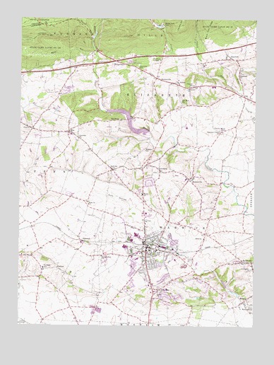
Lititz, PA USGS Topographic Map
Click on map above to begin viewing in our Map Viewer.

This topographic map contains these locations and features:
Feature Name Type Latitude Longitude GNIS ID View Map
Airy Hill FarmLocaleN40.2122°W76.3706°2711186View Map
Bethel CemeteryCemeteryN40.1726°W76.3030°1169356View Map
Borough of LititzCivilN40.1540°W76.3043°1215340View Map
BrickervillePopulated PlaceN40.2259°W76.3025°1170231View Map
Brickerville Census Designated PlaceCensusN40.2226°W76.2863°2389239View Map
Brickerville Fire Company Station 21BuildingN40.2249°W76.2919°2100276View Map
Brickerville Post Office (historical)Post OfficeN40.2259°W76.3025°1214365View Map
Brunersville Post Office (historical)Post OfficeN40.1848°W76.2847°1214366View Map
BrunnervillePopulated PlaceN40.1848°W76.2847°1170432View Map
Brunnerville Fire Company Station 22BuildingN40.1845°W76.2839°2100277View Map
Cannon HillRidgeN40.2479°W76.2897°1171161View Map
Cherry Grove SchoolSchoolN40.2045°W76.2675°1171635View Map
Church SchoolSchoolN40.2223°W76.2847°1171866View Map
ClayPopulated PlaceN40.2184°W76.2555°1171942View Map
Clayview FarmsLocaleN40.2156°W76.2575°2725656View Map
Coleman ChapelChurchN40.2334°W76.3005°1172185View Map
Cornwall Lookout TowerTowerN40.2412°W76.3711°1172475View Map
Danda FarmsLocaleN40.1278°W76.3547°2711109View Map
Doe Run Elementary SchoolSchoolN40.1744°W76.3722°2663579View Map
Eagle RockSummitN40.2426°W76.3152°1202168View Map
ElmPopulated PlaceN40.2040°W76.3488°1174167View Map
Elm Post OfficePost OfficeN40.2029°W76.3476°2773134View Map
Elm Post Office (historical)Post OfficeN40.2037°W76.3488°1214231View Map
Emanuel ChurchChurchN40.2218°W76.2861°1174202View Map
Erbs ChurchChurchN40.1751°W76.3386°1174300View Map
FairlandPopulated PlaceN40.1484°W76.3544°1203543View Map
Fairland Elementary SchoolSchoolN40.1484°W76.3616°1213841View Map
Fairview SchoolSchoolN40.2301°W76.3122°1174546View Map
Furnace RunStreamN40.2201°W76.2575°1175365View Map
Graybills ChurchChurchN40.2015°W76.3436°1176027View Map
HalfvillePopulated PlaceN40.1884°W76.3252°1176388View Map
Hammer Creek ChurchChurchN40.2043°W76.2686°1176436View Map
Heart of Lancaster Regional Medical CenterHospitalN40.1322°W76.3119°2718125View Map
Hess ChurchChurchN40.1607°W76.2763°1176908View Map
HopelandPopulated PlaceN40.2337°W76.2622°1177388View Map
Hopeland Census Designated PlaceCensusN40.2337°W76.2614°2584470View Map
Hopeland ChurchChurchN40.2281°W76.2583°1177389View Map
Hopeland Post OfficePost OfficeN40.2333°W76.2599°2780082View Map
Hubers RunStreamN40.1587°W76.2958°1177537View Map
Kettle RunStreamN40.2365°W76.3358°1178423View Map
King FarmLocaleN40.1339°W76.2558°2725753View Map
Kissel Hill Elementary SchoolSchoolN40.1401°W76.2958°1211708View Map
Kissell HillPopulated PlaceN40.1393°W76.2975°1200091View Map
LexingtonPopulated PlaceN40.1884°W76.2997°1179250View Map
LimerockPopulated PlaceN40.1590°W76.3405°1204029View Map
Linden Hall SchoolSchoolN40.1559°W76.3013°1179411View Map
Lions Club ParkParkN40.1501°W76.3094°1206608View Map
LititzPopulated PlaceN40.1573°W76.3069°1213981View Map
Lititz Borough Police DepartmentBuildingN40.1567°W76.3070°2780183View Map
Lititz Carrier Annex Post OfficePost OfficeN40.1665°W76.3104°2780081View Map
Lititz Elementary SchoolSchoolN40.1559°W76.3052°1206604View Map
Lititz Fire Company 1 Station 25BuildingN40.1567°W76.3085°2100280View Map
Lititz Post OfficePost OfficeN40.1565°W76.3047°2779615View Map
Lititz Post Office (historical)Post OfficeN40.1573°W76.3069°1214367View Map
Lititz SpringSpringN40.1570°W76.3117°1202265View Map
Lititz Springs ParkParkN40.1576°W76.3113°1206605View Map
Locust Street ParkParkN40.1601°W76.2977°1206606View Map
Longneckers ChurchChurchN40.1532°W76.3308°1179917View Map
Machpelah CemeteryCemeteryN40.1481°W76.3073°2729365View Map
MillportPopulated PlaceN40.1365°W76.2533°1204184View Map
Moravian CemeteryCemeteryN40.1529°W76.3027°1206602View Map
New HavenLocaleN40.1362°W76.3030°1206875View Map
New Haven RunStreamN40.1268°W76.2563°1212310View Map
Old Zion ChurchChurchN40.2162°W76.2888°1182956View Map
Penn Post Office (historical)Post OfficeN40.2040°W76.3488°1214364View Map
PenrynPopulated PlaceN40.2051°W76.3683°1183564View Map
Penryn Census Designated PlaceCensusN40.2016°W76.3675°2584497View Map
Penryn Fire Company 1 Station 28BuildingN40.2059°W76.3670°2653107View Map
Penryn Post OfficePost OfficeN40.2054°W76.3704°2780080View Map
Poplar GrovePopulated PlaceN40.2320°W76.3155°1184252View Map
Ric Rac FarmsLocaleN40.2233°W76.3714°2711188View Map
Rohrers QuarryMineN40.1311°W76.3375°2724945View Map
RomeLocaleN40.1534°W76.2897°1206874View Map
RothsvillePopulated PlaceN40.1512°W76.2511°1185510View Map
Rothsville Post Office (historical)Post OfficeN40.1512°W76.2511°1214368View Map
Saint Johns ChurchChurchN40.2231°W76.2913°1186101View Map
Salem ChurchChurchN40.1390°W76.3002°1186819View Map
Santo Domingo CreekStreamN40.1545°W76.2866°1186978View Map
Segloch RunStreamN40.2290°W76.2775°1187228View Map
Shenk Airport (historical)AirportN40.1668°W76.3163°1193853View Map
SpeedwellPopulated PlaceN40.2087°W76.3219°1188160View Map
Speedwell Forge DamReservoirN40.2084°W76.3165°1194627View Map
Spring LakeLakeN40.2471°W76.3017°1212311View Map
Spring Lake ParkParkN40.2473°W76.3000°1188241View Map
State Game Lands Number 46ParkN40.2484°W76.2683°1193454View Map
Township of ElizabethCivilN40.2229°W76.3068°1216628View Map
Township of PennCivilN40.1865°W76.3726°1216639View Map
Township of WarwickCivilN40.1558°W76.2798°1216647View Map
Union MettinghouseChurchN40.1337°W76.2502°1190164View Map
United ChurchChurchN40.1781°W76.3094°1190199View Map
Walnut RunStreamN40.2429°W76.3361°1190551View Map
Warner-Lambert HeliportAirportN40.1523°W76.3058°1213746View Map
WarwickPopulated PlaceN40.1623°W76.3069°1201963View Map
Warwick Community Ambulance Station 85BuildingN40.1572°W76.3023°2722203View Map
Warwick High SchoolSchoolN40.1557°W76.3147°1190614View Map
Warwick Middle SchoolSchoolN40.1576°W76.3186°1211709View Map
Webster SchoolSchoolN40.1968°W76.3083°1190760View Map
Woodridge Swim ClubParkN40.1401°W76.3075°1206607View Map

Note: Coordinates in the location and feature list above are referenced to NAD83 datum.


Copyright (C) 2008-2024 Ryan Niemi / Sunset Dynamics ... All Rights Reserved