TopoQuest Logo
Do you find TopoQuest useful?
Help keep TopoQuest running and adding new maps/features by donating!
Bitcoin:  19c7KJd3qBynnjoSw5npx9KScwjBe4ifkT
Litecoin:  LXs6TkuXGGXo1vDsWCkWVdjQX94eUKd6ui
Home View Maps Find Maps Find Places Resources & Links


Richland, Pennsylvania Topographic Map

USGS Map Title: Richland, PA
USGS Map MRC: 40076C3
DRG (GeoTIFF) Download: o40076c3.tif


Neighboring USGS Topographic Map Quads:


  Fredericksburg, PA  
40076D4
 

  Bethel, PA  
40076D3
 

  Strausstown, PA  
40076D2
 

  Lebanon, PA  
40076C4
 

  Richland, PA  
40076C3
 

  Womelsdorf, PA  
40076C2
 

  Manheim, PA  
40076B4
 

  Lititz, PA  
40076B3
 

  Ephrata, PA  
40076B2


Map MRC Location:

N41°
W77°
N41°
W76°
H8 H7 H6 H5 H4 H3 H2 H1
G8 G7 G6 G5 G4 G3 G2 G1
F8 F7 F6 F5 F4 F3 F2 F1
E8 E7 E6 E5 E4 E3 E2 E1
D8 D7 D6 D5 D4 D3 D2 D1
C8 C7 C6 C5 C4 C3 C2 C1
B8 B7 B6 B5 B4 B3 B2 B1
A8 A7 A6 A5 A4 A3 A2 A1
N40°
W77°
N40°
W76°

Richland, PA USGS 1:24K Topographic Map Preview:
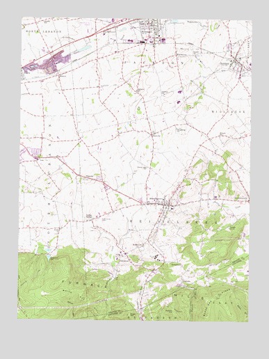
Richland, PA USGS Topographic Map
Click on map above to begin viewing in our Map Viewer.

This topographic map contains these locations and features:
Feature Name Type Latitude Longitude GNIS ID View Map
Avon HeightsPopulated PlaceN40.3526°W76.3750°1168527View Map
Black Oak RidgeRidgeN40.2520°W76.2716°1169723View Map
Borough of MyerstownCivilN40.3721°W76.3056°1215367View Map
Borough of RichlandCivilN40.3574°W76.2568°1215369View Map
Buffalo SpringsPopulated PlaceN40.2920°W76.3347°1170622View Map
Canaan GrovePopulated PlaceN40.2898°W76.2602°1203217View Map
Cannon HillSummitN40.2540°W76.2902°1171162View Map
Cherry Lane SchoolSchoolN40.3134°W76.3052°1171650View Map
Deck AirportAirportN40.3500°W76.3294°2442917View Map
DogtownPopulated PlaceN40.2668°W76.2850°1203427View Map
Elco Middle SchoolSchoolN40.3451°W76.2886°1211671View Map
Elco Senior High SchoolSchoolN40.3451°W76.2886°1211672View Map
Fairview ChurchChurchN40.3443°W76.2963°1174518View Map
FlintvillePopulated PlaceN40.3087°W76.3294°1174911View Map
Forge HillSummitN40.2520°W76.3136°1174986View Map
Furnace HillsRangeN40.2645°W76.3544°1175354View Map
Heidelberg ChurchChurchN40.3298°W76.2891°1176769View Map
Horseshoe TrailTrailN40.2545°W76.2847°1177468View Map
IonaPopulated PlaceN40.3212°W76.3711°1177852View Map
JohnstownPopulated PlaceN40.2784°W76.3163°1178131View Map
Keller Brothers AirportAirportN40.2917°W76.3302°1193916View Map
Keystone Hook and Ladder Company 1 Station 31BuildingN40.3745°W76.3037°2653159View Map
Kralls ChurchChurchN40.2862°W76.3533°1178659View Map
Lapps CemeteryCemeteryN40.3115°W76.3130°1178884View Map
Lebanon Dam Number OneDamN40.2801°W76.3580°1194699View Map
Lebanon ReservoirReservoirN40.2788°W76.3585°1179102View Map
Lebanon Valley Airpark (historical)AirportN40.3720°W76.3372°1193957View Map
Michters DistilleryBuildingN40.2773°W76.3180°1212326View Map
Millbach SchoolSchoolN40.3270°W76.2661°1181202View Map
MoonstownPopulated PlaceN40.2815°W76.3069°1181502View Map
MyerstownPopulated PlaceN40.3745°W76.3027°1182138View Map
Myerstown Elementary SchoolSchoolN40.3684°W76.3300°1211669View Map
Neptune Fire Department Station 33BuildingN40.3582°W76.2578°2652720View Map
PrescottPopulated PlaceN40.3515°W76.3544°1184390View Map
Prescott Community Fire Company Station 29BuildingN40.3545°W76.3549°2653324View Map
ReistvillePopulated PlaceN40.3273°W76.3027°1184887View Map
Rexmont Number Two DamDamN40.2768°W76.3580°1194695View Map
Rexmont Number Two ReservoirReservoirN40.2759°W76.3582°1194696View Map
RichlandPopulated PlaceN40.3593°W76.2583°1185009View Map
Richland Post OfficePost OfficeN40.3593°W76.2593°2779591View Map
Royers ChurchChurchN40.3604°W76.2797°1185593View Map
SchaefferstownPopulated PlaceN40.2984°W76.2944°1214011View Map
Schaefferstown Census Designated PlaceCensusN40.2968°W76.2939°2390259View Map
Schaefferstown Elementary SchoolSchoolN40.3004°W76.2963°1211670View Map
Schaefferstown Emergency Medical Services 160BuildingN40.3026°W76.3002°2722175View Map
Schaefferstown Post OfficePost OfficeN40.2984°W76.3014°2780016View Map
Schaefferstown SpringSpringN40.2956°W76.2938°1202260View Map
Schaefferstown Volunteer Fire Company Station 35BuildingN40.3003°W76.2996°2653181View Map
Shaeffer SchoolSchoolN40.3734°W76.3625°1187319View Map
South Lebanon Township Police DepartmentBuildingN40.3181°W76.3679°2780174View Map
Spangler SchoolSchoolN40.3454°W76.3116°1188151View Map
SpringhavenPopulated PlaceN40.2751°W76.2952°1204707View Map
Township of HeidelbergCivilN40.2954°W76.2941°1216674View Map
Township of South LebanonCivilN40.3058°W76.3708°1216682View Map
Tulpehocken Fishing Club DamDamN40.3659°W76.3480°1200056View Map
WaldeckPopulated PlaceN40.2684°W76.3041°1212289View Map
WeavertownPopulated PlaceN40.3601°W76.2897°1190748View Map
West SchoolSchoolN40.3704°W76.3288°1191108View Map
White Oak HillSummitN40.2590°W76.3380°1191302View Map
WVLV-AM (Lebanon)TowerN40.3729°W76.3644°1200407View Map

Note: Coordinates in the location and feature list above are referenced to NAD83 datum.


Copyright (C) 2008-2024 Ryan Niemi / Sunset Dynamics ... All Rights Reserved