TopoQuest Logo
Do you find TopoQuest useful?
Help keep TopoQuest running and adding new maps/features by donating!
Bitcoin:  19c7KJd3qBynnjoSw5npx9KScwjBe4ifkT
Litecoin:  LXs6TkuXGGXo1vDsWCkWVdjQX94eUKd6ui
Home View Maps Find Maps Find Places Resources & Links


Lowell, Michigan Topographic Map

USGS Map Title: Lowell, MI
USGS Map MRC: 42085H3
DRG (GeoTIFF) Download: o42085h3.tif


Neighboring USGS Topographic Map Quads:


  Cannonsburg, MI  
43085A4
 

  Smyrna, MI  
43085A3
 

  Belding, MI  
43085A2
 

  Cascade, MI  
42085H4
 

  Lowell, MI  
42085H3
 

  Saranac, MI  
42085H2
 

  Alto, MI  
42085G4
 

  Freeport, MI  
42085G3
 

  Lake Odessa, MI  
42085G2


Map MRC Location:

N43°
W86°
N43°
W85°
H8 H7 H6 H5 H4 H3 H2 H1
G8 G7 G6 G5 G4 G3 G2 G1
F8 F7 F6 F5 F4 F3 F2 F1
E8 E7 E6 E5 E4 E3 E2 E1
D8 D7 D6 D5 D4 D3 D2 D1
C8 C7 C6 C5 C4 C3 C2 C1
B8 B7 B6 B5 B4 B3 B2 B1
A8 A7 A6 A5 A4 A3 A2 A1
N42°
W86°
N42°
W85°

Lowell, MI USGS 1:24K Topographic Map Preview:
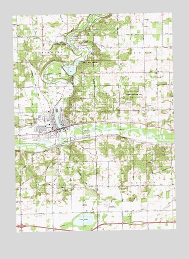
Lowell, MI USGS Topographic Map
Click on map above to begin viewing in our Map Viewer.

This topographic map contains these locations and features:
Feature Name Type Latitude Longitude GNIS ID View Map
Apostolic Lighthouse ChurchChurchN42.9672°W85.3556°2565305View Map
Avon Post Office (historical)Post OfficeN42.9803°W85.2575°2581762View Map
Bushnell Elementary SchoolSchoolN42.9367°W85.3472°2565328View Map
Calvary Christian Reformed ChurchChurchN42.9319°W85.3519°2565309View Map
Carr DrainCanalN42.9945°W85.2631°622775View Map
Charter Township of LowellCivilN42.8973°W85.3733°1626645View Map
Cherry Creek Elementary SchoolSchoolN42.9411°W85.3553°2565327View Map
Church of the NazareneChurchN42.9358°W85.3353°2565317View Map
City of LowellCivilN42.9351°W85.3457°1626644View Map
Congregational ChurchChurchN42.9361°W85.3431°2565316View Map
Cooper Woodland PreserveParkN42.9467°W85.3667°2565345View Map
Creekside ParkParkN42.9378°W85.3564°2565343View Map
Dairy Farm CreekStreamN42.9870°W85.3328°1699841View Map
Deer Run Golf CourseLocaleN42.8900°W85.3211°1623311View Map
Englehardt LibraryBuildingN42.9358°W85.3375°2565319View Map
Fallasburg County ParkParkN42.9836°W85.3278°625815View Map
Fallasburg Covered Bridge Historical MarkerParkN42.9803°W85.3275°2566843View Map
Fallasburg Pioneer Village Historical MarkerParkN42.9836°W85.3200°2566844View Map
Fallass CemeteryCemeteryN42.9844°W85.3187°625813View Map
FallassburgPopulated PlaceN42.9823°W85.3228°625814View Map
Fallassburg Post Office (historical)Post OfficeN42.9822°W85.3228°2570710View Map
Flat RiverStreamN42.9273°W85.3383°626143View Map
Foxes Corners CemeteryCemeteryN42.9553°W85.3530°2567116View Map
Free Baptist Church of LowellChurchN42.9317°W85.3656°2565310View Map
Good Shepherd Lutheran ChurchChurchN42.9389°W85.3019°2565306View Map
Grand River Riverfront ParkParkN42.9231°W85.3458°2565340View Map
Honey Creek Childrens HomeBuildingN42.8889°W85.3053°628526View Map
Impact of Wesleyan ChurchChurchN42.9839°W85.3528°2565313View Map
Interchange 52CrossingN42.8789°W85.3708°2566410View Map
John W Fallas Historical MarkerParkN42.9819°W85.3233°2566845View Map
John Wesley Fallas House Historical MarkerParkN42.9819°W85.3233°2566846View Map
Kingdom Hall of Jehovah's WitnessesChurchN42.9656°W85.3556°2565307View Map
Kyser PitMineN42.9108°W85.2642°2725138View Map
Lee CreekStreamN42.9239°W85.3528°630253View Map
LowellPopulated PlaceN42.9336°W85.3420°631155View Map
Lowell Area Fire Department - Look Memorial Fire StationBuildingN42.9304°W85.3417°2635949View Map
Lowell Area Historical MuseumBuildingN42.9336°W85.3417°2565349View Map
Lowell City AirportAirportN42.9536°W85.3453°1624013View Map
Lowell City HallBuildingN42.9347°W85.3372°2565347View Map
Lowell FairgroundsLocaleN42.9306°W85.3403°2565325View Map
Lowell Family Medical CenterHospitalN42.9306°W85.3647°2565312View Map
Lowell First United Methodist ChurchChurchN42.9358°W85.3322°2565318View Map
Lowell Middle SchoolSchoolN42.9392°W85.3492°2565326View Map
Lowell Police DepartmentBuildingN42.9354°W85.3367°2565320View Map
Lowell Post OfficePost OfficeN42.9344°W85.3408°2565322View Map
Lowell Senior High SchoolSchoolN42.9572°W85.3725°2565324View Map
Lowell State Game AreaParkN42.9578°W85.3100°631159View Map
Lowell StationLocaleN42.9328°W85.3431°2565352View Map
Lyons Baptist ChurchChurchN42.9417°W85.3464°2565308View Map
McBride CemeteryCemeteryN42.8998°W85.3360°631800View Map
McMahen ParkParkN42.9419°W85.3333°2565346View Map
Metro Health LowellHospitalN42.9306°W85.3647°2565321View Map
Natures Place LakeLakeN42.9421°W85.3583°2565333View Map
Oakwood CemeteryCemeteryN42.9450°W85.3384°633918View Map
Page CreekStreamN42.9836°W85.3314°634288View Map
Pinckney CemeteryCemeteryN42.9654°W85.2620°635018View Map
Pratt LakeLakeN42.8815°W85.3226°635402View Map
Pratt Lake CreekStreamN42.8792°W85.3303°635405View Map
Recreation ParkParkN42.9269°W85.3419°2565339View Map
Richards ParkParkN42.9356°W85.3431°2565338View Map
Robert W Graham Home Historical MarkerParkN42.9339°W85.3411°2566837View Map
Rogers FieldParkN42.9328°W85.3333°2565336View Map
Saint Mary CemeteryCemeteryN42.9546°W85.3522°636884View Map
Saint Mary ChurchChurchN42.9356°W85.3453°2565315View Map
SegwunPopulated PlaceN42.9239°W85.3428°637556View Map
South Boston CemeteryCemeteryN42.8868°W85.2781°2581769View Map
South Boston ChurchChurchN42.8870°W85.2767°638271View Map
South Boston Post Office (historical)Post OfficeN42.8858°W85.2769°2581727View Map
Stoney LakeLakeN42.9269°W85.3527°2565332View Map
Stoney Lakeside Park and Dog ParkParkN42.9281°W85.3575°2565342View Map
Swan PondsLakeN42.9975°W85.3378°1699840View Map
Toles CreekStreamN42.9286°W85.2633°1614931View Map
Township of BostonCivilN42.9005°W85.2526°1625962View Map
Township of KeeneCivilN42.9873°W85.2526°1626556View Map
Township of VergennesCivilN42.9866°W85.3716°1627193View Map
Unity SchoolSchoolN42.9364°W85.3383°2565350View Map
Upper Bridge ParkParkN42.9306°W85.3283°2565335View Map
Valley Vista Mobile Home ParkPopulated PlaceN42.9306°W85.3583°2565331View Map

Note: Coordinates in the location and feature list above are referenced to NAD83 datum.


Copyright (C) 2008-2024 Ryan Niemi / Sunset Dynamics ... All Rights Reserved