TopoQuest Logo
Do you find TopoQuest useful?
Help keep TopoQuest running and adding new maps/features by donating!
Bitcoin:  19c7KJd3qBynnjoSw5npx9KScwjBe4ifkT
Litecoin:  LXs6TkuXGGXo1vDsWCkWVdjQX94eUKd6ui
Home View Maps Find Maps Find Places Resources & Links


Smyrna, Michigan Topographic Map

USGS Map Title: Smyrna, MI
USGS Map MRC: 43085A3
DRG (GeoTIFF) Download: o43085a3.tif


Neighboring USGS Topographic Map Quads:


  Evans, MI  
43085B4
 

  Greenville West, MI  
43085B3
 

  Greenville East, MI  
43085B2
 

  Cannonsburg, MI  
43085A4
 

  Smyrna, MI  
43085A3
 

  Belding, MI  
43085A2
 

  Cascade, MI  
42085H4
 

  Lowell, MI  
42085H3
 

  Saranac, MI  
42085H2


Map MRC Location:

N44°
W86°
N44°
W85°
H8 H7 H6 H5 H4 H3 H2 H1
G8 G7 G6 G5 G4 G3 G2 G1
F8 F7 F6 F5 F4 F3 F2 F1
E8 E7 E6 E5 E4 E3 E2 E1
D8 D7 D6 D5 D4 D3 D2 D1
C8 C7 C6 C5 C4 C3 C2 C1
B8 B7 B6 B5 B4 B3 B2 B1
A8 A7 A6 A5 A4 A3 A2 A1
N43°
W86°
N43°
W85°

Smyrna, MI USGS 1:24K Topographic Map Preview:
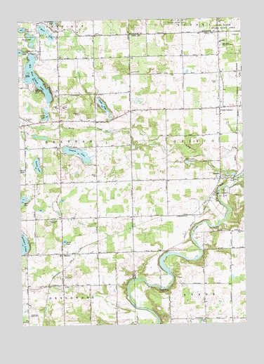
Smyrna, MI USGS Topographic Map
Click on map above to begin viewing in our Map Viewer.

This topographic map contains these locations and features:
Feature Name Type Latitude Longitude GNIS ID View Map
AltonPopulated PlaceN43.0164°W85.3517°620031View Map
Alton Bible ChurchChurchN43.0167°W85.3514°2565353View Map
Alton CemeteryCemeteryN43.0170°W85.3509°2567125View Map
Alton Pioneer Village Historical MarkerParkN43.0169°W85.3511°2566842View Map
Alton StationLocaleN43.0161°W85.3583°2570787View Map
Arrowhead Golf ClubLocaleN43.0045°W85.3706°1623211View Map
Ashley Baptist ChurchChurchN43.0881°W85.2825°2582409View Map
Ashley CemeteryCemeteryN43.1180°W85.3333°2567120View Map
Ashley ChurchChurchN43.1189°W85.3320°620274View Map
Ashley Post Office (historical)Post OfficeN43.1186°W85.3328°2570770View Map
Big Pine Island LakeLakeN43.1017°W85.3655°621342View Map
Boulder Canyon AirportAirportN43.0769°W85.2646°2717258View Map
Byrne LakeLakeN43.0512°W85.3741°622406View Map
Byrne ParkParkN43.0953°W85.3553°622407View Map
Candlestone Golf CourseLocaleN43.1047°W85.2600°2581765View Map
Christian ChurchChurchN43.1153°W85.2620°623244View Map
Cooks CornersPopulated PlaceN43.0884°W85.2625°623753View Map
Faith Community Christian SchoolSchoolN43.1097°W85.2764°2582407View Map
Grattan SchoolSchoolN43.0850°W85.3706°627237View Map
Grattan Township Fire DepartmentBuildingN43.0833°W85.3693°2635985View Map
Green LakeLakeN43.0894°W85.3275°627308View Map
Hart LakeLakeN43.1212°W85.3611°627874View Map
Hull LakeLakeN43.1215°W85.3730°628796View Map
Lakeside Mobile Home CommunityPopulated PlaceN43.1242°W85.3639°2567141View Map
Lakewood SchoolSchoolN43.1236°W85.2622°630082View Map
Lewis LakeLakeN43.0342°W85.3509°630349View Map
Marble CemeteryCemeteryN43.0017°W85.2732°631530View Map
Mason CemeteryCemeteryN43.0611°W85.3322°631698View Map
MoseleyPopulated PlaceN43.0295°W85.3520°1617732View Map
Moseley School Historical MarkerParkN43.0297°W85.3514°2567133View Map
Murray Lake Elementary SchoolSchoolN43.0294°W85.3725°2565323View Map
New Hope Church of GodChurchN43.0883°W85.2681°2582406View Map
Otisco CemeteryCemeteryN43.0989°W85.2636°634153View Map
Otisco Post Office (historical)Post OfficeN43.1028°W85.2639°2581737View Map
Rest Haven Memorial GardensCemeteryN43.1139°W85.2614°635809View Map
Ridgeview Golf ClubLocaleN43.0583°W85.2506°2581764View Map
Saint Mary's Catholic CemeteryCemeteryN43.0367°W85.2533°2581782View Map
Saint Marys ChurchChurchN43.0375°W85.2533°636901View Map
Scally LakeLakeN43.0656°W85.3656°637312View Map
Seely CreekStreamN43.0598°W85.2542°637554View Map
Slayton LakeLakeN43.0704°W85.3428°638093View Map
SmyrnaPopulated PlaceN43.0595°W85.2628°638183View Map
Smyrna Bible ChurchChurchN43.0564°W85.2647°2581766View Map
Smyrna CemeteryCemeteryN43.0611°W85.2622°2581783View Map
Smyrna Historical MarkerParkN43.0591°W85.2633°2567805View Map
Smyrna Post Office (historical)Post OfficeN43.0594°W85.2628°2581729View Map
Smyrna StationLocaleN43.0589°W85.2583°2581796View Map
Tower LakeLakeN43.0863°W85.3600°1614985View Map
Township of GrattanCivilN43.0738°W85.3718°1626389View Map
Township of OtiscoCivilN43.0716°W85.2563°1626867View Map
Twin LakesLakeN43.1180°W85.3666°1615258View Map
Vergennes District Number One Schoolhouse Historical MarkerParkN43.0158°W85.3481°2567135View Map
Vergennes Post Office (historical)Post OfficeN43.0164°W85.3517°2570690View Map
WCUZ-FM (Grand Rapids)TowerN43.0411°W85.3578°1625706View Map
Wellington Estates Mobile Home ParkPopulated PlaceN43.0892°W85.2508°2582405View Map
White's Bridge Historical MarkerParkN43.0143°W85.2980°2567804View Map
Whites BridgeBridgeN43.0145°W85.2975°1623705View Map
WODJ-FM (Greenville)TowerN43.0195°W85.3495°1625712View Map
Woodview Elementary SchoolSchoolN43.0981°W85.2506°2582404View Map

Note: Coordinates in the location and feature list above are referenced to NAD83 datum.


Copyright (C) 2008-2024 Ryan Niemi / Sunset Dynamics ... All Rights Reserved