TopoQuest Logo
Do you find TopoQuest useful?
Help keep TopoQuest running and adding new maps/features by donating!
Bitcoin:  19c7KJd3qBynnjoSw5npx9KScwjBe4ifkT
Litecoin:  LXs6TkuXGGXo1vDsWCkWVdjQX94eUKd6ui
Home View Maps Find Maps Find Places Resources & Links


Mallory, West Virginia Topographic Map

USGS Map Title: Mallory, WV
USGS Map MRC: 37081F7
DRG (GeoTIFF) Download: o37081f7.tif


Neighboring USGS Topographic Map Quads:


  Logan, WV  
37081G8
 

  Amherstdale, WV  
37081G7
 

  Lorado, WV  
37081G6
 

  Man, WV  
37081F8
 

  Mallory, WV  
37081F7
 

  Oceana, WV  
37081F6
 

  Wharncliffe, WV  
37081E8
 

  Gilbert, WV  
37081E7
 

  Baileysville, WV  
37081E6


Map MRC Location:

N38°
W82°
N38°
W81°
H8 H7 H6 H5 H4 H3 H2 H1
G8 G7 G6 G5 G4 G3 G2 G1
F8 F7 F6 F5 F4 F3 F2 F1
E8 E7 E6 E5 E4 E3 E2 E1
D8 D7 D6 D5 D4 D3 D2 D1
C8 C7 C6 C5 C4 C3 C2 C1
B8 B7 B6 B5 B4 B3 B2 B1
A8 A7 A6 A5 A4 A3 A2 A1
N37°
W82°
N37°
W81°

Mallory, WV USGS 1:24K Topographic Map Preview:
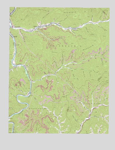
Mallory, WV USGS Topographic Map
Click on map above to begin viewing in our Map Viewer.

This topographic map contains these locations and features:
Feature Name Type Latitude Longitude GNIS ID View Map
Bear BranchStreamN37.6873°W81.8129°1535341View Map
Big Springs BranchStreamN37.7301°W81.8407°1535973View Map
Bills BranchStreamN37.6918°W81.8576°1535998View Map
Browning CemeteryCemeteryN37.6501°W81.8307°1536418View Map
BrunoPopulated PlaceN37.6907°W81.8690°1553999View Map
Bruno Census Designated PlaceCensusN37.6880°W81.8737°2586773View Map
Bruno Post OfficePost OfficeN37.6915°W81.8691°1742489View Map
Buckeye HollowValleyN37.6879°W81.7712°1536590View Map
Bum ForkStreamN37.6637°W81.8462°1536718View Map
Canebrake BranchStreamN37.6443°W81.8671°1536993View Map
ChristianPopulated PlaceN37.6921°W81.8560°1537327View Map
Christian BranchStreamN37.6815°W81.8296°1537328View Map
Christian Elementary School (historical)SchoolN37.6896°W81.8543°1742497View Map
ClaypoolPopulated PlaceN37.7332°W81.8146°1554142View Map
Claypool CemeteryCemeteryN37.7332°W81.8129°1742505View Map
Cline CemeteryCemeteryN37.6265°W81.7712°1537413View Map
Combs AdditionPopulated PlaceN37.7307°W81.8001°1537542View Map
Community ChurchChurchN37.6348°W81.8118°1537552View Map
DavinPopulated PlaceN37.7318°W81.8293°1554262View Map
Davin Post OfficePost OfficeN37.7321°W81.8278°1742514View Map
Deep Ford BranchStreamN37.6615°W81.8546°1538106View Map
Dingess RunStreamN37.6879°W81.7954°1538205View Map
Dolliver BranchStreamN37.7332°W81.8151°1538259View Map
Eastern DistrictCivilN37.7246°W81.8460°1928259View Map
Elk CreekStreamN37.6759°W81.8476°1538617View Map
Elk Trace BranchStreamN37.6451°W81.7726°1538639View Map
Elk Trace CemeteryCemeteryN37.6465°W81.7726°1538641View Map
Emanuel ChurchChurchN37.7279°W81.8404°1538702View Map
EmmettPopulated PlaceN37.6826°W81.8271°1554401View Map
Emmett Post OfficePost OfficeN37.6826°W81.8268°1742521View Map
Gillman BottomPopulated PlaceN37.7287°W81.7940°1554554View Map
Green BranchStreamN37.7296°W81.8629°1539665View Map
GreenvillePopulated PlaceN37.7209°W81.8718°1539722View Map
GuyanPopulated PlaceN37.6404°W81.7748°1554621View Map
Harrys BranchStreamN37.6251°W81.8637°1540020View Map
He HollowValleyN37.6871°W81.7751°1540103View Map
Hollow Log BranchStreamN37.7337°W81.7821°1540393View Map
Huff CreekStreamN37.7304°W81.8732°1540551View Map
Huff JunctionPopulated PlaceN37.7296°W81.8676°1540553View Map
Hunt Post OfficePost OfficeN37.7209°W81.8718°1721387View Map
LandvillePopulated PlaceN37.7123°W81.8673°1554909View Map
Laurel BranchStreamN37.6665°W81.8490°1541366View Map
Lick BranchStreamN37.7351°W81.7643°1541870View Map
MalloryPopulated PlaceN37.7307°W81.8379°1555032View Map
Mallory Census Designated PlaceCensusN37.7274°W81.8206°2390112View Map
Mallory Elementary School (historical)SchoolN37.7298°W81.8382°1742569View Map
Mallory Post OfficePost OfficeN37.7264°W81.8479°1742570View Map
Man Appalachian Regional Hospital (historical)HospitalN37.7315°W81.8746°1742571View Map
Man Elementary SchoolSchoolN37.7271°W81.8548°2489160View Map
Man Junior High School (historical)SchoolN37.7468°W81.8698°1742572View Map
Man Middle SchoolSchoolN37.7274°W81.8555°2088255View Map
Man Police DepartmentBuildingN37.7434°W81.8736°2728009View Map
Man Post OfficePost OfficeN37.7437°W81.8725°1742573View Map
Man Volunteer Fire DepartmentBuildingN37.7447°W81.8717°2577585View Map
McDonald CemeteryCemeteryN37.6965°W81.8687°1542986View Map
McDonald CemeteryCemeteryN37.7307°W81.8696°1542987View Map
Mill BranchStreamN37.7032°W81.7621°1543286View Map
Mineral CityPopulated PlaceN37.7337°W81.8237°1555134View Map
Moore ForkStreamN37.6834°W81.8176°1543514View Map
Morgan ForkStreamN37.6262°W81.8115°1543541View Map
Mossy BranchStreamN37.6534°W81.7579°1543601View Map
Mountain Mart Village Shopping CenterLocaleN37.7301°W81.8715°1742584View Map
Muddy Bridge BranchStreamN37.7357°W81.7726°1543925View Map
Oldhouse BranchStreamN37.6823°W81.8251°1544383View Map
Orchard BranchStreamN37.6462°W81.8590°1544431View Map
Pilgrim Rest ChurchChurchN37.7259°W81.8373°1544855View Map
Pointlick ForkStreamN37.6409°W81.8140°1545106View Map
Poplar Log HollowValleyN37.6882°W81.7815°1545149View Map
Pound Mill BranchStreamN37.7287°W81.8673°1545198View Map
Riddle BranchStreamN37.7312°W81.8340°1545568View Map
Right Hand Fork Elk CreekStreamN37.6898°W81.8112°1545728View Map
Riverview ChurchChurchN37.6279°W81.8698°1545780View Map
Road BranchStreamN37.6418°W81.7746°1545795View Map
Rockhouse BranchStreamN37.7007°W81.7573°1545967View Map
Sandlick BranchStreamN37.7296°W81.7965°1546386View Map
Sandlick ChurchChurchN37.6873°W81.8740°1546391View Map
Sandlick CreekStreamN37.6923°W81.8704°1546394View Map
SlabtownPopulated PlaceN37.6290°W81.8698°1555642View Map
Spice CreekStreamN37.6640°W81.8479°1547136View Map
Stonecoal BranchStreamN37.7023°W81.7598°1547468View Map
Sturgeon BranchStreamN37.6337°W81.7840°1547606View Map
Sugarcamp BranchStreamN37.7362°W81.7601°1547672View Map
Sugartree BranchStreamN37.6951°W81.7962°1547700View Map
Sycamore BranchStreamN37.6504°W81.7690°1547813View Map
Sylvia BranchStreamN37.6609°W81.8648°1547852View Map
The Church of the TimberChurchN37.7329°W81.8129°1742630View Map
Triadelphia Country ClubLocaleN37.6937°W81.8693°1557898View Map
Triadelphia Country Club Golf CourseLocaleN37.6952°W81.8696°2634221View Map
Turkeypen BranchStreamN37.6921°W81.8073°1548370View Map
VernerPopulated PlaceN37.6634°W81.8504°1548648View Map
Verner Post OfficePost OfficeN37.6645°W81.8497°1728876View Map
Wallace ForkStreamN37.6279°W81.8115°1548738View Map
Walnut HollowValleyN37.6532°W81.7593°1548770View Map
William C Browning BridgeBridgeN37.6648°W81.8485°2647482View Map
WyloPopulated PlaceN37.6765°W81.8471°1556031View Map

Note: Coordinates in the location and feature list above are referenced to NAD83 datum.


Copyright (C) 2008-2024 Ryan Niemi / Sunset Dynamics ... All Rights Reserved