TopoQuest Logo
Do you find TopoQuest useful?
Help keep TopoQuest running and adding new maps/features by donating!
Bitcoin:  19c7KJd3qBynnjoSw5npx9KScwjBe4ifkT
Litecoin:  LXs6TkuXGGXo1vDsWCkWVdjQX94eUKd6ui
Home View Maps Find Maps Find Places Resources & Links


Maxwell, Iowa Topographic Map

USGS Map Title: Maxwell, IA
USGS Map MRC: 41093H4
DRG (GeoTIFF) Download: o41093h4.tif


Neighboring USGS Topographic Map Quads:


  Ames East, IA  
42093A5
 

  Nevada, IA  
42093A4
 

  Colo, IA  
42093A3
 

  Huxley, IA  
41093H5
 

  Maxwell, IA  
41093H4
 

  Collins, IA  
41093H3
 

  Elkhart, IA  
41093G5
 

  Loring, IA  
41093G4
 

  Mingo, IA  
41093G3


Map MRC Location:

N42°
W94°
N42°
W93°
H8 H7 H6 H5 H4 H3 H2 H1
G8 G7 G6 G5 G4 G3 G2 G1
F8 F7 F6 F5 F4 F3 F2 F1
E8 E7 E6 E5 E4 E3 E2 E1
D8 D7 D6 D5 D4 D3 D2 D1
C8 C7 C6 C5 C4 C3 C2 C1
B8 B7 B6 B5 B4 B3 B2 B1
A8 A7 A6 A5 A4 A3 A2 A1
N41°
W94°
N41°
W93°

Maxwell, IA USGS 1:24K Topographic Map Preview:
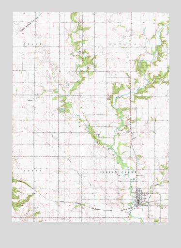
Maxwell, IA USGS Topographic Map
Click on map above to begin viewing in our Map Viewer.

This topographic map contains these locations and features:
Feature Name Type Latitude Longitude GNIS ID View Map
Brethren ChurchChurchN41.8905°W93.3999°1999403View Map
Brubaker CemeteryCemeteryN41.8847°W93.3919°1999499View Map
Calamus Creek BridgeBridgeN41.8850°W93.3819°1999522View Map
Center Grove CemeteryCemeteryN41.8834°W93.4834°455287View Map
Christian ChurchChurchN41.8889°W93.3985°1999404View Map
City of MaxwellCivilN41.8914°W93.3960°2395048View Map
Collins - Maxwell Middle / High SchoolSchoolN41.8905°W93.3974°1999407View Map
Community Historical Society MuseumLocaleN41.8919°W93.3997°1999400View Map
East Indian CreekStreamN41.9208°W93.4197°456161View Map
East Indian Creek BridgeBridgeN41.9753°W93.3869°1999523View Map
ElwellLocaleN41.8861°W93.4630°466197View Map
Elwell Post Office (historical)Post OfficeN41.8783°W93.4630°1999116View Map
Farmers Elevator Company ElevatorLocaleN41.8869°W93.3985°1999394View Map
First Presbyterian ChurchChurchN41.8894°W93.3985°1999405View Map
Indian Creek Country ClubLocaleN41.9758°W93.4455°465844View Map
Iowa CenterPopulated PlaceN41.9286°W93.4052°457823View Map
Iowa Center Post Office (historical)Post OfficeN41.9286°W93.4052°1999115View Map
MaxwellPopulated PlaceN41.8919°W93.3997°458863View Map
Maxwell (historical)LocaleN41.8855°W93.3997°1999401View Map
Maxwell CemeteryCemeteryN41.8958°W93.3999°1999502View Map
Maxwell City HallBuildingN41.8880°W93.3991°1999397View Map
Maxwell City ParkParkN41.8883°W93.4016°1999399View Map
Maxwell First RespondersBuildingN41.8882°W93.3993°2599817View Map
Maxwell Medical ClinicHospitalN41.8919°W93.3997°1999402View Map
Maxwell Post OfficePost OfficeN41.8872°W93.3999°1999398View Map
Maxwell Public LibraryBuildingN41.8880°W93.3991°1999396View Map
Maxwell Volunteer Fire DepartmentBuildingN41.8881°W93.3993°1999395View Map
Pleasant Run CemeteryCemeteryN41.9864°W93.4063°460297View Map
Robison-Whitaker AcresPopulated PlaceN41.9258°W93.4352°464724View Map
Rock CreekStreamN41.8778°W93.3974°460731View Map
Rolling Hills Mobile Home ParkPopulated PlaceN41.9133°W93.3974°1999408View Map
Rupple CreekStreamN41.9147°W93.4155°460852View Map
Township of Indian CreekCivilN41.9067°W93.4057°468070View Map
Township of NevadaCivilN41.9923°W93.4053°468426View Map
United Methodist ChurchChurchN41.8919°W93.3997°1999406View Map
West Indian CreekStreamN41.9208°W93.4197°462869View Map
Woodland CemeteryCemeteryN41.9324°W93.4067°463186View Map

Note: Coordinates in the location and feature list above are referenced to NAD83 datum.


Copyright (C) 2008-2024 Ryan Niemi / Sunset Dynamics ... All Rights Reserved