TopoQuest Logo
Do you find TopoQuest useful?
Help keep TopoQuest running and adding new maps/features by donating!
Bitcoin:  19c7KJd3qBynnjoSw5npx9KScwjBe4ifkT
Litecoin:  LXs6TkuXGGXo1vDsWCkWVdjQX94eUKd6ui
Home View Maps Find Maps Find Places Resources & Links


Nevada, Iowa Topographic Map

USGS Map Title: Nevada, IA
USGS Map MRC: 42093A4
DRG (GeoTIFF) Download: o42093a4.tif


Neighboring USGS Topographic Map Quads:


  Story City, IA  
42093B5
 

  McCallsburg, IA  
42093B4
 

  Zearing, IA  
42093B3
 

  Ames East, IA  
42093A5
 

  Nevada, IA  
42093A4
 

  Colo, IA  
42093A3
 

  Huxley, IA  
41093H5
 

  Maxwell, IA  
41093H4
 

  Collins, IA  
41093H3


Map MRC Location:

N43°
W94°
N43°
W93°
H8 H7 H6 H5 H4 H3 H2 H1
G8 G7 G6 G5 G4 G3 G2 G1
F8 F7 F6 F5 F4 F3 F2 F1
E8 E7 E6 E5 E4 E3 E2 E1
D8 D7 D6 D5 D4 D3 D2 D1
C8 C7 C6 C5 C4 C3 C2 C1
B8 B7 B6 B5 B4 B3 B2 B1
A8 A7 A6 A5 A4 A3 A2 A1
N42°
W94°
N42°
W93°

Nevada, IA USGS 1:24K Topographic Map Preview:
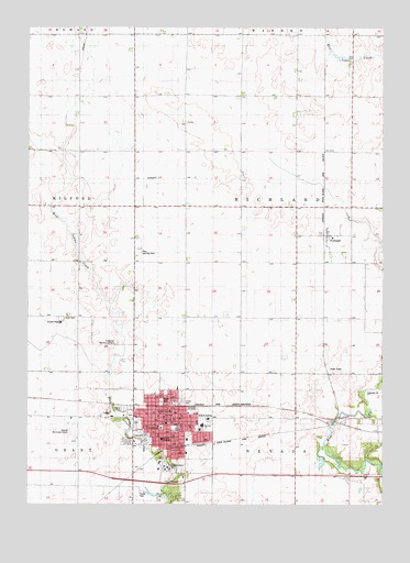
Nevada, IA USGS Topographic Map
Click on map above to begin viewing in our Map Viewer.

This topographic map contains these locations and features:
Feature Name Type Latitude Longitude GNIS ID View Map
4-H ParkParkN42.0186°W93.4619°1999475View Map
Assembly of God ChurchChurchN42.0244°W93.4491°1999470View Map
Bonthala ClinicHospitalN42.0205°W93.4510°1999458View Map
Central Elementary SchoolSchoolN42.0200°W93.4473°1999472View Map
Central Presbyterian ChurchChurchN42.0205°W93.4538°1999464View Map
Christian ChurchChurchN42.0153°W93.4608°1999469View Map
City of NevadaCivilN42.0185°W93.4637°2395178View Map
Community Evangelical Free ChurchChurchN42.0305°W93.4472°1999468View Map
Evergreen Memory GardensCemeteryN42.0425°W93.4685°456440View Map
FernaldPopulated PlaceN42.0708°W93.3949°456578View Map
FernaldLocaleN42.0708°W93.3952°1999114View Map
Fernald Post Office (historical)Post OfficeN42.0708°W93.3949°1999113View Map
Harrington ParkParkN42.0236°W93.4377°1999477View Map
Hattery ParkParkN42.0264°W93.4533°1999476View Map
Kiwanis ParkParkN42.0167°W93.4433°1999474View Map
Knoll CemeteryCemeteryN42.0489°W93.4871°458133View Map
Mardean ParkParkN42.0028°W93.4463°1999473View Map
McFarland ClinicHospitalN42.0122°W93.4530°1999459View Map
Memorial Lutheran ChurchChurchN42.0172°W93.4438°1999467View Map
NevadaLocaleN42.0255°W93.4516°1999457View Map
NevadaPopulated PlaceN42.0228°W93.4524°459461View Map
Nevada Back and Neck Care CenterHospitalN42.0305°W93.4472°1999460View Map
Nevada Baptist ChurchChurchN42.0214°W93.4491°1999466View Map
Nevada CemeteryCemeteryN42.0216°W93.4619°1999496View Map
Nevada Fire DepartmentBuildingN42.0230°W93.4472°1999450View Map
Nevada First RespondersBuildingN42.0230°W93.4473°2599659View Map
Nevada High SchoolSchoolN42.0207°W93.4389°1999471View Map
Nevada Middle SchoolSchoolN42.0213°W93.4389°2719904View Map
Nevada Municipal Airport (historical)AirportN42.0194°W93.4849°1999479View Map
Nevada Police DepartmentBuildingN42.0230°W93.4514°1999451View Map
Nevada Post OfficePost OfficeN42.0219°W93.4541°1999456View Map
Nevada Public LibraryBuildingN42.0219°W93.4513°1999452View Map
Nevada Seventh-day Adventist SchoolSchoolN42.0092°W93.4540°2719722View Map
North ParkParkN42.0272°W93.4533°459614View Map
Oak Park AcademySchoolN42.0097°W93.4508°459729View Map
Paul Landing Strip (historical)AirportN42.0667°W93.4602°1999498View Map
Saint Patrick Catholic CemeteryCemeteryN42.0236°W93.4641°1999497View Map
Saint Patrick's Catholic ChurchChurchN42.0225°W93.4466°1999463View Map
Sch HeliportAirportN42.0175°W93.4530°466891View Map
Seventh Day Adventist ChurchChurchN42.0100°W93.4519°1999465View Map
Story CountyCivilN42.0362°W93.4650°465273View Map
Story County CourthouseBuildingN42.0200°W93.4530°1999453View Map
Story County HomeBuildingN42.0478°W93.4883°463415View Map
Story County Medical CenterHospitalN42.0170°W93.4529°1999461View Map
Story County Sheriff's OfficeBuildingN42.0114°W93.4424°1999454View Map
Swanson ElevatorLocaleN42.0778°W93.4080°1999455View Map
Township of RichlandCivilN42.0788°W93.4050°468613View Map
United Methodist ChurchChurchN42.0214°W93.4513°1999462View Map

Note: Coordinates in the location and feature list above are referenced to NAD83 datum.


Copyright (C) 2008-2024 Ryan Niemi / Sunset Dynamics ... All Rights Reserved