TopoQuest Logo
Do you find TopoQuest useful?
Help keep TopoQuest running and adding new maps/features by donating!
Bitcoin:  19c7KJd3qBynnjoSw5npx9KScwjBe4ifkT
Litecoin:  LXs6TkuXGGXo1vDsWCkWVdjQX94eUKd6ui
Home View Maps Find Maps Find Places Resources & Links


McCausland, Iowa Topographic Map

USGS Map Title: McCausland, IA
USGS Map MRC: 41090F4
DRG (GeoTIFF) Download: o41090f4.tif


Neighboring USGS Topographic Map Quads:


  De Witt, IA  
41090G5
 

  Malone, IA  
41090G4
 

  Camanche, IA  
41090G3
 

  Eldridge, IA  
41090F5
 

  McCausland, IA  
41090F4
 

  Cordova, IL  
41090F3
 

  Davenport East, IA  
41090E5
 

  Silvis, IL  
41090E4
 

  Port Byron, IL  
41090E3


Map MRC Location:

N42°
W91°
N42°
W90°
H8 H7 H6 H5 H4 H3 H2 H1
G8 G7 G6 G5 G4 G3 G2 G1
F8 F7 F6 F5 F4 F3 F2 F1
E8 E7 E6 E5 E4 E3 E2 E1
D8 D7 D6 D5 D4 D3 D2 D1
C8 C7 C6 C5 C4 C3 C2 C1
B8 B7 B6 B5 B4 B3 B2 B1
A8 A7 A6 A5 A4 A3 A2 A1
N41°
W91°
N41°
W90°

McCausland, IA USGS 1:24K Topographic Map Preview:
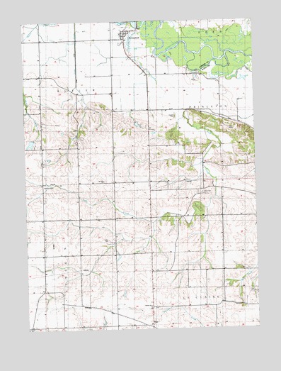
McCausland, IA USGS Topographic Map
Click on map above to begin viewing in our Map Viewer.

This topographic map contains these locations and features:
Feature Name Type Latitude Longitude GNIS ID View Map
ArgoPopulated PlaceN41.6259°W90.4326°454225View Map
Argo Post Office (historical)Post OfficeN41.6259°W90.4326°2046242View Map
Argo School (historical)SchoolN41.6336°W90.4324°465053View Map
Buffalo Bill Cody HomesteadLocaleN41.7139°W90.4512°2047399View Map
Buffalo Bill HomesteadLocaleN41.7461°W90.4432°463969View Map
City of McCauslandCivilN41.7435°W90.4461°2395059View Map
Criswell School (historical)SchoolN41.6373°W90.4715°465066View Map
Fessler CemeteryCemeteryN41.7117°W90.4182°456581View Map
Kerr Post Office (historical)Post OfficeN41.7042°W90.4307°2046241View Map
KMJC-FM (Clinton)TowerN41.6328°W90.4107°467307View Map
LeClaire Prairie CemeteryCemeteryN41.6337°W90.4316°2046577View Map
Lost Grove Lake Wildlife Management AreaParkN41.6750°W90.4585°2046265View Map
Lost Grove School (historical)SchoolN41.6698°W90.4240°465118View Map
Maple Glenn School (historical)SchoolN41.7081°W90.3815°465119View Map
McCauseland Volunteer Fire DepartmentBuildingN41.7455°W90.4445°2577235View Map
McCauslandPopulated PlaceN41.7461°W90.4432°458887View Map
McCausland CemeteryCemeteryN41.7477°W90.4465°2046579View Map
McCausland Methodist ChurchChurchN41.7461°W90.4432°2046492View Map
McCausland Post OfficePost OfficeN41.7461°W90.4432°2046491View Map
Mount Union CemeteryCemeteryN41.6851°W90.4567°459343View Map
Old Channel Lost CreekStreamN41.7381°W90.4279°465525View Map
Pleasant Hill School (historical)SchoolN41.6706°W90.3835°465139View Map
Pleasant Ridge School (historical)SchoolN41.6881°W90.4524°465140View Map
Quiet Valley HeliportAirportN41.7042°W90.4682°466872View Map
Rock Spring School (historical)SchoolN41.6984°W90.4912°465149View Map
Salem CemeteryCemeteryN41.6800°W90.4037°461358View Map
South Fork Lost CreekStreamN41.6686°W90.4310°465413View Map
Summit Church (historical)ChurchN41.6256°W90.4987°465170View Map
Summitt CemeteryCemeteryN41.6253°W90.4992°2046578View Map
Township of ButlerCivilN41.7258°W90.4923°467516View Map
Township of PrincetonCivilN41.6957°W90.3825°468578View Map
United ChurchChurchN41.6339°W90.4329°462477View Map
Wapsie View School (historical)SchoolN41.7139°W90.4521°465179View Map
West View School (historical)SchoolN41.6695°W90.4704°465182View Map

Note: Coordinates in the location and feature list above are referenced to NAD83 datum.


Copyright (C) 2008-2024 Ryan Niemi / Sunset Dynamics ... All Rights Reserved