TopoQuest Logo
Do you find TopoQuest useful?
Help keep TopoQuest running and adding new maps/features by donating!
Bitcoin:  19c7KJd3qBynnjoSw5npx9KScwjBe4ifkT
Litecoin:  LXs6TkuXGGXo1vDsWCkWVdjQX94eUKd6ui
Home View Maps Find Maps Find Places Resources & Links


Mill Iron, Montana Topographic Map

USGS Map Title: Mill Iron, MT
USGS Map MRC: 45104G2
DRG (GeoTIFF) Download: o45104g2.tif


Neighboring USGS Topographic Map Quads:


  Dutchmans Hill, MT  
45104H3
 

  Flasted Hill, MT  
45104H2
 

  Snider Hill, MT  
45104H1
 

  Lampkin Gulch, MT  
45104G3
 

  Mill Iron, MT  
45104G2
 

  Humbolt Hills, MT  
45104G1
 

  Belltower, MT  
45104F3
 

  Rustler Divide, MT  
45104F2
 

  North Slick Creek, MT  
45104F1


Map MRC Location:

N46°
W105°
N46°
W104°
H8 H7 H6 H5 H4 H3 H2 H1
G8 G7 G6 G5 G4 G3 G2 G1
F8 F7 F6 F5 F4 F3 F2 F1
E8 E7 E6 E5 E4 E3 E2 E1
D8 D7 D6 D5 D4 D3 D2 D1
C8 C7 C6 C5 C4 C3 C2 C1
B8 B7 B6 B5 B4 B3 B2 B1
A8 A7 A6 A5 A4 A3 A2 A1
N45°
W105°
N45°
W104°

Mill Iron, MT USGS 1:24K Topographic Map Preview:
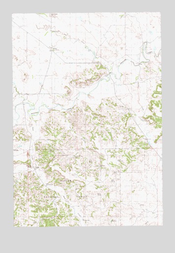
Mill Iron, MT USGS Topographic Map
Click on map above to begin viewing in our Map Viewer.

This topographic map contains these locations and features:
Feature Name Type Latitude Longitude GNIS ID View Map
01N60E34CDDD01 WellWellN45.7953°W104.2494°812107View Map
01N61E08BCDA01 WellWellN45.8622°W104.1722°812853View Map
01N61E29ADAB01 WellWellN45.8225°W104.1588°812458View Map
01N61E32BDBD01 WellWellN45.8019°W104.1686°812175View Map
01S61E03ABAB01 WellWellN45.7853°W104.1786°812005View Map
Arledge WellWellN45.7847°W104.2316°799445View Map
Bar C ReservoirReservoirN45.7944°W104.2204°799448View Map
Byrne WellWellN45.7950°W104.2497°799447View Map
Coal CreekStreamN45.8442°W104.1619°799624View Map
Coal Creek SchoolSchoolN45.8531°W104.2163°799427View Map
Flat ReservoirReservoirN45.7804°W104.1974°799442View Map
Hatch SpringSpringN45.7680°W104.1800°799441View Map
Herman ReservoirReservoirN45.7531°W104.1689°799452View Map
Iron SpringSpringN45.7527°W104.2311°799450View Map
L O ReservoirReservoirN45.7883°W104.1627°799435View Map
Latham WellWellN45.7719°W104.1988°799443View Map
Lower Snow Creek WellWellN45.7750°W104.2230°799444View Map
McNary School (historical)SchoolN45.8117°W104.2263°1688814View Map
Mill IronPopulated PlaceN45.8536°W104.2194°774229View Map
Mill Iron Post Office (historical)Post OfficeN45.8528°W104.2163°1688717View Map
Old Snow Creek WellWellN45.7539°W104.1930°799451View Map
Patton SpringSpringN45.7760°W104.1689°799438View Map
Patton Spring Number 2SpringN45.7812°W104.1662°799440View Map
Pine Hill School (historical)SchoolN45.8006°W104.1385°799431View Map
Red Bluff SpringSpringN45.7851°W104.2351°799446View Map
Saint Ann ChurchChurchN45.8528°W104.2163°1688699View Map
Set Inc Number 1 DamDamN45.8533°W104.1838°797500View Map
Snow CreekStreamN45.8150°W104.2380°776707View Map
Spring CreekStreamN45.8450°W104.1438°777040View Map
Wallenstein DamDamN45.8300°W104.1372°795069View Map
Willow SpringSpringN45.7879°W104.1874°799437View Map
Wood GulchValleyN45.8192°W104.2080°799429View Map
Wood Gulch SpringSpringN45.7908°W104.1994°799432View Map
Wood Gulch WellWellN45.7853°W104.1783°799433View Map

Note: Coordinates in the location and feature list above are referenced to NAD83 datum.


Copyright (C) 2008-2024 Ryan Niemi / Sunset Dynamics ... All Rights Reserved