TopoQuest Logo
Do you find TopoQuest useful?
Help keep TopoQuest running and adding new maps/features by donating!
Bitcoin:  19c7KJd3qBynnjoSw5npx9KScwjBe4ifkT
Litecoin:  LXs6TkuXGGXo1vDsWCkWVdjQX94eUKd6ui
Home View Maps Find Maps Find Places Resources & Links


Rustler Divide, Montana Topographic Map

USGS Map Title: Rustler Divide, MT
USGS Map MRC: 45104F2
DRG (GeoTIFF) Download: o45104f2.tif


Neighboring USGS Topographic Map Quads:


  Lampkin Gulch, MT  
45104G3
 

  Mill Iron, MT  
45104G2
 

  Humbolt Hills, MT  
45104G1
 

  Belltower, MT  
45104F3
 

  Rustler Divide, MT  
45104F2
 

  North Slick Creek, MT  
45104F1
 

  Belltower Butte, MT  
45104E3
 

  Timber Hill, MT  
45104E2
 

  Capitol Rock, MT  
45104E1


Map MRC Location:

N46°
W105°
N46°
W104°
H8 H7 H6 H5 H4 H3 H2 H1
G8 G7 G6 G5 G4 G3 G2 G1
F8 F7 F6 F5 F4 F3 F2 F1
E8 E7 E6 E5 E4 E3 E2 E1
D8 D7 D6 D5 D4 D3 D2 D1
C8 C7 C6 C5 C4 C3 C2 C1
B8 B7 B6 B5 B4 B3 B2 B1
A8 A7 A6 A5 A4 A3 A2 A1
N45°
W105°
N45°
W104°

Rustler Divide, MT USGS 1:24K Topographic Map Preview:
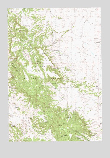
Rustler Divide, MT USGS Topographic Map
Click on map above to begin viewing in our Map Viewer.

This topographic map contains these locations and features:
Feature Name Type Latitude Longitude GNIS ID View Map
01S61E20CAAA01 WellWellN45.7333°W104.2202°811509View Map
Abel ReservoirReservoirN45.7253°W104.1888°799473View Map
Burditt SpringSpringN45.6476°W104.2222°799580View Map
Carter WellWellN45.7153°W104.2227°799468View Map
Coal Bank SpringSpringN45.7174°W104.1899°799474View Map
Dead Horse ReservoirReservoirN45.6755°W104.2443°799502View Map
Devils Canyon Spring Number 1SpringN45.6981°W104.2451°799500View Map
Devils Canyon Spring Number 2SpringN45.6942°W104.2409°799501View Map
Division SpringSpringN45.6531°W104.2051°799578View Map
Elmer SpringSpringN45.6339°W104.1618°799588View Map
Etta ReservoirReservoirN45.6573°W104.2414°799577View Map
Grasshopper SpringSpringN45.6433°W104.2015°799581View Map
Grassy ButteSummitN45.7208°W104.1352°771932View Map
Halbert GulchValleyN45.7249°W104.2152°799472View Map
Halbert SpringSpringN45.7306°W104.2380°799467View Map
Hart SpringSpringN45.6379°W104.1963°799584View Map
Jack SpringSpringN45.7100°W104.2341°799469View Map
Kennedy WellWellN45.7334°W104.2236°799466View Map
L/W ReservoirReservoirN45.7461°W104.2034°768222View Map
Lantis SpringSpringN45.6302°W104.1778°799586View Map
Lantis Spring CampgroundLocaleN45.6306°W104.1769°1721491View Map
Little Noise SpringSpringN45.6339°W104.2093°799582View Map
Long PinesRangeN45.6889°W104.2283°1688744View Map
Milo WellWellN45.6664°W104.2449°799576View Map
Mobray Reservoir Number 2ReservoirN45.7077°W104.1866°799476View Map
Mobray Reservoir Number 3ReservoirN45.7092°W104.1904°799475View Map
Mobray Spring Number 1SpringN45.7072°W104.1982°799477View Map
Mobray Spring Number 2SpringN45.7038°W104.1940°799478View Map
Mowbray Number 3 DamDamN45.7117°W104.1705°797499View Map
Pendleton SpringSpringN45.6279°W104.1547°799589View Map
Rustler CanyonValleyN45.6833°W104.1527°799593View Map
Rustler Canyon SpringSpringN45.6929°W104.1853°799592View Map
Rustler DivideRidgeN45.6969°W104.1958°799505View Map
Slick Creek SpringSpringN45.6531°W104.1928°799579View Map
South Carter SpringSpringN45.6467°W104.1666°799587View Map
Spring CanyonValleyN45.7156°W104.2230°799498View Map
Spring Canyon SpringSpringN45.7003°W104.2089°799499View Map
Stieg WellWellN45.7383°W104.1849°768233View Map
Stormy ButteSummitN45.6297°W104.1419°799591View Map
Stormy SpringSpringN45.6336°W104.1398°799590View Map
Summers ReservoirReservoirN45.6395°W104.2459°799583View Map
Tarter WellWellN45.7356°W104.2061°799470View Map
Tri Point TowerTowerN45.6400°W104.1844°799585View Map
Ward Spring Number 1SpringN45.6757°W104.2068°799503View Map
Ward Spring Number 2SpringN45.6791°W104.1917°799504View Map
X/X SpringSpringN45.6721°W104.2005°799575View Map

Note: Coordinates in the location and feature list above are referenced to NAD83 datum.


Copyright (C) 2008-2024 Ryan Niemi / Sunset Dynamics ... All Rights Reserved