TopoQuest Logo
Do you find TopoQuest useful?
Help keep TopoQuest running and adding new maps/features by donating!
Bitcoin:  19c7KJd3qBynnjoSw5npx9KScwjBe4ifkT
Litecoin:  LXs6TkuXGGXo1vDsWCkWVdjQX94eUKd6ui
Home View Maps Find Maps Find Places Resources & Links


Minooka, Illinois Topographic Map

USGS Map Title: Minooka, IL
USGS Map MRC: 41088D3
DRG (GeoTIFF) Download: o41088d3.tif


Neighboring USGS Topographic Map Quads:


  Plattville, IL  
41088E4
 

  Yorkville SE, IL  
41088E3
 

  Plainfield, IL  
41088E2
 

  Lisbon, IL  
41088D4
 

  Minooka, IL  
41088D3
 

  Channahon, IL  
41088D2
 

  Morris, IL  
41088C4
 

  Coal City, IL  
41088C3
 

  Wilmington, IL  
41088C2


Map MRC Location:

N42°
W89°
N42°
W88°
H8 H7 H6 H5 H4 H3 H2 H1
G8 G7 G6 G5 G4 G3 G2 G1
F8 F7 F6 F5 F4 F3 F2 F1
E8 E7 E6 E5 E4 E3 E2 E1
D8 D7 D6 D5 D4 D3 D2 D1
C8 C7 C6 C5 C4 C3 C2 C1
B8 B7 B6 B5 B4 B3 B2 B1
A8 A7 A6 A5 A4 A3 A2 A1
N41°
W89°
N41°
W88°

Minooka, IL USGS 1:24K Topographic Map Preview:
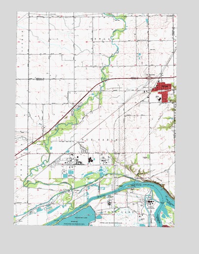
Minooka, IL USGS Topographic Map
Click on map above to begin viewing in our Map Viewer.

This topographic map contains these locations and features:
Feature Name Type Latitude Longitude GNIS ID View Map
Aux SablePopulated PlaceN41.3948°W88.3287°403746View Map
Aux Sable AqueductCanalN41.3964°W88.3301°2037555View Map
Aux Sable CemeteryCemeteryN41.4225°W88.3523°403747View Map
Aux Sable ChurchChurchN41.4456°W88.3540°403748View Map
Aux Sable CreekStreamN41.3811°W88.3378°403749View Map
Aux Sable IslandIslandN41.3786°W88.3376°403750View Map
Aux Sable LakeLakeN41.3967°W88.3134°1720468View Map
Aux Sable LockDamN41.3956°W88.3320°424585View Map
Aux Sable School (historical)SchoolN41.3931°W88.3381°403751View Map
Bell School (historical)SchoolN41.4973°W88.3109°1720237View Map
Broadway School (historical)SchoolN41.4548°W88.2951°1720470View Map
Chapman CemeteryCemeteryN41.4844°W88.2776°405973View Map
Chapman School (historical)SchoolN41.4839°W88.2731°1720238View Map
Collins RunStreamN41.4223°W88.3506°406382View Map
Des Plaines RiverStreamN41.3917°W88.2584°421765View Map
DivinePopulated PlaceN41.3859°W88.2953°422630View Map
Dollinger Family FarmLocaleN41.4061°W88.2867°2566243View Map
Dresden CemeteryCemeteryN41.4036°W88.2767°407386View Map
Dresden Heights School (historical)SchoolN41.4178°W88.2890°407387View Map
Dresden IslandIslandN41.3992°W88.2853°407388View Map
Dresden Island Lock and DamDamN41.4009°W88.2815°407389View Map
Dresden Island PoolReservoirN41.4009°W88.2815°1690863View Map
Dresden RunStreamN41.4025°W88.2809°407390View Map
Dresden Station Nuclear PowerplantLocaleN41.3897°W88.2692°1808670View Map
Henderson School (historical)SchoolN41.4681°W88.3151°1720239View Map
Interchange 122CrossingN41.4625°W88.2717°1720493View Map
Kankakee BluffsCliffN41.3978°W88.2581°411301View Map
Kankakee RiverStreamN41.3917°W88.2584°411304View Map
Little Dresden IslandIslandN41.3986°W88.2901°412327View Map
Lyondell Chemical CompanyBuildingN41.4141°W88.3290°2682606View Map
Martin School (historical)SchoolN41.4756°W88.3484°1720241View Map
MinookaPopulated PlaceN41.4553°W88.2617°413659View Map
Minooka Bible ChurchChurchN41.4611°W88.2615°1986430View Map
Minooka Community High SchoolSchoolN41.4500°W88.2631°1721114View Map
Minooka Elementary SchoolSchoolN41.4603°W88.2642°1811067View Map
Minooka Fire Department Station 2BuildingN41.4171°W88.3066°2682609View Map
Minooka Fire Protection District Station 1BuildingN41.4543°W88.2817°2681826View Map
Minooka Junior High SchoolSchoolN41.4581°W88.2651°1811068View Map
Minooka Police DepartmentBuildingN41.4488°W88.2604°2756760View Map
Minooka Post OfficePost OfficeN41.4555°W88.2647°1808672View Map
Minooka United Methodist ChurchChurchN41.4581°W88.2642°1986431View Map
Negro SloughLakeN41.3840°W88.3444°1721116View Map
Plattville Evangelical Lutheran CemeteryCemeteryN41.4961°W88.3593°1808679View Map
Plattville Lutheran ChurchChurchN41.4973°W88.3595°415769View Map
Saint Marys CemeteryCemeteryN41.4567°W88.2706°417569View Map
Saint Marys ChurchChurchN41.4567°W88.2648°1986432View Map
Sand RidgePopulated PlaceN41.4239°W88.3265°423151View Map
Shurtliffe BridgeBridgeN41.4981°W88.2992°1720244View Map
Skinner IslandIslandN41.3889°W88.2576°418573View Map
Three Rivers Farm Airport (historical)AirportN41.4028°W88.2626°427549View Map
Township of Aux SableCivilN41.4237°W88.3100°428623View Map
Village of ChannahonCivilN41.4202°W88.2624°2397601View Map
Village of MinookaCivilN41.4507°W88.2791°2399376View Map
Walley RunStreamN41.4261°W88.3490°420433View Map
Walley School (historical)SchoolN41.4234°W88.3631°420434View Map
WJCH-FM (Joliet)TowerN41.4153°W88.2720°428504View Map
Wood SpurLocaleN41.4178°W88.2978°421415View Map

Note: Coordinates in the location and feature list above are referenced to NAD83 datum.


Copyright (C) 2008-2024 Ryan Niemi / Sunset Dynamics ... All Rights Reserved