TopoQuest Logo
Do you find TopoQuest useful?
Help keep TopoQuest running and adding new maps/features by donating!
Bitcoin:  19c7KJd3qBynnjoSw5npx9KScwjBe4ifkT
Litecoin:  LXs6TkuXGGXo1vDsWCkWVdjQX94eUKd6ui
Home View Maps Find Maps Find Places Resources & Links


Mount Vernon, Tennessee Topographic Map

USGS Map Title: Mount Vernon, TN
USGS Map MRC: 35084D3
DRG (GeoTIFF) Download: o35084d3.tif


Neighboring USGS Topographic Map Quads:


  Sweetwater, TN  
35084E4
 

  Madisonville, TN  
35084E3
 

  Vonore, TN  
35084E2
 

  Englewood, TN  
35084D4
 

  Mount Vernon, TN  
35084D3
 

  Rafter, TN  
35084D2
 

  Mecca, TN  
35084C4
 

  Tellico Plains, TN  
35084C3
 

  Bald River Falls, TN  
35084C2


Map MRC Location:

N36°
W85°
N36°
W84°
H8 H7 H6 H5 H4 H3 H2 H1
G8 G7 G6 G5 G4 G3 G2 G1
F8 F7 F6 F5 F4 F3 F2 F1
E8 E7 E6 E5 E4 E3 E2 E1
D8 D7 D6 D5 D4 D3 D2 D1
C8 C7 C6 C5 C4 C3 C2 C1
B8 B7 B6 B5 B4 B3 B2 B1
A8 A7 A6 A5 A4 A3 A2 A1
N35°
W85°
N35°
W84°

Mount Vernon, TN USGS 1:24K Topographic Map Preview:
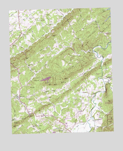
Mount Vernon, TN USGS Topographic Map
Click on map above to begin viewing in our Map Viewer.

This topographic map contains these locations and features:
Feature Name Type Latitude Longitude GNIS ID View Map
Atkins BranchStreamN35.3890°W84.3274°1327477View Map
Atkins KnobSummitN35.3984°W84.3421°1327478View Map
Barum CreekStreamN35.3795°W84.2630°1327510View Map
Bascom Irvin KnobSummitN35.3834°W84.3730°1327511View Map
Belcher GapGapN35.4726°W84.3216°1327556View Map
BelltownPopulated PlaceN35.4292°W84.2505°1327804View Map
Belltown MillPopulated PlaceN35.4251°W84.2546°1327563View Map
Belltown Post OfficePost OfficeN35.4292°W84.2508°1648556View Map
BethlehemPopulated PlaceN35.4417°W84.3508°1640692View Map
Bethlehem Baptist ChurchChurchN35.4401°W84.3496°1327586View Map
Bethlehem CemeteryCemeteryN35.4373°W84.3421°1327584View Map
Bethlehem SchoolSchoolN35.4451°W84.3446°1327587View Map
Beulah CemeteryCemeteryN35.4153°W84.2866°1640746View Map
Beulah ChurchChurchN35.4154°W84.2866°1327590View Map
Big CreekPopulated PlaceN35.4642°W84.2991°1327606View Map
Big CreekStreamN35.4567°W84.2730°1327609View Map
Big Creek Baptist ChurchChurchN35.4637°W84.2999°1640747View Map
Big Creek CemeteryCemeteryN35.4670°W84.2994°1646998View Map
Big Creek KnobsRidgeN35.4442°W84.3221°1327611View Map
Big Creek School (historical)SchoolN35.4648°W84.2996°1640748View Map
Bogard GapGapN35.4504°W84.3558°1327677View Map
Boyd RidgeRidgeN35.4906°W84.3633°1327695View Map
Bullet BranchStreamN35.4006°W84.2721°1327753View Map
Bullet MountainSummitN35.4054°W84.2527°1327757View Map
Cane CreekStreamN35.4281°W84.2616°1327806View Map
Cane Creek Baptist ChurchChurchN35.4304°W84.2510°1640751View Map
Cane Creek CemeteryCemeteryN35.4309°W84.2507°1640752View Map
Cane Creek School (historical)SchoolN35.4292°W84.2513°1640753View Map
Carter CemeteryCemeteryN35.3945°W84.2657°1327835View Map
Cedar Grove School (historical)SchoolN35.4181°W84.3330°1640695View Map
Cedar KnobSummitN35.4645°W84.2819°1327864View Map
CenterLocaleN35.4767°W84.3596°1327865View Map
Center CemeteryCemeteryN35.3878°W84.2646°1640754View Map
Center Presbyterian ChurchChurchN35.3881°W84.2641°1640755View Map
Center SchoolSchoolN35.3890°W84.2635°1327866View Map
Chickasaw BranchStreamN35.4648°W84.2516°1326921View Map
Comanche BranchStreamN35.4554°W84.3171°1327959View Map
Connahanee SchoolSchoolN35.4170°W84.3330°1327964View Map
Cook HollowValleyN35.4452°W84.3302°1647002View Map
Crowder BranchStreamN35.4854°W84.3171°1328003View Map
Davis BranchStreamN35.4417°W84.2635°1326924View Map
Dean BranchStreamN35.4606°W84.3560°1328032View Map
Dean RidgeRidgeN35.4745°W84.3699°1328033View Map
Donley MountainSummitN35.3854°W84.2569°1328067View Map
Druid Hill CemeteryCemeteryN35.3962°W84.2921°1640756View Map
Druid Hills Baptist ChurchChurchN35.3962°W84.2921°1328072View Map
Eleazar United Methodist ChurchChurchN35.4098°W84.3527°1328125View Map
Eleazer CemeteryCemeteryN35.4087°W84.3527°1640757View Map
Ellis MillPopulated PlaceN35.3898°W84.3738°1328141View Map
Fairview Baptist ChurchChurchN35.4504°W84.2688°1640758View Map
Fairview SchoolSchoolN35.4498°W84.2688°1328163View Map
Fate Irvin KnobSummitN35.3856°W84.3677°1328176View Map
Gambles GapGapN35.3926°W84.3524°1328243View Map
Givens GapGapN35.4220°W84.3458°1328275View Map
Green Hill SchoolSchoolN35.4967°W84.3305°1328326View Map
Harris RidgeRidgeN35.4734°W84.2727°1328393View Map
Hicks School (historical)SchoolN35.4545°W84.3177°1640700View Map
High TopSummitN35.3884°W84.2541°1328437View Map
Isbell GapGapN35.4242°W84.3285°1328543View Map
Ivans BranchStreamN35.4565°W84.2860°1328546View Map
Jones BranchStreamN35.4851°W84.3221°1328585View Map
Jones MountainSummitN35.4256°W84.3333°1328591View Map
Kelso KnobSummitN35.3895°W84.3580°1328608View Map
Laurel CreekStreamN35.4556°W84.2802°1328652View Map
Laurel MountainSummitN35.4392°W84.2894°1328657View Map
Laurel Mountain DamDamN35.4334°W84.3249°1640196View Map
Laurel Mountain LakeReservoirN35.4297°W84.3312°1640197View Map
Left Prong Upper Prong Sinkhole CreekStreamN35.4134°W84.2741°1328675View Map
Little Laurel CreekStreamN35.4529°W84.2921°1328731View Map
Little Renfrow TopSummitN35.4259°W84.3138°1328744View Map
Lulah CemeteryCemeteryN35.4228°W84.2582°1328811View Map
Lulah Church (historical)ChurchN35.4229°W84.2585°1640702View Map
Mahan CemeteryCemeteryN35.4431°W84.2577°1328824View Map
McKinney GapGapN35.4287°W84.3394°1328870View Map
Monroe CountyCivilN35.4426°W84.2528°1639776View Map
Morgan BranchStreamN35.3870°W84.2808°1326957View Map
Moses MountainSummitN35.4020°W84.3330°1328954View Map
Mount HarmonyPopulated PlaceN35.3815°W84.3485°1647023View Map
Mount Harmony Baptist ChurchChurchN35.3820°W84.3463°1640760View Map
Mount Harmony SchoolSchoolN35.3820°W84.3474°1328959View Map
Mount VernonPopulated PlaceN35.4117°W84.3644°1328965View Map
Mount Vernon Baptist ChurchChurchN35.4131°W84.3655°1640761View Map
Mount Vernon Post OfficePost OfficeN35.4126°W84.3644°1649593View Map
Mount Vernon QuarryMineN35.4244°W84.3514°2633134View Map
Mount Vernon School (historical)SchoolN35.4126°W84.3635°1640762View Map
Mount Vernon Volunteer Fire Department Tellico PlainsBuildingN35.3999°W84.3560°2654585View Map
Muddy BranchStreamN35.3890°W84.3716°1328979View Map
Nars FordCrossingN35.4209°W84.2588°1328996View Map
New Providence ChurchChurchN35.3779°W84.3171°1329007View Map
Notchey Creek Baptist ChurchChurchN35.4659°W84.3713°1640763View Map
Notchey Creek CemeteryCemeteryN35.4612°W84.3713°1640764View Map
Notchey Creek School (historical)SchoolN35.4667°W84.3694°1640765View Map
Notchey Creek Volunteer Fire DepartmentBuildingN35.4664°W84.3708°2654582View Map
Notchy CreekPopulated PlaceN35.4654°W84.3716°1329035View Map
Notchy Creek KnobsSummitN35.4667°W84.3338°1326963View Map
Old Prospect CemeteryCemeteryN35.4937°W84.3266°1329057View Map
Piney Grove ChurchChurchN35.4179°W84.3205°1639471View Map
Possum BranchStreamN35.4354°W84.3433°1639499View Map
Puncheon HollowValleyN35.3795°W84.2633°1326971View Map
Red KnobsRidgeN35.4151°W84.3071°1639556View Map
Red MountainSummitN35.4279°W84.2874°1639558View Map
Regan ValleyValleyN35.4462°W84.2625°1639566View Map
Renfrow TopSummitN35.4248°W84.3221°1639572View Map
Robinson PointSummitN35.4295°W84.3094°1639626View Map
Rocky SpringPopulated PlaceN35.4890°W84.3377°1639642View Map
Rocky Spring BranchStreamN35.4765°W84.3280°1639643View Map
Rocky Spring CemeteryCemeteryN35.4923°W84.3499°1639644View Map
Rocky Springs Baptist ChurchChurchN35.4884°W84.3366°1640766View Map
Rogers CemeteryCemeteryN35.4103°W84.3271°1639648View Map
Rogers StationLocaleN35.3795°W84.3155°1639651View Map
Shortfoots PondLakeN35.3752°W84.3237°1270223View Map
Shortfoots PondLakeN35.3751°W84.3238°1641171View Map
Sink (historical)Populated PlaceN35.4181°W84.2894°1640706View Map
Sink CemeteryCemeteryN35.4048°W84.2882°1640768View Map
Sink ChurchChurchN35.4045°W84.2880°1327014View Map
Sink SchoolSchoolN35.4176°W84.2899°1327015View Map
Sinkhole CreekStreamN35.4131°W84.2741°1327018View Map
Smoky RunStreamN35.3887°W84.2746°1327053View Map
Snake BranchStreamN35.4681°W84.3427°1327057View Map
Stakely MillPopulated PlaceN35.4437°W84.3533°1327094View Map
Stevens CemeteryCemeteryN35.4301°W84.2563°1327112View Map
Tellico CampLocaleN35.4701°W84.2549°1647033View Map
Tellico PlainsFlatN35.3895°W84.2791°1327192View Map
Tellico Plains High SchoolSchoolN35.3815°W84.3066°1640707View Map
Tellico Plains Junior High SchoolSchoolN35.3815°W84.3077°1640708View Map
Tellico Plains Municipal AirportAirportN35.3802°W84.3055°1641111View Map
TevisPopulated PlaceN35.4973°W84.3124°1640709View Map
Tevis Spring ChurchChurchN35.4984°W84.3146°1327198View Map
Tom StationLocaleN35.3829°W84.3430°1327236View Map
Union HallLocaleN35.4862°W84.2694°1327286View Map
Union Hall Baptist ChurchChurchN35.4842°W84.2660°1640769View Map
Union Hall School (historical)SchoolN35.4851°W84.2677°1640770View Map
Upper Prong Sinkhole CreekStreamN35.3929°W84.3160°1327291View Map
Webb CemeteryCemeteryN35.4992°W84.3227°1327342View Map
Wies MountainSummitN35.4520°W84.2780°1327380View Map

Note: Coordinates in the location and feature list above are referenced to NAD83 datum.


Copyright (C) 2008-2024 Ryan Niemi / Sunset Dynamics ... All Rights Reserved