TopoQuest Logo
Do you find TopoQuest useful?
Help keep TopoQuest running and adding new maps/features by donating!
Bitcoin:  19c7KJd3qBynnjoSw5npx9KScwjBe4ifkT
Litecoin:  LXs6TkuXGGXo1vDsWCkWVdjQX94eUKd6ui
Home View Maps Find Maps Find Places Resources & Links


Madisonville, Tennessee Topographic Map

USGS Map Title: Madisonville, TN
USGS Map MRC: 35084E3
DRG (GeoTIFF) Download: o35084e3.tif


Neighboring USGS Topographic Map Quads:


  Philadelphia, TN  
35084F4
 

  Loudon, TN  
35084F3
 

  Meadow, TN  
35084F2
 

  Sweetwater, TN  
35084E4
 

  Madisonville, TN  
35084E3
 

  Vonore, TN  
35084E2
 

  Englewood, TN  
35084D4
 

  Mount Vernon, TN  
35084D3
 

  Rafter, TN  
35084D2


Map MRC Location:

N36°
W85°
N36°
W84°
H8 H7 H6 H5 H4 H3 H2 H1
G8 G7 G6 G5 G4 G3 G2 G1
F8 F7 F6 F5 F4 F3 F2 F1
E8 E7 E6 E5 E4 E3 E2 E1
D8 D7 D6 D5 D4 D3 D2 D1
C8 C7 C6 C5 C4 C3 C2 C1
B8 B7 B6 B5 B4 B3 B2 B1
A8 A7 A6 A5 A4 A3 A2 A1
N35°
W85°
N35°
W84°

Madisonville, TN USGS 1:24K Topographic Map Preview:
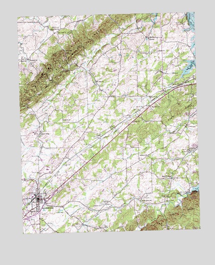
Madisonville, TN USGS Topographic Map
Click on map above to begin viewing in our Map Viewer.

This topographic map contains these locations and features:
Feature Name Type Latitude Longitude GNIS ID View Map
Acorn GapGapN35.6042°W84.3369°1275440View Map
Bat Creek KnobsSummitN35.6134°W84.3202°1276445View Map
Blevins SpringSpringN35.6209°W84.3555°1642727View Map
Brakebill (historical)Populated PlaceN35.6145°W84.2888°1308280View Map
Brakebill SchoolSchoolN35.5429°W84.2858°1278221View Map
Bulging BranchStreamN35.5934°W84.3266°1278936View Map
Burton CemeteryCemeteryN35.6178°W84.3499°1279128View Map
Burton Hill SchoolSchoolN35.6173°W84.3516°1279132View Map
Carson PondLakeN35.5128°W84.3482°1279765View Map
Cedar Grove SchoolSchoolN35.5173°W84.2905°1280059View Map
City of MadisonvilleCivilN35.5234°W84.3638°2404995View Map
Commissioner District 2CivilN35.5237°W84.3551°2463955View Map
Corntassel ChurchChurchN35.5462°W84.2560°1281323View Map
Craighead CreekStreamN35.5509°W84.3610°1306168View Map
Craighead DamDamN35.5951°W84.3699°1301947View Map
Craighead LakeReservoirN35.5951°W84.3699°1301946View Map
Craighead QuarryMineN35.5956°W84.3747°2633352View Map
Crowder BluffCliffN35.5217°W84.2530°1281743View Map
FaginPopulated PlaceN35.5548°W84.3185°1315033View Map
FIrst Baptist Church of MadisonvilleChurchN35.5185°W84.3632°2744465View Map
First United Methodist ChurchChurchN35.5179°W84.3635°1317899View Map
Florida BranchStreamN35.6223°W84.3533°1284503View Map
Fork Creek ChurchChurchN35.6156°W84.3466°1284619View Map
Griffith BranchStreamN35.5126°W84.2771°1328339View Map
Henderson BranchStreamN35.5112°W84.3202°1287375View Map
Henderson CemeteryCemeteryN35.5165°W84.3166°1287381View Map
Hiwassee CemeteryCemeteryN35.5653°W84.3444°1317901View Map
Hiwassee CollegePopulated PlaceN35.5579°W84.3624°1287913View Map
Hiwassee CollegeSchoolN35.5576°W84.3646°1308300View Map
Hiwassee School (historical)SchoolN35.5559°W84.3619°1317902View Map
Holiness ChurchChurchN35.5648°W84.3446°1288041View Map
Hopewell MillPopulated PlaceN35.5209°W84.2594°1315255View Map
Hopewell SpringsPopulated PlaceN35.5295°W84.2694°1288327View Map
Hopewell Springs Baptist ChurchChurchN35.5301°W84.2702°1317904View Map
Hopewell Volunteer Fire DepartmentBuildingN35.5301°W84.2792°2654580View Map
Kimbrough CemeteryCemeteryN35.5153°W84.3191°1290172View Map
KincaidPopulated PlaceN35.5717°W84.2827°1315328View Map
LakesidePopulated PlaceN35.6109°W84.2821°1315343View Map
Lakeside ChurchChurchN35.6031°W84.2771°1290511View Map
Lakeside School (historical)SchoolN35.6106°W84.2816°1317906View Map
Little Notchy CreekStreamN35.5026°W84.2888°1326953View Map
MadisonvillePopulated PlaceN35.5198°W84.3635°1326391View Map
Madisonville CemeteryCemeteryN35.5176°W84.3635°1317908View Map
Madisonville Division (historical)CensusN35.5037°W84.3663°1648878View Map
Madisonville Elementary SchoolSchoolN35.5220°W84.3580°1308313View Map
Madisonville Fire DepartmentBuildingN35.5144°W84.3662°2654430View Map
Madisonville High SchoolSchoolN35.5367°W84.3563°1308314View Map
Madisonville Junior High SchoolSchoolN35.5229°W84.3658°1308316View Map
Madisonville Police DepartmentBuildingN35.5146°W84.3662°2765814View Map
Madisonville Post OfficePost OfficeN35.5194°W84.3598°1649590View Map
Madisonville Presbyterian ChurchChurchN35.5201°W84.3646°1317909View Map
Madisonville Shopping CenterLocaleN35.5212°W84.3677°1308317View Map
Monroe County Ambulance ServiceBuildingN35.5201°W84.3637°2697471View Map
Monroe County Rescue SquadBuildingN35.5217°W84.3616°2654507View Map
Monroe County Sheriff's DepartmentBuildingN35.5217°W84.3619°2765756View Map
Monroe County Vocational CenterSchoolN35.5354°W84.3546°1308323View Map
Monroe Tri - Community Volunteer Fire DepartmentBuildingN35.6069°W84.3020°2654583View Map
Monroe Tri - Community Volunteer Fire Department Station 2BuildingN35.5601°W84.3626°2654727View Map
Moree BranchStreamN35.5912°W84.2574°1294335View Map
Negro RidgeRidgeN35.5692°W84.2644°1295351View Map
New Hope ChurchChurchN35.5865°W84.3216°1295532View Map
North Fork Notchy CreekStreamN35.5112°W84.2799°1329023View Map
Oak GrovePopulated PlaceN35.5776°W84.3119°1315617View Map
Oak Grove Baptist ChurchChurchN35.5773°W84.3291°1317914View Map
Oak Grove School (historical)SchoolN35.5779°W84.3116°1317915View Map
Old Lutheran CemeteryCemeteryN35.6023°W84.2827°1296335View Map
Park City Church of GodChurchN35.5220°W84.3580°1317918View Map
Park City School (historical)SchoolN35.5231°W84.3583°1317919View Map
PhillipsPopulated PlaceN35.5617°W84.2971°1647026View Map
Phillips SchoolSchoolN35.5626°W84.2955°1297367View Map
Red BranchStreamN35.5823°W84.3460°1299041View Map
RockvillePopulated PlaceN35.6004°W84.3683°1299835View Map
Saint Paul CemeteryCemeteryN35.6103°W84.2827°1317922View Map
Saint Paul ChurchChurchN35.6106°W84.2827°1300494View Map
Sequoyah SchoolSchoolN35.5998°W84.3669°1301079View Map
Solomon ChapelChurchN35.5773°W84.2524°1270810View Map
Stephens CemeteryCemeteryN35.5715°W84.2816°1271329View Map
Tevis SpringSpringN35.5023°W84.3163°1272347View Map
Turkeypen BranchStreamN35.5873°W84.3505°1273038View Map
Turkeypen RidgeRidgeN35.5956°W84.3546°1273044View Map
Vonore Volunteer Fire Department Station 2BuildingN35.5919°W84.2701°2654714View Map
Walnut Grove ChurchChurchN35.5770°W84.2835°1273722View Map
Westside Baptist ChurchChurchN35.5198°W84.3727°1317937View Map
White CemeteryCemeteryN35.5592°W84.2563°1274343View Map

Note: Coordinates in the location and feature list above are referenced to NAD83 datum.


Copyright (C) 2008-2024 Ryan Niemi / Sunset Dynamics ... All Rights Reserved