TopoQuest Logo
Do you find TopoQuest useful?
Help keep TopoQuest running and adding new maps/features by donating!
Bitcoin:  19c7KJd3qBynnjoSw5npx9KScwjBe4ifkT
Litecoin:  LXs6TkuXGGXo1vDsWCkWVdjQX94eUKd6ui
Home View Maps Find Maps Find Places Resources & Links


Newell West, Iowa Topographic Map

USGS Map Title: Newell West, IA
USGS Map MRC: 42095E1
DRG (GeoTIFF) Download: o42095e1.tif


Neighboring USGS Topographic Map Quads:


  Storm Lake, IA  
42095F2
 

  Storm Lake NE, IA  
42095F1
 

  Varina, IA  
42094F8
 

  Lakeside, IA  
42095E2
 

  Newell West, IA  
42095E1
 

  Newell East, IA  
42094E8
 

  Early, IA  
42095D2
 

  Sac City West, IA  
42095D1
 

  Sac City East, IA  
42094D8


Map MRC Location:

N43°
W96°
N43°
W95°
H8 H7 H6 H5 H4 H3 H2 H1
G8 G7 G6 G5 G4 G3 G2 G1
F8 F7 F6 F5 F4 F3 F2 F1
E8 E7 E6 E5 E4 E3 E2 E1
D8 D7 D6 D5 D4 D3 D2 D1
C8 C7 C6 C5 C4 C3 C2 C1
B8 B7 B6 B5 B4 B3 B2 B1
A8 A7 A6 A5 A4 A3 A2 A1
N42°
W96°
N42°
W95°

Newell West, IA USGS 1:24K Topographic Map Preview:
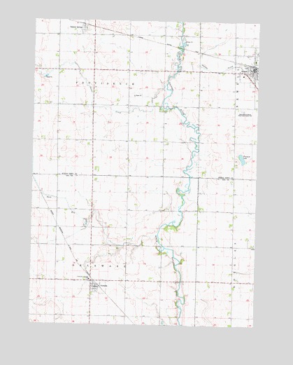
Newell West, IA USGS Topographic Map
Click on map above to begin viewing in our Map Viewer.

This topographic map contains these locations and features:
Feature Name Type Latitude Longitude GNIS ID View Map
Bethel Baptist ChurchChurchN42.6008°W95.0047°1925828View Map
Buck RunStreamN42.5369°W95.0550°454931View Map
Bush Lake (historical)LakeN42.5328°W95.0080°464022View Map
City of NemahaCivilN42.5150°W95.0889°2395169View Map
City of NewellCivilN42.6097°W95.0040°2395223View Map
Crestland Community SchoolSchoolN42.5189°W95.0922°455715View Map
Iowa State University Allee Experimental FarmLocaleN42.6000°W95.0125°465647View Map
Leota Post Office (historical)Post OfficeN42.5194°W95.0905°1982892View Map
Nain Lutheran ChurchChurchN42.6111°W95.0064°1925826View Map
NemahaPopulated PlaceN42.5158°W95.0883°459456View Map
Nemaha (historical)LocaleN42.5166°W95.0875°1983023View Map
Nemaha CemeteryCemeteryN42.5102°W95.0908°459457View Map
Nemaha Community HallBuildingN42.5158°W95.0883°1983022View Map
Nemaha Fire DepartmentBuildingN42.5152°W95.0883°2577376View Map
Nemaha Post OfficePost OfficeN42.5158°W95.0883°1983020View Map
Nemaha United Methodist ChurchChurchN42.5158°W95.0883°1983021View Map
NewellPopulated PlaceN42.6055°W95.0028°459505View Map
NewellLocaleN42.6072°W95.0030°1925832View Map
Newell Catholic CemeteryCemeteryN42.6144°W95.0322°1925882View Map
Newell City HallBuildingN42.6055°W95.0008°1925822View Map
Newell Cooperative ElevatorLocaleN42.6066°W95.0030°1925821View Map
Newell Fire Department and Ambulance ServiceBuildingN42.6057°W95.0007°2577510View Map
Newell Good Samaritan CenterHospitalN42.6028°W95.0086°1925825View Map
Newell Post OfficePost OfficeN42.6058°W95.0019°1925820View Map
Newell Public LibraryBuildingN42.6055°W95.0008°1925823View Map
Outlet CreekStreamN42.5966°W95.0508°459969View Map
Pleasant LakeLakeN42.5688°W95.0085°1823239View Map
Sturchler Pit AreaParkN42.6166°W95.0378°1925740View Map
Sulphur SpringsPopulated PlaceN42.6219°W95.0972°462074View Map
Sulphur SpringsLocaleN42.6219°W95.0972°1925791View Map
Sulphur Springs Post Office (historical)Post OfficeN42.6219°W95.0972°1925792View Map
Township of DelawareCivilN42.5178°W95.0918°467700View Map
Township of ProvidenceCivilN42.6042°W95.0923°468579View Map
Trimark Physicians GroupHospitalN42.6055°W95.0028°1925824View Map
Vogel AccessLocaleN42.5514°W95.0422°1982873View Map

Note: Coordinates in the location and feature list above are referenced to NAD83 datum.


Copyright (C) 2008-2024 Ryan Niemi / Sunset Dynamics ... All Rights Reserved