TopoQuest Logo
Do you find TopoQuest useful?
Help keep TopoQuest running and adding new maps/features by donating!
Bitcoin:  19c7KJd3qBynnjoSw5npx9KScwjBe4ifkT
Litecoin:  LXs6TkuXGGXo1vDsWCkWVdjQX94eUKd6ui
Home View Maps Find Maps Find Places Resources & Links


Nora, South Dakota Topographic Map

USGS Map Title: Nora, SD
USGS Map MRC: 42096H6
DRG (GeoTIFF) Download: o42096h6.tif


Neighboring USGS Topographic Map Quads:


  Beresford, SD  
43096A7
 

  Alcester, SD  
43096A6
 

  Alcester SE, SD  
43096A5
 

  Alsen, SD  
42096H7
 

  Nora, SD  
42096H6
 

  Chatsworth, IA  
42096H5
 

  Vermillion SE, SD  
42096G7
 

  Richland, SD  
42096G6
 

  Akron, IA  
42096G5


Map MRC Location:

N43°
W97°
N43°
W96°
H8 H7 H6 H5 H4 H3 H2 H1
G8 G7 G6 G5 G4 G3 G2 G1
F8 F7 F6 F5 F4 F3 F2 F1
E8 E7 E6 E5 E4 E3 E2 E1
D8 D7 D6 D5 D4 D3 D2 D1
C8 C7 C6 C5 C4 C3 C2 C1
B8 B7 B6 B5 B4 B3 B2 B1
A8 A7 A6 A5 A4 A3 A2 A1
N42°
W97°
N42°
W96°

Nora, SD USGS 1:24K Topographic Map Preview:
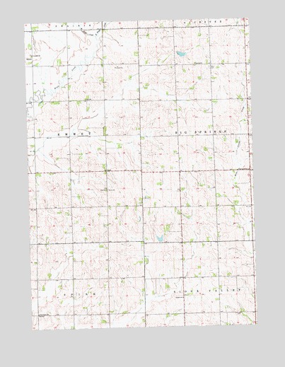
Nora, SD USGS Topographic Map
Click on map above to begin viewing in our Map Viewer.

This topographic map contains these locations and features:
Feature Name Type Latitude Longitude GNIS ID View Map
East Brule CreekStreamN42.9942°W96.7112°1254823View Map
EmmetPopulated PlaceN42.9828°W96.7462°1261002View Map
Garland SchoolSchoolN42.8867°W96.6659°1255210View Map
Ludwig SchoolSchoolN42.9822°W96.6564°1256272View Map
NoraPopulated PlaceN42.9392°W96.7070°1256716View Map
Nora CemeteryCemeteryN42.9312°W96.7063°1256717View Map
Nora Post Office (historical)Post OfficeN42.9708°W96.6878°1267170View Map
Nora SchoolSchoolN42.9314°W96.7073°1256718View Map
North Spink SchoolSchoolN42.8811°W96.7462°1256780View Map
Peace Lutheran CemeteryCemeteryN42.9803°W96.6478°1256975View Map
Saint Joseph Catholic CemeteryCemeteryN42.9870°W96.7470°2779403View Map
Saint Josephs ChurchChurchN42.9869°W96.7467°1257647View Map
School Number 49 (historical)SchoolN42.8861°W96.7337°1264393View Map
School Number 63 (historical)SchoolN42.9514°W96.6559°1264394View Map
Star SchoolSchoolN42.9686°W96.7175°1258324View Map
Township of Big SpringsCivilN42.9528°W96.6275°1268999View Map
Township of EmmetCivilN42.9534°W96.7463°1269001View Map
West Brule CreekStreamN42.9942°W96.7112°1258884View Map

Note: Coordinates in the location and feature list above are referenced to NAD83 datum.


Copyright (C) 2008-2024 Ryan Niemi / Sunset Dynamics ... All Rights Reserved