TopoQuest Logo
Do you find TopoQuest useful?
Help keep TopoQuest running and adding new maps/features by donating!
Bitcoin:  19c7KJd3qBynnjoSw5npx9KScwjBe4ifkT
Litecoin:  LXs6TkuXGGXo1vDsWCkWVdjQX94eUKd6ui
Home View Maps Find Maps Find Places Resources & Links


Alsen, South Dakota Topographic Map

USGS Map Title: Alsen, SD
USGS Map MRC: 42096H7
DRG (GeoTIFF) Download: o42096h7.tif


Neighboring USGS Topographic Map Quads:


  Centerville, SD  
43096A8
 

  Beresford, SD  
43096A7
 

  Alcester, SD  
43096A6
 

  Hub City, SD  
42096H8
 

  Alsen, SD  
42096H7
 

  Nora, SD  
42096H6
 

  Vermillion, SD  
42096G8
 

  Vermillion SE, SD  
42096G7
 

  Richland, SD  
42096G6


Map MRC Location:

N43°
W97°
N43°
W96°
H8 H7 H6 H5 H4 H3 H2 H1
G8 G7 G6 G5 G4 G3 G2 G1
F8 F7 F6 F5 F4 F3 F2 F1
E8 E7 E6 E5 E4 E3 E2 E1
D8 D7 D6 D5 D4 D3 D2 D1
C8 C7 C6 C5 C4 C3 C2 C1
B8 B7 B6 B5 B4 B3 B2 B1
A8 A7 A6 A5 A4 A3 A2 A1
N42°
W97°
N42°
W96°

Alsen, SD USGS 1:24K Topographic Map Preview:
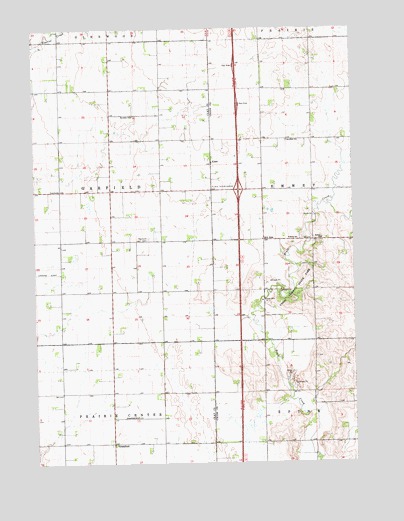
Alsen, SD USGS Topographic Map
Click on map above to begin viewing in our Map Viewer.

This topographic map contains these locations and features:
Feature Name Type Latitude Longitude GNIS ID View Map
AlsenPopulated PlaceN42.9611°W96.8056°1260973View Map
Alsen InterchangeCrossingN42.9539°W96.7950°1253632View Map
Brule SchoolSchoolN42.9397°W96.7756°1254091View Map
Cleveland SchoolSchoolN42.9678°W96.7759°1254400View Map
GreenfieldPopulated PlaceN42.8806°W96.8456°1261009View Map
Greenfield SchoolSchoolN42.8883°W96.8359°1265236View Map
Hill SidePopulated PlaceN42.9392°W96.7853°1261016View Map
Howard FieldAirportN42.9068°W96.8114°2444010View Map
Newdale SchoolSchoolN42.9750°W96.8362°1256689View Map
Olbue Lerseth CemeteryCemeteryN42.9281°W96.7516°2779410View Map
Rockfield CemeteryCemeteryN42.9397°W96.8306°1257438View Map
Rosen ChurchChurchN42.9394°W96.7625°1257482View Map
Roseni Lutheran Church CemeteryCemeteryN42.9386°W96.7633°2779402View Map
Saint Paul Evangelical Lutheran Church (historical)ChurchN42.9222°W96.8392°1264472View Map
School Number 43 (historical)SchoolN42.9222°W96.7753°1264388View Map
Steadman CemeteryCemeteryN42.9682°W96.7958°2779398View Map
Township of GarfieldCivilN42.9533°W96.8648°1269090View Map
Union County State ParkParkN42.9219°W96.7767°1258701View Map

Note: Coordinates in the location and feature list above are referenced to NAD83 datum.


Copyright (C) 2008-2024 Ryan Niemi / Sunset Dynamics ... All Rights Reserved