TopoQuest Logo
Do you find TopoQuest useful?
Help keep TopoQuest running and adding new maps/features by donating!
Bitcoin:  19c7KJd3qBynnjoSw5npx9KScwjBe4ifkT
Litecoin:  LXs6TkuXGGXo1vDsWCkWVdjQX94eUKd6ui
Home View Maps Find Maps Find Places Resources & Links


Oak Lake, Michigan Topographic Map

USGS Map Title: Oak Lake, MI
USGS Map MRC: 44084G2
DRG (GeoTIFF) Download: o44084g2.tif


Neighboring USGS Topographic Map Quads:


  Lewiston, MI  
44084H3
 

  Crooked Lake, MI  
44084H2
 

  Avery, MI  
44084H1
 

  Comstock Hills, MI  
44084G3
 

  Oak Lake, MI  
44084G2
 

  Comins, MI  
44084G1
 

  Red Oak, MI  
44084F3
 

  Mio, MI  
44084F2
 

  Fairview, MI  
44084F1


Map MRC Location:

N45°
W85°
N45°
W84°
H8 H7 H6 H5 H4 H3 H2 H1
G8 G7 G6 G5 G4 G3 G2 G1
F8 F7 F6 F5 F4 F3 F2 F1
E8 E7 E6 E5 E4 E3 E2 E1
D8 D7 D6 D5 D4 D3 D2 D1
C8 C7 C6 C5 C4 C3 C2 C1
B8 B7 B6 B5 B4 B3 B2 B1
A8 A7 A6 A5 A4 A3 A2 A1
N44°
W85°
N44°
W84°

Oak Lake, MI USGS 1:24K Topographic Map Preview:
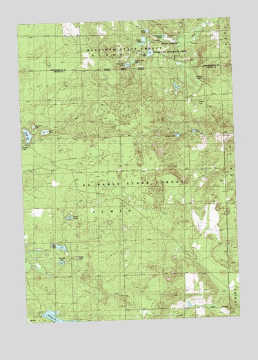
Oak Lake, MI USGS Topographic Map
Click on map above to begin viewing in our Map Viewer.

This topographic map contains these locations and features:
Feature Name Type Latitude Longitude GNIS ID View Map
Bushman SwampSwampN44.8503°W84.1464°622357View Map
East Fish LakeLakeN44.8610°W84.1726°625183View Map
Eleventh LakeLakeN44.8320°W84.2425°625434View Map
First LakeLakeN44.8281°W84.1492°626016View Map
Fuller CreekStreamN44.8670°W84.1458°626553View Map
Fuller LakeLakeN44.8663°W84.1766°626557View Map
Harder LakeLakeN44.8392°W84.1461°627765View Map
Hunt Creek Fisheries Research AreaParkN44.8667°W84.1500°2100223View Map
Hunt Creek Fisheries Research AreaLocaleN44.8667°W84.1500°2100224View Map
Indian LakeLakeN44.7810°W84.2281°628993View Map
Marshall PondLakeN44.8676°W84.1645°631638View Map
Middle Fish LakeLakeN44.8578°W84.1828°632246View Map
Muskrat LakeLakeN44.7520°W84.2337°1620970View Map
Muskrat Lake State Forest CampgroundLocaleN44.7528°W84.2417°2500020View Map
Noodles LakeLakeN44.7747°W84.2283°633452View Map
Oak LakeLakeN44.8282°W84.2460°633845View Map
Perry LakeLakeN44.8294°W84.2365°634672View Map
Rudd LakeLakeN44.7934°W84.2228°636360View Map
Second LakeLakeN44.8265°W84.1582°637522View Map
Sutton PondLakeN44.8702°W84.1737°639133View Map
Township of ElmerCivilN44.7682°W84.1914°1626231View Map
West Fish LakeLakeN44.8565°W84.1860°1616106View Map
Young LakeLakeN44.7766°W84.2191°1616901View Map

Note: Coordinates in the location and feature list above are referenced to NAD83 datum.


Copyright (C) 2008-2024 Ryan Niemi / Sunset Dynamics ... All Rights Reserved