TopoQuest Logo
Do you find TopoQuest useful?
Help keep TopoQuest running and adding new maps/features by donating!
Bitcoin:  19c7KJd3qBynnjoSw5npx9KScwjBe4ifkT
Litecoin:  LXs6TkuXGGXo1vDsWCkWVdjQX94eUKd6ui
Home View Maps Find Maps Find Places Resources & Links


Lewiston, Michigan Topographic Map

USGS Map Title: Lewiston, MI
USGS Map MRC: 44084H3
DRG (GeoTIFF) Download: o44084h3.tif


Neighboring USGS Topographic Map Quads:


  Saunders Creek, MI  
45084A4
 

  Hetherton, MI  
45084A3
 

  Atlanta, MI  
45084A2
 

  Johannesburg, MI  
44084H4
 

  Lewiston, MI  
44084H3
 

  Crooked Lake, MI  
44084H2
 

  Lovells, MI  
44084G4
 

  Comstock Hills, MI  
44084G3
 

  Oak Lake, MI  
44084G2


Map MRC Location:

N45°
W85°
N45°
W84°
H8 H7 H6 H5 H4 H3 H2 H1
G8 G7 G6 G5 G4 G3 G2 G1
F8 F7 F6 F5 F4 F3 F2 F1
E8 E7 E6 E5 E4 E3 E2 E1
D8 D7 D6 D5 D4 D3 D2 D1
C8 C7 C6 C5 C4 C3 C2 C1
B8 B7 B6 B5 B4 B3 B2 B1
A8 A7 A6 A5 A4 A3 A2 A1
N44°
W85°
N44°
W84°

Lewiston, MI USGS 1:24K Topographic Map Preview:
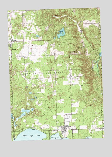
Lewiston, MI USGS Topographic Map
Click on map above to begin viewing in our Map Viewer.

This topographic map contains these locations and features:
Feature Name Type Latitude Longitude GNIS ID View Map
Albert Township HallBuildingN44.8828°W84.3061°2438534View Map
Albert Township Lewiston Fire DepartmentBuildingN44.8843°W84.3092°2438536View Map
Albert Township SchoolSchoolN44.8878°W84.3056°619904View Map
Angusdale Stock Farm Historical MarkerParkN44.9600°W84.3133°2438612View Map
Bethlehem ChurchChurchN44.8836°W84.3167°621235View Map
BigelowPopulated PlaceN44.9783°W84.2761°621371View Map
Bingham ParkParkN44.8808°W84.3070°621389View Map
Bourne LakeLakeN44.8978°W84.3625°1617063View Map
Camp NakomisLocaleN44.8858°W84.3433°622610View Map
Charleton CemeteryCemeteryN44.9917°W84.3711°623114View Map
Congregational United Church of Christ Historical MarkerParkN44.8867°W84.3050°2438602View Map
Crystal LakeLakeN44.9204°W84.3474°624177View Map
DonnellyPopulated PlaceN44.9936°W84.3128°1617528View Map
Double LakeLakeN44.9746°W84.3355°624817View Map
Doubles SchoolSchoolN44.9706°W84.3347°624818View Map
Ellsworth LakeLakeN44.9474°W84.2588°625498View Map
First Baptist ChurchChurchN44.8839°W84.2819°2438537View Map
First Congregational Community ChurchChurchN44.8867°W84.3050°626003View Map
Gaylanta LakeLakeN44.9768°W84.3030°626695View Map
Gee LakeLakeN44.8986°W84.3732°626701View Map
Hidden LakeLakeN44.9259°W84.3521°628210View Map
Idlewild Post Office (historical)Post OfficeN44.9625°W84.2811°2438567View Map
Kirtland LakeLakeN44.9029°W84.3530°2568308View Map
LewistonPopulated PlaceN44.8839°W84.3056°630355View Map
Lewiston CemeteryCemeteryN44.8917°W84.3022°630356View Map
Lewiston Post OfficePost OfficeN44.8839°W84.3097°2438535View Map
Lewiston Public LibraryBuildingN44.8828°W84.3064°2438533View Map
Lewiston Station (historical)LocaleN44.8814°W84.3056°2438532View Map
Lighthouse TabernacleChurchN44.9622°W84.3720°630388View Map
Little Crystal LakeLakeN44.9194°W84.3425°630604View Map
Lunden LakeLakeN44.9719°W84.3124°1617074View Map
McCormick Lake CampgroundLocaleN44.9550°W84.2536°2438410View Map
McMullen LakeLakeN44.9160°W84.3405°632002View Map
Presque Isle State ForestForestN44.9378°W84.3331°635436View Map
Saint Francis ChurchChurchN44.8842°W84.3117°636644View Map
Saint Francis of Assisi Catholic CemeteryCemeteryN44.9062°W84.2924°2774403View Map
Sheridan CreekStreamN44.9533°W84.2520°637749View Map
Shoepack LakeLakeN44.8896°W84.3688°637834View Map
Silver Beach LodgeLocaleN44.9361°W84.3745°637899View Map
Spectacle LakeLakeN44.9033°W84.3520°1617013View Map
Spectacle LakesLakeN44.9028°W84.3550°638489View Map
Stanniger CreekStreamN44.9586°W84.2536°638725View Map
Thompson PondLakeN44.9420°W84.2634°1614776View Map
Township of AlbertCivilN44.8984°W84.2516°1625812View Map
Twin Lakes Airport (historical)AirportN44.9000°W84.3000°1624007View Map
Vienna CornersPopulated PlaceN44.9703°W84.3708°1615579View Map
Vienna JunctionPopulated PlaceN44.8797°W84.3236°1615580View Map
Vienna Junction Station (historical)LocaleN44.8811°W84.3228°2438553View Map
Vienna Post Office (historical)Post OfficeN44.8797°W84.3236°2438552View Map
Vienna Township HallLocaleN44.9706°W84.3461°1615581View Map
Vienna Township Volunteer Fire DepartmentBuildingN44.9705°W84.3550°2627015View Map
West Twin LakeLakeN44.8761°W84.3503°1616186View Map
Woodmere LakeLakeN44.9044°W84.3456°1617015View Map

Note: Coordinates in the location and feature list above are referenced to NAD83 datum.


Copyright (C) 2008-2024 Ryan Niemi / Sunset Dynamics ... All Rights Reserved