TopoQuest Logo
Do you find TopoQuest useful?
Help keep TopoQuest running and adding new maps/features by donating!
Bitcoin:  19c7KJd3qBynnjoSw5npx9KScwjBe4ifkT
Litecoin:  LXs6TkuXGGXo1vDsWCkWVdjQX94eUKd6ui
Home View Maps Find Maps Find Places Resources & Links


Ovett SE, Mississippi Topographic Map

USGS Map Title: Ovett SE, MS
USGS Map MRC: 31089C1
DRG (GeoTIFF) Download: o31089c1.tif


Neighboring USGS Topographic Map Quads:


  Barrontown, MS  
31089D2
 

  Ovett, MS  
31089D1
 

  Rhodes, MS  
31088D8
 

  Carterville, MS  
31089C2
 

  Ovett SE, MS  
31089C1
 

  Richton, MS  
31088C8
 

  McLaurin, MS  
31089B2
 

  New Augusta, MS  
31089B1
 

  Beaumont, MS  
31088B8


Map MRC Location:

N32°
W90°
N32°
W89°
H8 H7 H6 H5 H4 H3 H2 H1
G8 G7 G6 G5 G4 G3 G2 G1
F8 F7 F6 F5 F4 F3 F2 F1
E8 E7 E6 E5 E4 E3 E2 E1
D8 D7 D6 D5 D4 D3 D2 D1
C8 C7 C6 C5 C4 C3 C2 C1
B8 B7 B6 B5 B4 B3 B2 B1
A8 A7 A6 A5 A4 A3 A2 A1
N31°
W90°
N31°
W89°

Ovett SE, MS USGS 1:24K Topographic Map Preview:
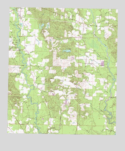
Ovett SE, MS USGS Topographic Map
Click on map above to begin viewing in our Map Viewer.

This topographic map contains these locations and features:
Feature Name Type Latitude Longitude GNIS ID View Map
B Conway Lake DamDamN31.3135°W89.0601°680652View Map
Bear BranchStreamN31.2902°W89.0064°666634View Map
Bethel ChurchChurchN31.3246°W89.0601°666900View Map
Blue LakeLakeN31.3415°W89.1148°667302View Map
Bogue Homo Creek Boat RampLocaleN31.3582°W89.0262°2596920View Map
Bogue Homo Creek Mississippi Highway 42 BridgeBridgeN31.3580°W89.0260°2596392View Map
Buck CreekStreamN31.3507°W89.0270°692742View Map
Buck Creek ChurchChurchN31.3457°W89.0401°667730View Map
Burch CemeteryCemeteryN31.3582°W89.0345°667795View Map
Buzzard BranchStreamN31.3571°W89.1176°667873View Map
Carter BranchStreamN31.3141°W89.1084°668110View Map
Chatman BranchStreamN31.3638°W89.1151°668358View Map
Clear LakeLakeN31.3213°W89.0101°668579View Map
Courtney CemeteryCemeteryN31.2893°W89.0470°668882View Map
D C Leach Lake DamDamN31.2718°W89.0567°680634View Map
Dry BranchStreamN31.3116°W89.0870°669397View Map
Eddy LakeLakeN31.3465°W89.1143°669663View Map
Flat BranchStreamN31.3052°W89.0045°670020View Map
Frances BranchStreamN31.3588°W89.1217°670154View Map
Gandy LakeLakeN31.3560°W89.1105°670311View Map
Gandy Lake DamDamN31.3568°W89.1117°680681View Map
Grantham LakeLakeN31.3175°W89.1070°670597View Map
Grapevine BranchStreamN31.3224°W89.0089°670599View Map
Hammock BranchStreamN31.3280°W89.1070°670867View Map
Harper BranchStreamN31.3516°W89.0256°670949View Map
Hickory Grove ChurchChurchN31.3207°W89.0292°671161View Map
Holiness ChurchChurchN31.3249°W89.0398°671286View Map
Hood BranchStreamN31.3424°W89.1134°671387View Map
Hurricane BayStreamN31.2991°W89.0906°671599View Map
Izola LakeLakeN31.3299°W89.1117°671754View Map
James CemeteryCemeteryN31.2818°W89.0831°671800View Map
McGilvary CemeteryCemeteryN31.3416°W89.0789°673358View Map
Memorial ChurchChurchN31.2593°W89.1098°673469View Map
Merritt Springs BranchStreamN31.2521°W89.0006°673499View Map
Middle LakeLakeN31.3399°W89.1153°673531View Map
Mill CreekStreamN31.2705°W89.0078°673595View Map
Mill CreekStreamN31.2941°W89.0964°673596View Map
Nicholson BranchStreamN31.2874°W89.0067°674920View Map
Pitts BranchStreamN31.3591°W89.1092°675950View Map
Prospect CemeteryCemeteryN31.3024°W89.0525°676351View Map
Prospect ChurchChurchN31.3030°W89.0620°676355View Map
Providence ChurchChurchN31.2510°W89.0742°676397View Map
Ready BranchStreamN31.3243°W89.0295°676509View Map
Round LakeLakeN31.3227°W89.0111°676905View Map
Rubin LakeLakeN31.3381°W89.1158°676942View Map
Runnelstown Volunteer Fire Department Station 2BuildingN31.3135°W89.0363°2667934View Map
Sapp BranchStreamN31.3724°W89.1187°694712View Map
Sportsman LakeReservoirN31.3328°W89.0577°683357View Map
Sportsman Lake DamDamN31.3335°W89.0534°680666View Map
Supervisor District 2CivilN31.3560°W89.0708°712027View Map
Tallahalla Creek Mississippi Highway 42 BridgeBridgeN31.3733°W89.1193°2596753View Map
Thomas CreekStreamN31.3349°W89.1153°678680View Map
Underwood BranchStreamN31.3171°W89.0109°679027View Map
Vernon McDonnell Pond DamDamN31.3268°W89.0501°680664View Map
White BranchStreamN31.3668°W89.0276°679568View Map
Young Mobile Home ParkPopulated PlaceN31.2997°W89.0494°2596792View Map

Note: Coordinates in the location and feature list above are referenced to NAD83 datum.


Copyright (C) 2008-2024 Ryan Niemi / Sunset Dynamics ... All Rights Reserved