TopoQuest Logo
Do you find TopoQuest useful?
Help keep TopoQuest running and adding new maps/features by donating!
Bitcoin:  19c7KJd3qBynnjoSw5npx9KScwjBe4ifkT
Litecoin:  LXs6TkuXGGXo1vDsWCkWVdjQX94eUKd6ui
Home View Maps Find Maps Find Places Resources & Links


Berlin, West Virginia Topographic Map

USGS Map Title: Berlin, WV
USGS Map MRC: 39080A3
DRG (GeoTIFF) Download: o39080a3.tif


Neighboring USGS Topographic Map Quads:


  West Milford, WV  
39080B4
 

  Mount Clare, WV  
39080B3
 

  Brownton, WV  
39080B2
 

  Weston, WV  
39080A4
 

  Berlin, WV  
39080A3
 

  Century, WV  
39080A2
 

  Roanoke, WV  
38080H4
 

  Adrian, WV  
38080H3
 

  Buckhannon, WV  
38080H2


Map MRC Location:

N40°
W81°
N40°
W80°
H8 H7 H6 H5 H4 H3 H2 H1
G8 G7 G6 G5 G4 G3 G2 G1
F8 F7 F6 F5 F4 F3 F2 F1
E8 E7 E6 E5 E4 E3 E2 E1
D8 D7 D6 D5 D4 D3 D2 D1
C8 C7 C6 C5 C4 C3 C2 C1
B8 B7 B6 B5 B4 B3 B2 B1
A8 A7 A6 A5 A4 A3 A2 A1
N39°
W81°
N39°
W80°

Berlin, WV USGS 1:24K Topographic Map Preview:
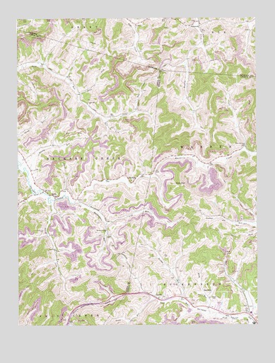
Berlin, WV USGS Topographic Map
Click on map above to begin viewing in our Map Viewer.

This topographic map contains these locations and features:
Feature Name Type Latitude Longitude GNIS ID View Map
AberdeenPopulated PlaceN39.0584°W80.3159°1553686View Map
Bear KnobSummitN39.0573°W80.2898°1553817View Map
BerlinPopulated PlaceN39.0526°W80.3551°1535657View Map
Bills LickStreamN39.0943°W80.3423°1536008View Map
Blake School (historical)SchoolN39.1215°W80.3126°1956576View Map
Bloody RunStreamN39.0632°W80.3695°1536109View Map
Bridge RunStreamN39.0107°W80.2906°1536339View Map
Bridge Run School (historical)SchoolN39.0243°W80.2926°1956607View Map
Buckhannon RunStreamN39.0504°W80.3445°1536597View Map
Buckhannon Run ChurchChurchN39.0387°W80.3284°1536598View Map
Buckhannon Run School (historical)SchoolN39.0393°W80.3290°1956596View Map
Bull LickStreamN39.0834°W80.3284°1536700View Map
Frog RunStreamN39.0415°W80.3284°1539277View Map
Jesse Run ChurchChurchN39.0912°W80.3373°1540889View Map
JohnstownPopulated PlaceN39.1234°W80.2793°1554824View Map
Johnstown United Methodist ChurchChurchN39.1181°W80.2770°1718468View Map
Johnstown Volunteer Fire DepartmentBuildingN39.1238°W80.2796°2577966View Map
Laurel LickStreamN39.0501°W80.3573°1541480View Map
Laurel Lick CemeteryCemeteryN39.0387°W80.3615°1541482View Map
Laurel Lick ChurchChurchN39.0307°W80.3548°1541483View Map
LorentzPopulated PlaceN39.0109°W80.3023°1542457View Map
Lorentz Methodist Protestant ChurchChurchN39.0109°W80.2998°1696727View Map
Lorentz Post OfficePost OfficeN39.0107°W80.3016°1696728View Map
Mick Hill School (historical)SchoolN39.0465°W80.2820°1956608View Map
Morrison CemeteryCemeteryN39.0631°W80.3646°2586256View Map
Mud LickStreamN39.0032°W80.2565°1543908View Map
Mudlick School (historical)SchoolN39.0170°W80.2601°1956609View Map
New Johnstown CemeteryCemeteryN39.1176°W80.2767°1718495View Map
Old Johnstown CemeteryCemeteryN39.1190°W80.2770°1718498View Map
Red RockPopulated PlaceN39.0120°W80.2762°1555454View Map
Reger CemeteryCemeteryN39.0109°W80.2737°1545500View Map
Rooting Creek School (historical)SchoolN39.0870°W80.2818°1956610View Map
Sauls RunStreamN39.0104°W80.3045°1546449View Map
Upper Jesse Run School (historical)SchoolN39.0851°W80.3262°1956605View Map
Valley ChapelChurchN39.0007°W80.3484°1548586View Map
Walnut Grove School (historical)SchoolN39.0693°W80.2901°1956611View Map
Wash RunStreamN39.0051°W80.2748°1548811View Map
WBUC-AM (Buckhannon)TowerN39.0020°W80.2637°1559692View Map
White OakPopulated PlaceN39.0723°W80.2559°1696807View Map
White Oak Grove School (historical)SchoolN39.0726°W80.2556°1549060View Map
Whiteoak Grove School (historical)SchoolN39.0726°W80.2565°1956612View Map

Note: Coordinates in the location and feature list above are referenced to NAD83 datum.


Copyright (C) 2008-2024 Ryan Niemi / Sunset Dynamics ... All Rights Reserved