TopoQuest Logo
Do you find TopoQuest useful?
Help keep TopoQuest running and adding new maps/features by donating!
Bitcoin:  19c7KJd3qBynnjoSw5npx9KScwjBe4ifkT
Litecoin:  LXs6TkuXGGXo1vDsWCkWVdjQX94eUKd6ui
Home View Maps Find Maps Find Places Resources & Links


Petersburg, Ohio Topographic Map

USGS Map Title: Petersburg, OH
USGS Map MRC: 38082H6
DRG (GeoTIFF) Download: o38082h6.tif


Neighboring USGS Topographic Map Quads:


  Beaver, OH  
39082A7
 

  Jackson, OH  
39082A6
 

  Wellston, OH  
39082A5
 

  Stockdale, OH  
38082H7
 

  Petersburg, OH  
38082H6
 

  Oak Hill, OH  
38082H5
 

  Minford, OH  
38082G7
 

  South Webster, OH  
38082G6
 

  Gallia, OH  
38082G5


Map MRC Location:

N39°
W83°
N39°
W82°
H8 H7 H6 H5 H4 H3 H2 H1
G8 G7 G6 G5 G4 G3 G2 G1
F8 F7 F6 F5 F4 F3 F2 F1
E8 E7 E6 E5 E4 E3 E2 E1
D8 D7 D6 D5 D4 D3 D2 D1
C8 C7 C6 C5 C4 C3 C2 C1
B8 B7 B6 B5 B4 B3 B2 B1
A8 A7 A6 A5 A4 A3 A2 A1
N38°
W83°
N38°
W82°

Petersburg, OH USGS 1:24K Topographic Map Preview:
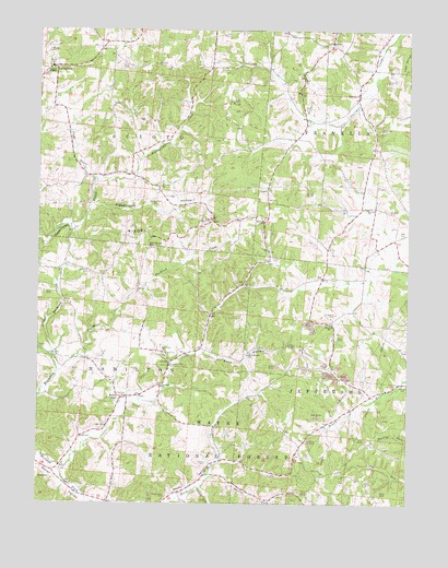
Petersburg, OH USGS Topographic Map
Click on map above to begin viewing in our Map Viewer.

This topographic map contains these locations and features:
Feature Name Type Latitude Longitude GNIS ID View Map
Antioch CemeteryCemeteryN38.9523°W82.6313°1037440View Map
Antioch ChurchChurchN38.9531°W82.6388°1037447View Map
Bethany ChurchChurchN38.9501°W82.6729°1037889View Map
Brown CemeteryCemeteryN38.9553°W82.6575°1038366View Map
Canter CemeteryCemeteryN38.8856°W82.6921°1038800View Map
Canter CemeteryCemeteryN38.9045°W82.6957°1038801View Map
Comer CemeteryCemeteryN38.9054°W82.6251°1039283View Map
Crabtree Cemetery Number 1CemeteryN38.9942°W82.7441°1039435View Map
Culp CemeteryCemeteryN38.9892°W82.7213°1039527View Map
Dark HollowValleyN38.9154°W82.6932°1063442View Map
Dark Hollow ChurchChurchN38.9142°W82.6782°1039584View Map
Dever CemeteryCemeteryN38.8815°W82.7454°1039685View Map
Four MilePopulated PlaceN38.9834°W82.6421°1071610View Map
Fourmile CemeteryCemeteryN38.9735°W82.6341°1040616View Map
Fourmile ChurchChurchN38.9223°W82.6510°1040617View Map
Fourmile ChurchChurchN38.9831°W82.6413°1070753View Map
GrahamsvillePopulated PlaceN38.9587°W82.7093°1065523View Map
Grahamsville CemeteryCemeteryN38.9551°W82.7102°1041023View Map
Grahamsville Post Office (historical)Post OfficeN38.9584°W82.7096°2013723View Map
Hamilton Christian ChurchChurchN38.9148°W82.7071°1070767View Map
Hamilton SchoolSchoolN38.9062°W82.7077°1041271View Map
Hamilton Township Volunteer Fire and RescueBuildingN38.8979°W82.7241°2549583View Map
Horton CemeteryCemeteryN38.9251°W82.6488°1041809View Map
Jacko RunStreamN38.9606°W82.7310°1066769View Map
Jacobs CemeteryCemeteryN38.9787°W82.6593°1042041View Map
Laurel ForkStreamN38.8820°W82.6913°1042437View Map
Little Bucklick CreekStreamN38.9095°W82.7432°1057804View Map
Lumen ChapelChurchN38.9895°W82.7452°1070827View Map
Mabee CemeteryCemeteryN38.9101°W82.7388°1042859View Map
Mabee CornerPopulated PlaceN38.9029°W82.7210°1070828View Map
Masters CemeteryCemeteryN38.9867°W82.6324°1043057View Map
McCoyPopulated PlaceN38.9142°W82.7077°1071616View Map
McCoy CemeteryCemeteryN38.9148°W82.7068°1043158View Map
McCoy GroveWoodsN38.9117°W82.7052°1071617View Map
Mount Pleasant ChurchChurchN38.9431°W82.7118°1070855View Map
PetersburgPopulated PlaceN38.9898°W82.7443°1062936View Map
Pigeonroost HollowValleyN38.9531°W82.7316°1044433View Map
Riegel RidgeRidgeN38.9440°W82.7066°1070913View Map
Russ AirportAirportN38.9121°W82.7244°1082753View Map
Saint Johns CemeteryCemeteryN38.9359°W82.7327°1045507View Map
Saint Johns Church (historical)ChurchN38.9362°W82.7332°1071624View Map
Scaffold LickStreamN38.8790°W82.6941°1076844View Map
Scioto Elementary SchoolSchoolN38.9904°W82.7460°1081867View Map
Smith CemeteryCemeteryN38.9015°W82.7096°1046359View Map
Smith CemeteryCemeteryN38.9401°W82.6702°1046360View Map
Stephenson CemeteryCemeteryN38.8767°W82.7060°1046673View Map
Township of HamiltonCivilN38.8981°W82.7198°1086366View Map
Township of JeffersonCivilN38.8923°W82.6263°1086368View Map
Township of SciotoCivilN38.9882°W82.7378°1086373View Map

Note: Coordinates in the location and feature list above are referenced to NAD83 datum.


Copyright (C) 2008-2024 Ryan Niemi / Sunset Dynamics ... All Rights Reserved