TopoQuest Logo
Do you find TopoQuest useful?
Help keep TopoQuest running and adding new maps/features by donating!
Bitcoin:  19c7KJd3qBynnjoSw5npx9KScwjBe4ifkT
Litecoin:  LXs6TkuXGGXo1vDsWCkWVdjQX94eUKd6ui
Home View Maps Find Maps Find Places Resources & Links


Phelps, Wisconsin Topographic Map

USGS Map Title: Phelps, WI
USGS Map MRC: 46089A1
DRG (GeoTIFF) Download: o46089a1.tif


Neighboring USGS Topographic Map Quads:


  Land O' Lakes, WI  
46089B2
 

  Imp Lake, MI  
46089B1
 

  Golden Lake, MI  
46088B8
 

  Pioneer Lake, WI  
46089A2
 

  Phelps, WI  
46089A1
 

  Smoky Lake, MI  
46088A8
 

  Eagle River East, WI  
45089H2
 

  Anvil Lake, WI  
45089H1
 

  Alvin NW, WI  
45088H8


Map MRC Location:

N47°
W90°
N47°
W89°
H8 H7 H6 H5 H4 H3 H2 H1
G8 G7 G6 G5 G4 G3 G2 G1
F8 F7 F6 F5 F4 F3 F2 F1
E8 E7 E6 E5 E4 E3 E2 E1
D8 D7 D6 D5 D4 D3 D2 D1
C8 C7 C6 C5 C4 C3 C2 C1
B8 B7 B6 B5 B4 B3 B2 B1
A8 A7 A6 A5 A4 A3 A2 A1
N46°
W90°
N46°
W89°

Phelps, WI USGS 1:24K Topographic Map Preview:
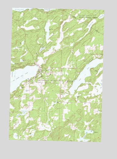
Phelps, WI USGS Topographic Map
Click on map above to begin viewing in our Map Viewer.

This topographic map contains these locations and features:
Feature Name Type Latitude Longitude GNIS ID View Map
Afterglow LakeLakeN46.0863°W89.0834°1578643View Map
Baker LakeLakeN46.0235°W89.1125°1578685View Map
Burman School (historical)SchoolN46.0833°W89.0007°1840341View Map
Camp One LakeLakeN46.0452°W89.1036°1578933View Map
Camp Two LakeLakeN46.0754°W89.1113°1578941View Map
Catherine LakeLakeN46.0669°W89.0045°1578959View Map
Ellen LakeLakeN46.0427°W89.0348°1579201View Map
Finger LakeLakeN46.1191°W89.0030°1619910View Map
Goodall LakeLakeN46.0730°W89.1234°1579339View Map
Gross LakeLakeN46.0038°W89.1157°1579872View Map
Lac Vieux Desert Seaplane BaseAirportN46.1216°W89.1210°1582145View Map
Lobischer CreekStreamN46.1241°W89.0751°1579726View Map
Lobischer CreekStreamN46.1241°W89.0751°1620600View Map
Long and Big Sand Lakes 15ReservoirN46.0645°W89.0225°1793392View Map
Long LakeLakeN46.0645°W89.0225°1579746View Map
Long-On-Deerskin 1909c361 DamDamN46.0450°W89.0435°1793391View Map
Manuel LakeLakeN46.0271°W89.1054°1579805View Map
Military CreekStreamN46.0705°W89.0912°1579874View Map
Military HillSummitN46.0666°W89.0787°1579873View Map
Military Hill Fire TowerTowerN46.0666°W89.0779°1840342View Map
Muskeg LakeLakeN46.0496°W89.1110°1579975View Map
Northwoods Hospital HeliportAirportN46.0600°W89.0901°1582144View Map
Norwood LakeLakeN46.1109°W89.0174°1621069View Map
Noseeum LakeLakeN46.0610°W89.0857°1580043View Map
PhelpsPopulated PlaceN46.0644°W89.0876°1580131View Map
Phelps Area Emergency Medical ServicesBuildingN46.0644°W89.0844°2698433View Map
Phelps Elementary SchoolSchoolN46.0628°W89.0871°2713399View Map
Phelps High SchoolSchoolN46.0628°W89.0872°2713316View Map
Phelps Volunteer Fire DepartmentBuildingN46.0649°W89.0845°2696851View Map
Potfish LakeLakeN46.1151°W89.0942°1580204View Map
Spectacle LakeLakeN46.0006°W89.0207°1580468View Map
Spectacle Lake CampgroundLocaleN46.0088°W89.0099°1833728View Map
Stub Walsh LakeLakeN46.0361°W89.0585°1580543View Map
Sugar Maple LakeLakeN46.1027°W89.0768°1580548View Map
Thoroughfare CreekStreamN46.0511°W89.0065°1580606View Map
Town of PhelpsCivilN46.0535°W89.0655°1583917View Map
Vista LakeLakeN46.0054°W89.0938°1580713View Map
Warvet LakeLakeN46.0862°W89.1198°1580726View Map
Weber LakeLakeN46.0917°W89.1097°1580727View Map

Note: Coordinates in the location and feature list above are referenced to NAD83 datum.


Copyright (C) 2008-2024 Ryan Niemi / Sunset Dynamics ... All Rights Reserved