TopoQuest Logo
Do you find TopoQuest useful?
Help keep TopoQuest running and adding new maps/features by donating!
Bitcoin:  19c7KJd3qBynnjoSw5npx9KScwjBe4ifkT
Litecoin:  LXs6TkuXGGXo1vDsWCkWVdjQX94eUKd6ui
Home View Maps Find Maps Find Places Resources & Links


Pioneer Lake, Wisconsin Topographic Map

USGS Map Title: Pioneer Lake, WI
USGS Map MRC: 46089A2
DRG (GeoTIFF) Download: o46089a2.tif


Neighboring USGS Topographic Map Quads:


  Black Oak Lake, WI  
46089B3
 

  Land O' Lakes, WI  
46089B2
 

  Imp Lake, MI  
46089B1
 

  Stormy Lake, WI  
46089A3
 

  Pioneer Lake, WI  
46089A2
 

  Phelps, WI  
46089A1
 

  Eagle River West, WI  
45089H3
 

  Eagle River East, WI  
45089H2
 

  Anvil Lake, WI  
45089H1


Map MRC Location:

N47°
W90°
N47°
W89°
H8 H7 H6 H5 H4 H3 H2 H1
G8 G7 G6 G5 G4 G3 G2 G1
F8 F7 F6 F5 F4 F3 F2 F1
E8 E7 E6 E5 E4 E3 E2 E1
D8 D7 D6 D5 D4 D3 D2 D1
C8 C7 C6 C5 C4 C3 C2 C1
B8 B7 B6 B5 B4 B3 B2 B1
A8 A7 A6 A5 A4 A3 A2 A1
N46°
W90°
N46°
W89°

Pioneer Lake, WI USGS 1:24K Topographic Map Preview:
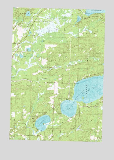
Pioneer Lake, WI USGS Topographic Map
Click on map above to begin viewing in our Map Viewer.

This topographic map contains these locations and features:
Feature Name Type Latitude Longitude GNIS ID View Map
Augustus Adolphus ChurchChurchN46.0250°W89.2026°1840340View Map
Conover Volunteer Fire Department and AmbulanceBuildingN46.0507°W89.2497°2696824View Map
Denton LakeLakeN46.0790°W89.2372°1579119View Map
Hildegard CemeteryCemeteryN46.0508°W89.2115°1579037View Map
Kildare LakeLakeN46.1154°W89.1610°1579588View Map
Lac des FleursLakeN46.1192°W89.2296°1579610View Map
Lac Vieux Desert 1907C335 DamDamN46.1216°W89.1518°1793597View Map
Lake PleasantLakeN46.1016°W89.2259°1580174View Map
Lawler LakeLakeN46.0855°W89.2268°1567884View Map
Little Donahue LakeLakeN46.0988°W89.2276°1579679View Map
North Twin LakeLakeN46.0494°W89.1384°1580039View Map
Outlet BayBayN46.1222°W89.1457°1580075View Map
Pioneer LakeLakeN46.0169°W89.2061°1580168View Map
Portage CreekStreamN46.1027°W89.2460°1580200View Map
South Lakes ChurchChurchN46.0311°W89.1721°1580464View Map
Twin Lake ChurchChurchN46.0325°W89.1468°1580679View Map
Twin LakesReservoirN46.0216°W89.1685°1793091View Map
Twin Lakes 2WP264 DamDamN46.0216°W89.1685°1793090View Map
Twin RiverStreamN46.0161°W89.2024°1580680View Map
Wolf LakeLakeN46.0938°W89.2094°1580817View Map

Note: Coordinates in the location and feature list above are referenced to NAD83 datum.


Copyright (C) 2008-2024 Ryan Niemi / Sunset Dynamics ... All Rights Reserved