TopoQuest Logo
Do you find TopoQuest useful?
Help keep TopoQuest running and adding new maps/features by donating!
Bitcoin:  19c7KJd3qBynnjoSw5npx9KScwjBe4ifkT
Litecoin:  LXs6TkuXGGXo1vDsWCkWVdjQX94eUKd6ui
Home View Maps Find Maps Find Places Resources & Links


Picture Mountain, Arizona Topographic Map

USGS Map Title: Picture Mountain, AZ
USGS Map MRC: 33111H2
DRG (GeoTIFF) Download: o33111h2.tif


Neighboring USGS Topographic Map Quads:


  Gisela, AZ  
34111A3
 

  Sheep Basin Mountain, AZ  
34111A2
 

  Buzzard Roost Mesa, AZ  
34111A1
 

  Kayler Butte, AZ  
33111H3
 

  Picture Mountain, AZ  
33111H2
 

  Copper Mountain, AZ  
33111H1
 

  Tonto Basin, AZ  
33111G3
 

  Greenback Creek, AZ  
33111G2
 

  Armer Mountain, AZ  
33111G1


Map MRC Location:

N34°
W112°
N34°
W111°
H8 H7 H6 H5 H4 H3 H2 H1
G8 G7 G6 G5 G4 G3 G2 G1
F8 F7 F6 F5 F4 F3 F2 F1
E8 E7 E6 E5 E4 E3 E2 E1
D8 D7 D6 D5 D4 D3 D2 D1
C8 C7 C6 C5 C4 C3 C2 C1
B8 B7 B6 B5 B4 B3 B2 B1
A8 A7 A6 A5 A4 A3 A2 A1
N33°
W112°
N33°
W111°

Picture Mountain, AZ USGS 1:24K Topographic Map Preview:
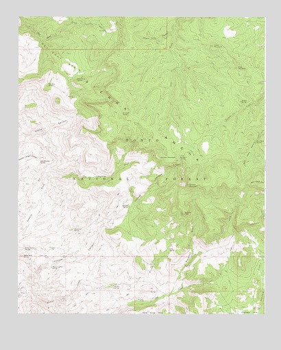
Picture Mountain, AZ USGS Topographic Map
Click on map above to begin viewing in our Map Viewer.

This topographic map contains these locations and features:
Feature Name Type Latitude Longitude GNIS ID View Map
Bear Head MountainSummitN33.9278°W111.1257°26093View Map
Bear Head SpringSpringN33.9483°W111.1292°26094View Map
Cane SpringSpringN33.9022°W111.1736°27246View Map
Chalk MountainSummitN33.9878°W111.1515°27482View Map
Del Shay BasinBasinN33.9862°W111.2337°28411View Map
Del Shay CabinLocaleN33.9934°W111.2054°40902View Map
Del Shay SpringSpringN33.9716°W111.2354°28413View Map
Grapevine SpringSpringN33.9108°W111.2220°29521View Map
Hidden SpringSpringN33.9645°W111.1377°29938View Map
Horse TankReservoirN33.9537°W111.2396°39523View Map
Hummingbird SpringSpringN33.8944°W111.2330°30287View Map
Hymn Book SpringSpringN33.8993°W111.2474°30312View Map
Jump-Off SpringSpringN33.9592°W111.1977°30645View Map
Juniper MountainSummitN33.9403°W111.1729°30665View Map
Juniper SpringSpringN33.9204°W111.1942°30674View Map
Maverick BasinValleyN33.8837°W111.1732°31573View Map
Mistake PeakSummitN33.9175°W111.1665°31935View Map
Oak Creek RanchLocaleN33.8806°W111.1865°32435View Map
Oaker SpringSpringN33.8847°W111.1803°39668View Map
Pasture SpringSpringN33.8955°W111.1659°39678View Map
Picture MountainSummitN33.9292°W111.1637°32870View Map
Pine MountainSummitN33.9787°W111.1390°32952View Map
Quartz Ledge SpringSpringN33.9397°W111.2389°33276View Map
Rattlesnake SpringSpringN33.9614°W111.2396°39725View Map
Red Rock SpringSpringN33.9411°W111.1687°33503View Map
Rock Horse SpringSpringN33.9806°W111.2493°40901View Map
Rock House SpringSpringN33.9735°W111.2206°33717View Map
Rocky Dublin SpringSpringN33.9027°W111.2470°33763View Map
Sierra AnchaRangeN33.9575°W111.1868°34411View Map
Skunk Tank CanyonValleyN33.9931°W111.1721°34511View Map
Walnut SpringSpringN33.8870°W111.2020°35871View Map

Note: Coordinates in the location and feature list above are referenced to NAD83 datum.


Copyright (C) 2008-2024 Ryan Niemi / Sunset Dynamics ... All Rights Reserved