TopoQuest Logo
Do you find TopoQuest useful?
Help keep TopoQuest running and adding new maps/features by donating!
Bitcoin:  19c7KJd3qBynnjoSw5npx9KScwjBe4ifkT
Litecoin:  LXs6TkuXGGXo1vDsWCkWVdjQX94eUKd6ui
Home View Maps Find Maps Find Places Resources & Links


Pine Island, Minnesota Topographic Map

USGS Map Title: Pine Island, MN
USGS Map MRC: 44092B6
DRG (GeoTIFF) Download: o44092b6.tif


Neighboring USGS Topographic Map Quads:


  Wanamingo, MN  
44092C7
 

  Zumbrota, MN  
44092C6
 

  Mazeppa, MN  
44092C5
 

  Concord, MN  
44092B7
 

  Pine Island, MN  
44092B6
 

  Oronoco, MN  
44092B5
 

  Dodge Center, MN  
44092A7
 

  Byron, MN  
44092A6
 

  Douglas, MN  
44092A5


Map MRC Location:

N45°
W93°
N45°
W92°
H8 H7 H6 H5 H4 H3 H2 H1
G8 G7 G6 G5 G4 G3 G2 G1
F8 F7 F6 F5 F4 F3 F2 F1
E8 E7 E6 E5 E4 E3 E2 E1
D8 D7 D6 D5 D4 D3 D2 D1
C8 C7 C6 C5 C4 C3 C2 C1
B8 B7 B6 B5 B4 B3 B2 B1
A8 A7 A6 A5 A4 A3 A2 A1
N44°
W93°
N44°
W92°

Pine Island, MN USGS 1:24K Topographic Map Preview:
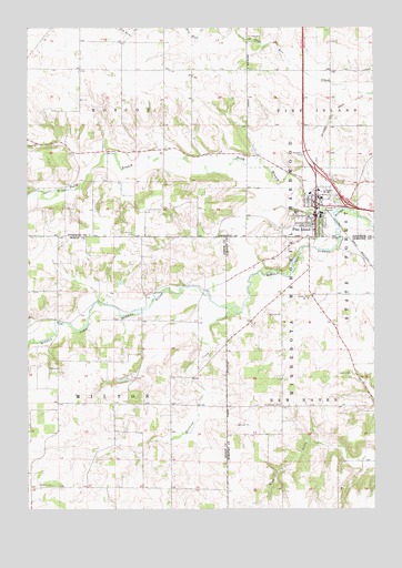
Pine Island, MN USGS Topographic Map
Click on map above to begin viewing in our Map Viewer.

This topographic map contains these locations and features:
Feature Name Type Latitude Longitude GNIS ID View Map
Alberts-Rueg Group DamDamN44.1666°W92.7169°1776465View Map
Baptist ChurchChurchN44.2014°W92.6464°2064923View Map
County Line CemeteryCemeteryN44.1964°W92.7114°2064973View Map
Free Mission CemeteryCemeteryN44.2042°W92.7117°2064972View Map
Goodnews Evangelical Free ChurchChurchN44.2050°W92.6472°2064928View Map
Harkcom CreekStreamN44.1761°W92.6746°644671View Map
La Moyne Bruce Detention DamDamN44.1333°W92.6319°1776589View Map
Milton CemeteryCemeteryN44.1311°W92.7466°647896View Map
North Branch Middle Fork Zumbro RiverStreamN44.2027°W92.6544°648614View Map
Olmsted Medical CenterHospitalN44.2014°W92.6461°2064930View Map
Overland Pond DamDamN44.2316°W92.6635°1777097View Map
Pine Haven Care CenterHospitalN44.2072°W92.6478°2064931View Map
Pine IslandPopulated PlaceN44.2014°W92.6463°649465View Map
Pine Island (historical)LocaleN44.2067°W92.6450°2064922View Map
Pine Island Assembly of God ChurchChurchN44.1978°W92.6464°2064926View Map
Pine Island CemeteryCemeteryN44.2047°W92.6389°2065013View Map
Pine Island Elementary SchoolSchoolN44.2011°W92.6442°2064933View Map
Pine Island Fire DepartmentBuildingN44.1997°W92.6460°2666248View Map
Pine Island High SchoolSchoolN44.2011°W92.6442°2064932View Map
Pine Island Post OfficePost OfficeN44.2008°W92.6458°2064921View Map
Pine Island Wayside ParkParkN44.2169°W92.6506°2065022View Map
Saint Michael CemeteryCemeteryN44.1519°W92.6591°650904View Map
Saint Michael's Catholic ChurchChurchN44.1983°W92.6506°2064925View Map
Saint Paul's Lutheran ChurchChurchN44.2011°W92.6486°2064924View Map
Township of MiltonCivilN44.1522°W92.7386°664981View Map
Township of RoscoeCivilN44.2392°W92.7313°665457View Map
United Methodist ChurchChurchN44.2044°W92.6464°2064927View Map
Van Horn LibraryBuildingN44.2000°W92.6444°2064920View Map

Note: Coordinates in the location and feature list above are referenced to NAD83 datum.


Copyright (C) 2008-2024 Ryan Niemi / Sunset Dynamics ... All Rights Reserved