TopoQuest Logo
Do you find TopoQuest useful?
Help keep TopoQuest running and adding new maps/features by donating!
Bitcoin:  19c7KJd3qBynnjoSw5npx9KScwjBe4ifkT
Litecoin:  LXs6TkuXGGXo1vDsWCkWVdjQX94eUKd6ui
Home View Maps Find Maps Find Places Resources & Links


Wanamingo, Minnesota Topographic Map

USGS Map Title: Wanamingo, MN
USGS Map MRC: 44092C7
DRG (GeoTIFF) Download: o44092c7.tif


Neighboring USGS Topographic Map Quads:


  Sogn, MN  
44092D8
 

  White Rock, MN  
44092D7
 

  Goodhue West, MN  
44092D6
 

  Kenyon, MN  
44092C8
 

  Wanamingo, MN  
44092C7
 

  Zumbrota, MN  
44092C6
 

  West Concord, MN  
44092B8
 

  Concord, MN  
44092B7
 

  Pine Island, MN  
44092B6


Map MRC Location:

N45°
W93°
N45°
W92°
H8 H7 H6 H5 H4 H3 H2 H1
G8 G7 G6 G5 G4 G3 G2 G1
F8 F7 F6 F5 F4 F3 F2 F1
E8 E7 E6 E5 E4 E3 E2 E1
D8 D7 D6 D5 D4 D3 D2 D1
C8 C7 C6 C5 C4 C3 C2 C1
B8 B7 B6 B5 B4 B3 B2 B1
A8 A7 A6 A5 A4 A3 A2 A1
N44°
W93°
N44°
W92°

Wanamingo, MN USGS 1:24K Topographic Map Preview:
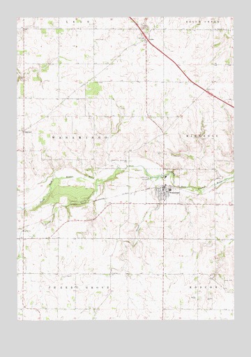
Wanamingo, MN USGS Topographic Map
Click on map above to begin viewing in our Map Viewer.

This topographic map contains these locations and features:
Feature Name Type Latitude Longitude GNIS ID View Map
Aspelund Emmanuel ChurchChurchN44.3044°W92.7903°2064916View Map
Aspelund Norwegian Lutheran CemeteryCemeteryN44.3275°W92.8714°2064968View Map
City of WanamingoCivilN44.3027°W92.7872°2397189View Map
Dale CemeteryCemeteryN44.2680°W92.8472°2064967View Map
Dale ChurchChurchN44.2680°W92.8469°642604View Map
HaderPopulated PlaceN44.3655°W92.8010°654739View Map
Hader Post Office (historical)Post OfficeN44.3656°W92.8008°2064876View Map
Kenyon - Wanamingo Elementary SchoolSchoolN44.3036°W92.7867°2064914View Map
L Jackson Pond DamDamN44.3416°W92.8252°1777175View Map
Minneola ChurchChurchN44.3691°W92.7596°647929View Map
Minneola German Methodist CemeteryCemeteryN44.3550°W92.7889°2065000View Map
Minneola Lutheran CemeteryCemeteryN44.3694°W92.7603°2065001View Map
Nazareth Lutheran ChurchCemeteryN44.3678°W92.8000°2064969View Map
New Life ChurchChurchN44.3036°W92.7867°2064915View Map
Olmsted Medical CenterHospitalN44.3044°W92.7911°2064906View Map
Riverview ManorHospitalN44.3019°W92.7833°2064907View Map
Shingle CreekStreamN44.3091°W92.7938°651984View Map
Spring CreekStreamN44.3075°W92.8291°652434View Map
Township of WanamingoCivilN44.3272°W92.8559°665910View Map
Trinity CemeteryCemeteryN44.3188°W92.7916°653288View Map
Trinity Lutheran ChurchChurchN44.3047°W92.7847°2064911View Map
WanamingoPopulated PlaceN44.3044°W92.7905°653758View Map
Wanamingo (historical)LocaleN44.3056°W92.7917°2064910View Map
Wanamingo CemeteryCemeteryN44.3156°W92.8113°653759View Map
Wanamingo Fire DepartmentBuildingN44.3053°W92.7912°2666373View Map
Wanamingo Four Square ChurchChurchN44.2994°W92.7861°2064913View Map
Wanamingo Lutheran ChurchChurchN44.3031°W92.7931°2064912View Map
Wanamingo Police DepartmentBuildingN44.3036°W92.7903°2064909View Map
Wanamingo Post OfficePost OfficeN44.3039°W92.7911°2064908View Map

Note: Coordinates in the location and feature list above are referenced to NAD83 datum.


Copyright (C) 2008-2024 Ryan Niemi / Sunset Dynamics ... All Rights Reserved