TopoQuest Logo
Do you find TopoQuest useful?
Help keep TopoQuest running and adding new maps/features by donating!
Bitcoin:  19c7KJd3qBynnjoSw5npx9KScwjBe4ifkT
Litecoin:  LXs6TkuXGGXo1vDsWCkWVdjQX94eUKd6ui
Home View Maps Find Maps Find Places Resources & Links


Piney Point, Maryland Topographic Map

USGS Map Title: Piney Point, MD
USGS Map MRC: 38076B5
DRG (GeoTIFF) Download: o38076b5.tif


Neighboring USGS Topographic Map Quads:


  Leonardtown, MD  
38076C6
 

  Hollywood, MD  
38076C5
 

  Solomons Island, MD  
38076C4
 

  Saint Clements Island, MD  
38076B6
 

  Piney Point, MD  
38076B5
 

  St. Marys City, MD  
38076B4
 

  Machodoc, VA  
38076A6
 

  Kinsale, VA  
38076A5
 

  Saint George Island, MD  
38076A4


Map MRC Location:

N39°
W77°
N39°
W76°
H8 H7 H6 H5 H4 H3 H2 H1
G8 G7 G6 G5 G4 G3 G2 G1
F8 F7 F6 F5 F4 F3 F2 F1
E8 E7 E6 E5 E4 E3 E2 E1
D8 D7 D6 D5 D4 D3 D2 D1
C8 C7 C6 C5 C4 C3 C2 C1
B8 B7 B6 B5 B4 B3 B2 B1
A8 A7 A6 A5 A4 A3 A2 A1
N38°
W77°
N38°
W76°

Piney Point, MD USGS 1:24K Topographic Map Preview:
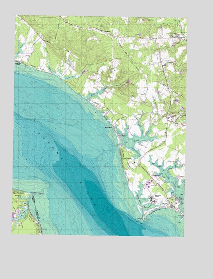
Piney Point, MD USGS Topographic Map
Click on map above to begin viewing in our Map Viewer.

This topographic map contains these locations and features:
Feature Name Type Latitude Longitude GNIS ID View Map
Albright PointCapeN38.1662°W76.5177°594571View Map
Andover EstatesPopulated PlaceN38.1687°W76.5044°594573View Map
Belvedere CreekStreamN38.2165°W76.5944°594587View Map
Belvedere WoodlandPopulated PlaceN38.2396°W76.5663°1697478View Map
Big Duke CreekStreamN38.1821°W76.5305°594590View Map
Biscoe PointCapeN38.1671°W76.5225°594593View Map
Blackbeard PondLakeN38.1462°W76.6161°1463517View Map
Blake CreekBayN38.2071°W76.5630°594595View Map
CallawayPopulated PlaceN38.2385°W76.5191°594622View Map
Callaway Post OfficePost OfficeN38.2248°W76.5186°1697487View Map
Cecils Mill Historic DistrictParkN38.2404°W76.5036°1697719View Map
ChingvillePopulated PlaceN38.2410°W76.5586°594655View Map
Coles NeckCapeN38.1357°W76.6233°1465102View Map
Coombs PointCapeN38.1646°W76.5141°594677View Map
District 2, Valley LeeCivilN38.1697°W76.5344°1929542View Map
Dukes RetreatPopulated PlaceN38.1954°W76.5266°1697724View Map
Faith Ridge FarmLocaleN38.2389°W76.5953°2706911View Map
George B Cecil Memorial ParkParkN38.1987°W76.5038°1697726View Map
Glebe BranchStreamN38.1923°W76.5186°594721View Map
Herring CreekBayN38.1804°W76.5308°594745View Map
Herring CreekLocaleN38.1912°W76.5366°1697732View Map
Herring CreekPopulated PlaceN38.1862°W76.5413°1697547View Map
Herring Creek EstatesPopulated PlaceN38.1779°W76.5288°1697548View Map
Herring Run BarBarN38.1732°W76.5469°1697549View Map
Hodgson PointCapeN38.1454°W76.5025°594749View Map
Holy Face ChurchChurchN38.2390°W76.5091°594755View Map
Holy Face Parish CemeteryCemeteryN38.2404°W76.5094°1697734View Map
Holy Family Catholic Church (historical)ChurchN38.1465°W76.5113°1697735View Map
Jubilee FarmLocaleN38.2073°W76.5733°1697565View Map
Lane BeachPopulated PlaceN38.1993°W76.5652°598317View Map
Lane BeachBeachN38.1993°W76.5675°1697570View Map
Lane CreekStreamN38.1960°W76.5588°1697572View Map
Lane PondLakeN38.1957°W76.5602°594785View Map
LanedonPopulated PlaceN38.1940°W76.5580°1697706View Map
Little Duke CreekStreamN38.1915°W76.5336°594793View Map
Little Flower SchoolSchoolN38.2396°W76.5070°594794View Map
Long BarBarN38.1479°W76.5044°594798View Map
Long PondLakeN38.1365°W76.6178°1469834View Map
Lundeberg Seamanship SchoolBuildingN38.1447°W76.5031°1697731View Map
McKay BeachPopulated PlaceN38.1871°W76.5513°594820View Map
McKay CoveBayN38.1810°W76.5441°594821View Map
Morgan PointCapeN38.1508°W76.5101°594836View Map
Mulberry FieldsLocaleN38.2135°W76.5733°1697601View Map
Nuthalls FollyLocaleN38.1557°W76.5302°1697741View Map
Oakland CoveBayN38.1626°W76.5141°594850View Map
Patuxent Seventh Day Adventist ChurchChurchN38.2496°W76.5919°1697615View Map
Paul Hall Center for Maritime Training and EducationSchoolN38.1436°W76.5048°2132756View Map
Piney PointCapeN38.1354°W76.5291°594875View Map
Piney PointPopulated PlaceN38.1423°W76.5075°594876View Map
Piney Point Airport (historical)AirportN38.1482°W76.5216°598350View Map
Piney Point BarBarN38.1340°W76.5308°1697743View Map
Piney Point BeachBeachN38.1401°W76.5219°594877View Map
Piney Point Census Designated PlaceCensusN38.1483°W76.5204°2629802View Map
Piney Point CreekBayN38.1460°W76.5305°594878View Map
Piney Point Elementary SchoolSchoolN38.1672°W76.5365°594879View Map
Piney Point LighthouseLocaleN38.1354°W76.5297°1697744View Map
Piney Point Naval Outer Landing Field (historical)MilitaryN38.1486°W76.5219°2571507View Map
Piney Point Post OfficePost OfficeN38.1394°W76.5029°1697745View Map
Piney Point ShoresPopulated PlaceN38.1476°W76.5080°1697746View Map
Pond-A-River MarinaLocaleN38.1429°W76.6152°1791447View Map
Poplar Hill CreekStreamN38.2160°W76.5941°594886View Map
Potomac ShoresPopulated PlaceN38.1996°W76.5644°1697624View Map
Pustey CreekStreamN38.2229°W76.5697°1697625View Map
Ragged PointCapeN38.1482°W76.6055°1472934View Map
Ragged Point BeachBeachN38.1407°W76.6133°1472936View Map
Ragged Point BeachPopulated PlaceN38.1487°W76.6163°1497112View Map
Redman BranchStreamN38.1893°W76.5222°594896View Map
Russell PointCapeN38.1615°W76.5186°594904View Map
Saint George BeachPopulated PlaceN38.1529°W76.5094°1697750View Map
Saint George HarborHarborN38.1462°W76.5047°594919View Map
Saint George ParkPopulated PlaceN38.1590°W76.5180°594924View Map
Saint Georges ChurchChurchN38.1948°W76.5205°594925View Map
Saint Georges ChurchChurchN38.1951°W76.5033°594926View Map
Saint Georges Parish CemeteryCemeteryN38.1941°W76.5034°1697752View Map
Saint Georges Poplar Hill Episcopal CemeteryCemeteryN38.1953°W76.5218°1697751View Map
Saint Lukes ChurchChurchN38.1543°W76.5197°594938View Map
Saint Mary's CountyCivilN38.2159°W76.5291°1697853View Map
Schoolhouse BranchStreamN38.1535°W76.5013°594952View Map
Second District Volunteer Fire Department and Volunteer Rescue Squad Company 6BuildingN38.1908°W76.5113°2131792View Map
Sheehan PointCapeN38.1615°W76.5108°594956View Map
Stinking PointCapeN38.1279°W76.6033°1501642View Map
Straits PointCapeN38.1382°W76.5011°594972View Map
Streams End PointCapeN38.1548°W76.5041°1697755View Map
Tall TimbersPopulated PlaceN38.1690°W76.5450°594973View Map
Tall Timbers Census Designated PlaceCensusN38.1654°W76.5365°2629807View Map
Tall Timbers CoveBayN38.1737°W76.5338°594974View Map
Tall Timbers Post OfficePost OfficeN38.1651°W76.5346°1697756View Map
Tarleton BranchStreamN38.2101°W76.5561°594978View Map
TolsonPopulated PlaceN38.1379°W76.5272°1697759View Map
Tolson Post Office (historical)Post OfficeN38.1379°W76.5272°1697760View Map
Valley LeePopulated PlaceN38.1960°W76.5127°595001View Map
Valley Lee Post OfficePost OfficeN38.1941°W76.5143°1697762View Map
Westbury ManorLocaleN38.1662°W76.5136°1697765View Map
Western Branch Saint Marys RiverStreamN38.2479°W76.5077°595007View Map
WestonLocaleN38.1718°W76.5197°1697766View Map
White Point BeachPopulated PlaceN38.2237°W76.6202°595012View Map
WildernessPopulated PlaceN38.2473°W76.5977°1697693View Map
Woodland BranchStreamN38.1954°W76.5138°595020View Map
Yellow BankBarN38.1546°W76.5033°595023View Map

Note: Coordinates in the location and feature list above are referenced to NAD83 datum.


Copyright (C) 2008-2024 Ryan Niemi / Sunset Dynamics ... All Rights Reserved