TopoQuest Logo
Do you find TopoQuest useful?
Help keep TopoQuest running and adding new maps/features by donating!
Bitcoin:  19c7KJd3qBynnjoSw5npx9KScwjBe4ifkT
Litecoin:  LXs6TkuXGGXo1vDsWCkWVdjQX94eUKd6ui
Home View Maps Find Maps Find Places Resources & Links


Bethel Valley, Tennessee Topographic Map

USGS Map Title: Bethel Valley, TN
USGS Map MRC: 35084H3
DRG (GeoTIFF) Download: o35084h3.tif


Neighboring USGS Topographic Map Quads:


  Petros, TN  
36084A4
 

  Windrock, TN  
36084A3
 

  Clinton, TN  
36084A2
 

  Elverton, TN  
35084H4
 

  Bethel Valley, TN  
35084H3
 

  Lovell, TN  
35084H2
 

  Cave Creek, TN  
35084G4
 

  Lenoir City, TN  
35084G3
 

  Concord, TN  
35084G2


Map MRC Location:

N36°
W85°
N36°
W84°
H8 H7 H6 H5 H4 H3 H2 H1
G8 G7 G6 G5 G4 G3 G2 G1
F8 F7 F6 F5 F4 F3 F2 F1
E8 E7 E6 E5 E4 E3 E2 E1
D8 D7 D6 D5 D4 D3 D2 D1
C8 C7 C6 C5 C4 C3 C2 C1
B8 B7 B6 B5 B4 B3 B2 B1
A8 A7 A6 A5 A4 A3 A2 A1
N35°
W85°
N35°
W84°

Bethel Valley, TN USGS 1:24K Topographic Map Preview:
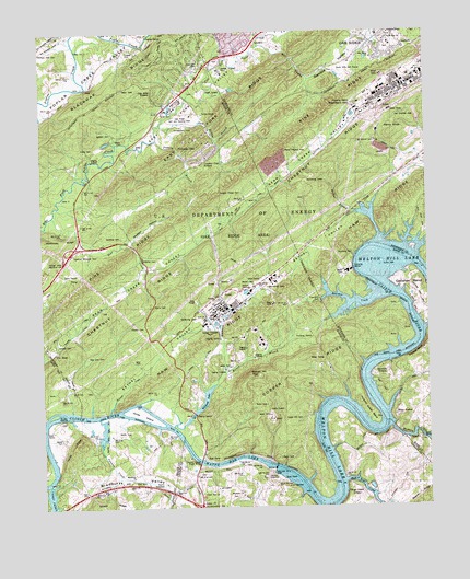
Bethel Valley, TN USGS Topographic Map
Click on map above to begin viewing in our Map Viewer.

This topographic map contains these locations and features:
Feature Name Type Latitude Longitude GNIS ID View Map
Acme School (historical)SchoolN35.8815°W84.3466°1316360View Map
Bear (historical)Populated PlaceN35.9492°W84.3144°1310397View Map
Bear CreekStreamN35.9515°W84.3713°1276580View Map
Bearden CreekStreamN35.9301°W84.2658°1276647View Map
Bethel CemeteryCemeteryN35.9340°W84.3055°1277112View Map
Bethel ValleyValleyN35.9004°W84.3536°1277141View Map
Blue Spring Island ShoalsBarN35.9012°W84.3419°1644089View Map
Bogles ShoalsBarN35.8773°W84.2880°1643259View Map
Bradbury ValleyValleyN35.8784°W84.3318°1305374View Map
Burns Mill (historical)LocaleN35.9226°W84.3277°1316368View Map
Buttermilk ShoresPopulated PlaceN35.8815°W84.3624°1310401View Map
Caney CreekStreamN35.8812°W84.3727°1305671View Map
Charles Vanden Bulck BridgeBridgeN35.8870°W84.3241°1305864View Map
City of Oak RidgeCivilN35.9639°W84.2938°2404409View Map
Clinch View ChurchChurchN35.8787°W84.3238°1305978View Map
Commissioner District 4CivilN35.9544°W84.3531°2464080View Map
Commissioner District 6CivilN35.9751°W84.2652°2464508View Map
Cumberland Church (historical)ChurchN35.9417°W84.3680°1316382View Map
Currier CemeteryCemeteryN35.9406°W84.3371°1281889View Map
Douglas Chapel CemeteryCemeteryN35.9576°W84.3091°1282731View Map
East Fork CemeteryCemeteryN35.9906°W84.3224°1283334View Map
East Fork Church (historical)ChurchN35.9904°W84.3219°1316391View Map
East Fork RidgeRidgeN35.9848°W84.3038°1283361View Map
Ethel (historical)Populated PlaceN35.9804°W84.3341°1310416View Map
Fanny KnobSummitN35.9729°W84.2608°1284125View Map
Gallaher BendBendN35.9334°W84.2549°1285092View Map
Gallaher CemeteryCemeteryN35.9176°W84.3705°1285095View Map
Gallaher CemeteryCemeteryN35.9731°W84.3510°1285097View Map
Gamble ValleyValleyN35.9986°W84.2654°1285122View Map
George Jones Memorial ChurchChurchN35.9384°W84.3724°1285308View Map
Gravel Hill CemeteryCemeteryN35.8984°W84.2966°1285931View Map
Gravel Hill School (historical)SchoolN35.9015°W84.2960°1316400View Map
Grubb CreekStreamN35.8795°W84.3349°1286363View Map
Grubb IslandsIslandN35.9001°W84.3710°1286364View Map
Gum Hollow BranchStreamN35.9754°W84.3355°1286407View Map
Gum Hollow BranchStreamN35.9754°W84.3355°1286408View Map
Haw RidgeRidgeN35.9409°W84.2819°1287167View Map
Hembree CemeteryCemeteryN35.9459°W84.3488°1287360View Map
Hickory CreekStreamN35.8965°W84.2616°1287569View Map
Hickory Creek BendBendN35.8995°W84.2694°1287571View Map
Hickory Creek ParkParkN35.8926°W84.2546°1321569View Map
Hickory ShoalsBarN35.9006°W84.2660°1645099View Map
Hood RidgeRidgeN35.8912°W84.3655°1288232View Map
Hope CreekStreamN35.8817°W84.2771°1288278View Map
Hope Creek ColonyLocaleN35.8801°W84.2752°1288279View Map
Hops ShoalsBarN35.8854°W84.2810°1643283View Map
Hursts ShoalsBarN35.9170°W84.2530°1645101View Map
Jaynes CemeteryCemeteryN35.8931°W84.3688°1289316View Map
Jones IslandIslandN35.8995°W84.3430°1289810View Map
Lakeland SubdivisionPopulated PlaceN35.8884°W84.3396°1310445View Map
Leedom (historical)Populated PlaceN35.9523°W84.2744°1307687View Map
Lockett CemeteryCemeteryN35.9948°W84.3460°1291774View Map
Macedonia ChurchChurchN35.8837°W84.3455°1292413View Map
McKinney RidgeRidgeN35.9445°W84.3749°1293383View Map
McNew HollowValleyN35.9456°W84.3455°1293448View Map
Melton BranchStreamN35.9104°W84.3160°1293563View Map
Melton HillSummitN35.9095°W84.3049°1293569View Map
Melton Hill DamDamN35.8854°W84.3002°1306743View Map
Melton Hill Dam Recreation AreaParkN35.8826°W84.2988°1309582View Map
Mill BranchStreamN35.9959°W84.3027°1293800View Map
Mount Vernon CemeteryCemeteryN35.9703°W84.2658°1294820View Map
Mount Zion Baptist ChurchChurchN35.9976°W84.2602°1294900View Map
Mountain View School (historical)SchoolN35.9120°W84.3305°1316422View Map
New Bethel Church (historical)ChurchN35.9342°W84.3052°1316423View Map
New Zion CemeteryCemeteryN35.9148°W84.3602°1295669View Map
New Zion Church (historical)ChurchN35.9148°W84.3608°1316427View Map
Oak Hills EstatesPopulated PlaceN35.9856°W84.3333°1296153View Map
Oak Ridge Fire Department Station 1BuildingN35.9998°W84.2970°2654785View Map
Oak Ridge Golf and Country ClubLocaleN35.9779°W84.3252°1296159View Map
Oak Ridge National Laboratory Fire DepartmentBuildingN35.9248°W84.3203°2654818View Map
Oak Valley Baptist ChurchChurchN35.9920°W84.2660°1314148View Map
Orchard View CemeteryCemeteryN35.9951°W84.3749°1296477View Map
Paw Paw Island ShoalsBarN35.9006°W84.3708°1644126View Map
Pawpaw CreekStreamN35.8987°W84.3563°1297000View Map
Pinhook BranchStreamN35.9717°W84.3366°1297660View Map
Pinhook GapGapN35.9690°W84.3299°1297665View Map
Raccoon CreekStreamN35.9004°W84.3530°1298791View Map
Scarboro Church of ChristChurchN35.9931°W84.2671°1650862View Map
Scott CemeteryCemeteryN35.9787°W84.3349°1300932View Map
Selkirk (historical)Populated PlaceN35.9029°W84.3541°1310462View Map
South Hills Golf CourseLocaleN35.9895°W84.2738°1270896View Map
Stubbs BluffCliffN35.9156°W84.2533°1271617View Map
Thacker CemeteryCemeteryN35.9223°W84.3416°1272356View Map
United States Atomic Energy CommissionLocaleN35.9492°W84.3080°1646798View Map
Vancouvers ShoalsBarN35.8965°W84.2713°1643326View Map
Walker BranchStreamN35.9523°W84.2724°1273565View Map
Waller CemeteryCemeteryN35.8945°W84.3508°1273696View Map
Wallers Ferry (historical)CrossingN35.9001°W84.3527°1644141View Map
WheatLocaleN35.9367°W84.3735°1304508View Map
White Wing Ferry (historical)CrossingN35.8870°W84.3241°1309614View Map
Whiteoak CreekStreamN35.8965°W84.3327°1304546View Map
Whiteoak DamDamN35.8995°W84.3258°1307166View Map
Williams Ferry (historical)CrossingN35.8859°W84.3010°1643329View Map
WoodlawnPopulated PlaceN35.8781°W84.3099°1309615View Map
Woodlawn ChurchChurchN35.8781°W84.3108°1304668View Map

Note: Coordinates in the location and feature list above are referenced to NAD83 datum.


Copyright (C) 2008-2024 Ryan Niemi / Sunset Dynamics ... All Rights Reserved