TopoQuest Logo
Do you find TopoQuest useful?
Help keep TopoQuest running and adding new maps/features by donating!
Bitcoin:  19c7KJd3qBynnjoSw5npx9KScwjBe4ifkT
Litecoin:  LXs6TkuXGGXo1vDsWCkWVdjQX94eUKd6ui
Home View Maps Find Maps Find Places Resources & Links


Elverton, Tennessee Topographic Map

USGS Map Title: Elverton, TN
USGS Map MRC: 35084H4
DRG (GeoTIFF) Download: o35084h4.tif


Neighboring USGS Topographic Map Quads:


  Camp Austin, TN  
36084A5
 

  Petros, TN  
36084A4
 

  Windrock, TN  
36084A3
 

  Harriman, TN  
35084H5
 

  Elverton, TN  
35084H4
 

  Bethel Valley, TN  
35084H3
 

  Bacon Gap, TN  
35084G5
 

  Cave Creek, TN  
35084G4
 

  Lenoir City, TN  
35084G3


Map MRC Location:

N36°
W85°
N36°
W84°
H8 H7 H6 H5 H4 H3 H2 H1
G8 G7 G6 G5 G4 G3 G2 G1
F8 F7 F6 F5 F4 F3 F2 F1
E8 E7 E6 E5 E4 E3 E2 E1
D8 D7 D6 D5 D4 D3 D2 D1
C8 C7 C6 C5 C4 C3 C2 C1
B8 B7 B6 B5 B4 B3 B2 B1
A8 A7 A6 A5 A4 A3 A2 A1
N35°
W85°
N35°
W84°

Elverton, TN USGS 1:24K Topographic Map Preview:
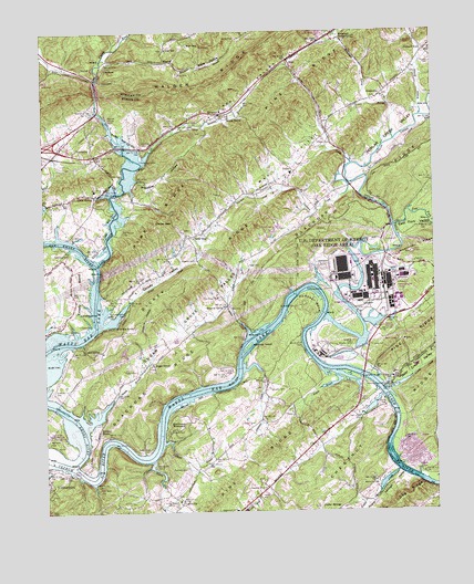
Elverton, TN USGS Topographic Map
Click on map above to begin viewing in our Map Viewer.

This topographic map contains these locations and features:
Feature Name Type Latitude Longitude GNIS ID View Map
Adkisson SpringSpringN35.9271°W84.4895°1275496View Map
Anchor Boat DockLocaleN35.9529°W84.4777°1316362View Map
Bear Creek ValleyValleyN35.9066°W84.3893°1276606View Map
Big Emory Baptist ChurchChurchN35.9579°W84.4827°1644088View Map
Bitter CreekStreamN35.9879°W84.4827°1277531View Map
BlairPopulated PlaceN35.9926°W84.4208°1314691View Map
Blair Volunteer Fire DepartmentBuildingN35.9958°W84.3754°2654568View Map
Blair Volunteer Fire Department Station 2BuildingN35.9558°W84.4664°2654683View Map
Blue GemPopulated PlaceN35.9965°W84.4527°1314698View Map
Brashear CreekStreamN35.9212°W84.4344°1278243View Map
Brashear IslandIslandN35.9179°W84.4349°1305400View Map
Brashears ShoalsBarN35.9242°W84.4252°1644091View Map
Brashears SubdivisionPopulated PlaceN35.9381°W84.4991°1310399View Map
Breadtray HollowValleyN35.9614°W84.4695°1278266View Map
Campbell BendBendN35.9292°W84.4144°1305639View Map
Centers FerryCrossingN35.8848°W84.4905°1305809View Map
Century AcresPopulated PlaceN35.9048°W84.4291°1310404View Map
Chestnut HillsPopulated PlaceN35.9012°W84.3999°1310406View Map
ChristmasLocaleN35.9912°W84.4808°1280532View Map
Clacks GapGapN35.9506°W84.4585°1305936View Map
Clacks GapLocaleN35.9467°W84.4541°1280578View Map
Clacks Gap CemeteryCemeteryN35.9484°W84.4549°1326168View Map
Clacks Gap SchoolSchoolN35.9465°W84.4524°1316379View Map
Clax Gap Baptist ChurchChurchN35.9473°W84.4538°1644097View Map
Clinch River Industrial ParkLocaleN35.9098°W84.3860°1316380View Map
Coal HillPopulated PlaceN35.9959°W84.4599°1314864View Map
Coal Hill CemeteryCemeteryN35.9959°W84.4602°1646611View Map
Coal Hill ChurchChurchN35.9954°W84.4599°1309646View Map
Commissioner District 3CivilN35.9472°W84.4602°2464190View Map
Crowder CemeteryCemeteryN35.9073°W84.4280°1281745View Map
Davidson CreekStreamN35.9606°W84.4013°1282105View Map
DeArmondPopulated PlaceN35.9681°W84.4833°1306296View Map
DeArmond CemeteryCemeteryN35.9798°W84.4835°1282235View Map
Dickey CemeteryCemeteryN35.9267°W84.4774°1282442View Map
Dickey RidgeRidgeN35.9420°W84.4441°1282446View Map
Dickey SpringSpringN35.9233°W84.4767°1282448View Map
Dickey ValleyValleyN35.9297°W84.4740°1282449View Map
DyllisPopulated PlaceN35.9637°W84.4191°1314992View Map
Dyllis Baptist ChurchChurchN35.9617°W84.4216°1644099View Map
Dyllis CemeteryCemeteryN35.9603°W84.4216°1326171View Map
Dyllis Elementary SchoolSchoolN35.9631°W84.4205°1316388View Map
East Fork Poplar CreekStreamN35.9495°W84.3874°1283359View Map
East Fork ValleyValleyN35.9495°W84.3870°1283371View Map
East Roane County Volunteer Fire Department Station 5 LawnvilleBuildingN35.8783°W84.4587°2654697View Map
Edgewood SchoolSchoolN35.8754°W84.4394°1283528View Map
Edwards CemeteryCemeteryN35.9403°W84.4513°1283547View Map
Edwards SpringSpringN35.9281°W84.4422°1283565View Map
Ellis CemeteryCemeteryN35.9409°W84.3891°1283682View Map
Ellis CemeteryCemeteryN35.9631°W84.4744°1283683View Map
ElvertonPopulated PlaceN35.9787°W84.4430°1306420View Map
Elverton BranchStreamN35.9690°W84.4655°1283734View Map
Elverton CemeteryCemeteryN35.9798°W84.4421°1326173View Map
Elverton Primitive Baptist ChurchChurchN35.9792°W84.4427°1326174View Map
Elverton School (historical)SchoolN35.9779°W84.4458°1316173View Map
Emory BendBendN35.9329°W84.4883°1283761View Map
Emory CemeteryCemeteryN35.9592°W84.4827°1326175View Map
Emory RiverStreamN35.8876°W84.4916°1283771View Map
Emory School (historical)SchoolN35.9590°W84.4833°1316172View Map
Gallagher Ferry (historical)CrossingN35.9140°W84.4130°1316399View Map
Gallaher BridgeBridgeN35.9104°W84.3980°1285093View Map
Gallaher CemeteryCemeteryN35.9187°W84.4016°1285096View Map
Gallaher Road ChurchChurchN35.8817°W84.4294°1285098View Map
Gallahers ShoalsBarN35.9112°W84.4005°1644101View Map
Geasland CemeteryCemeteryN35.9428°W84.4919°1285268View Map
Goddards ShoalsBarN35.9145°W84.4374°1644102View Map
Grassy CreekStreamN35.9095°W84.3824°1285887View Map
Hartland EstatesPopulated PlaceN35.9695°W84.3838°1310422View Map
Heglars ShoalsBarN35.9006°W84.3877°1644106View Map
Hen ValleyValleyN35.9661°W84.4678°1287370View Map
Hensley CemeteryCemeteryN35.8853°W84.3785°1287459View Map
Hester CemeteryCemeteryN35.9120°W84.4708°1287521View Map
Hidden ValleyPopulated PlaceN35.9654°W84.4833°1310424View Map
Holiday ShoresPopulated PlaceN35.8965°W84.4827°1315247View Map
Johnson CreekStreamN35.9120°W84.4358°1289596View Map
JonesvillePopulated PlaceN35.9831°W84.3913°1315307View Map
Jonesville CemeteryCemeteryN35.9828°W84.3924°1326183View Map
Jonesville United Methodist ChurchChurchN35.9829°W84.3908°1646065View Map
Kaklan CemeteryCemeteryN35.9715°W84.4094°1289901View Map
Kings CreekStreamN35.9240°W84.4810°1290244View Map
Kingston Fire Department Station 2BuildingN35.8763°W84.4362°2654901View Map
Kingston Police DepartmentBuildingN35.8841°W84.4986°2765960View Map
KriesPopulated PlaceN35.9292°W84.4408°1310439View Map
Kries CemeteryCemeteryN35.9284°W84.4405°1306656View Map
Ladd CemeteryCemeteryN35.8912°W84.4674°1290454View Map
Ladd EstatesPopulated PlaceN35.9501°W84.4874°1310440View Map
Ladds ShoalsBarN35.8895°W84.4722°1644117View Map
LawnvillePopulated PlaceN35.8767°W84.4569°1315363View Map
Lewis BranchStreamN35.8981°W84.4852°1291058View Map
Little EmoryPopulated PlaceN35.9576°W84.4833°1291494View Map
Little Emory RiverStreamN35.9398°W84.4824°1291495View Map
Machine BranchStreamN35.9929°W84.4808°1292434View Map
Mahoney CemeteryCemeteryN35.8934°W84.4988°1292509View Map
Manhattan Project National Historical ParkParkN35.9354°W84.3933°2775864View Map
Martins Ford (historical)CrossingN35.8887°W84.4985°1644147View Map
Martins ShoalsBarN35.8890°W84.4994°1644120View Map
Massengil Spring CemeteryCemeteryN35.9992°W84.4038°1326185View Map
Massengill SpringSpringN35.9990°W84.4044°1292902View Map
Massengill Spring BranchStreamN35.9715°W84.3869°1292903View Map
May ValleyValleyN35.9742°W84.4061°1293000View Map
McGee SpringSpringN35.9776°W84.4402°1293307View Map
McKinney CemeteryCemeteryN35.9284°W84.4194°1293372View Map
McKinney CemeteryCemeteryN35.9067°W84.4327°1326186View Map
Merriwater HomeparkLocaleN35.8984°W84.4538°1293632View Map
Mill SpringSpringN35.9172°W84.4868°1293894View Map
New Greenwood CemeteryCemeteryN35.8787°W84.4563°1316424View Map
Oak Ridge Division (historical)CensusN35.9756°W84.3813°1648924View Map
Oak Ridge Fire Department Station 4BuildingN35.9314°W84.3931°2654782View Map
Ollis CemeteryCemeteryN35.9984°W84.4005°1296431View Map
Orchard Valley EstatesPopulated PlaceN35.9656°W84.4191°1310450View Map
Orchard ViewPopulated PlaceN35.9951°W84.3772°1315654View Map
Orchard View Baptist ChurchChurchN35.9954°W84.3752°1644124View Map
Orchard View School (historical)SchoolN35.9948°W84.3760°1316433View Map
Osborne CemeteryCemeteryN35.9545°W84.4710°1296501View Map
Oxier CreekStreamN35.9656°W84.4008°1296623View Map
Palko CemeteryCemeteryN35.9562°W84.4919°1296687View Map
Patterson BranchStreamN35.8929°W84.4619°1296927View Map
Patterson CemeteryCemeteryN35.8865°W84.4549°1296941View Map
Pauper CemeteryCemeteryN35.8978°W84.4330°1296996View Map
Pickel Island (historical)IslandN35.8895°W84.3896°1310454View Map
Pickles ShoalsBarN35.8929°W84.3902°1644127View Map
Pine Ridge ChurchChurchN35.9312°W84.4444°1297585View Map
Poor Farm CemeteryCemeteryN35.8812°W84.4835°1298132View Map
Poplar CreekStreamN35.9276°W84.4088°1298184View Map
Poplar Creek Island (historical)IslandN35.9301°W84.4210°1310457View Map
Poplar Creek ValleyValleyN35.9616°W84.4037°1269868View Map
Poplar Springs CemeteryCemeteryN35.8762°W84.4135°1326192View Map
Poplar Springs ChurchChurchN35.8756°W84.4135°1326193View Map
Poplar Springs CreekStreamN35.8856°W84.3871°1298235View Map
Poplar Springs ValleyValleyN35.8852°W84.3868°1298237View Map
Raybourn CemeteryCemeteryN35.8823°W84.3941°1299002View Map
Riggs CemeteryCemeteryN35.9392°W84.4344°1299423View Map
Riverbend EstatesPopulated PlaceN35.8862°W84.4610°1310459View Map
Roane County Farm (historical)LocaleN35.8784°W84.4833°1316448View Map
Roberts BranchStreamN35.9115°W84.4077°1299616View Map
Roberts CemeteryCemeteryN35.8959°W84.4602°1299629View Map
Rodgers Ridge SubdivisionPopulated PlaceN35.8876°W84.3999°1310460View Map
Russell CemeteryCemeteryN35.9923°W84.3755°1300317View Map
Shelton CemeteryCemeteryN35.9431°W84.3919°1270019View Map
Slave CemeteryCemeteryN35.9181°W84.3949°1270497View Map
Suddath CemeteryCemeteryN35.9067°W84.4972°1271638View Map
Sugar GrovePopulated PlaceN35.9140°W84.4652°1314352View Map
Sugar Grove CemeteryCemeteryN35.9131°W84.4658°1326197View Map
Sugar Grove School (historical)SchoolN35.9134°W84.4660°1316462View Map
Sugar Grove ValleyValleyN35.8981°W84.4856°1303899View Map
Tedder CemeteryCemeteryN35.9240°W84.4891°1272269View Map
UnionPopulated PlaceN35.9023°W84.4222°1314432View Map
Union ChapelChurchN35.9009°W84.4210°1316467View Map
Walker SubdivisionPopulated PlaceN35.9390°W84.4902°1310476View Map
Walkers ShoalsBarN35.8992°W84.4627°1644140View Map
Wallers ShoalsBarN35.8815°W84.3763°1644142View Map
Walls HollowValleyN35.9901°W84.4553°1273705View Map
Watson CemeteryCemeteryN35.9473°W84.4902°1273923View Map
Watsons Ferry (historical)CrossingN35.9051°W84.3908°1644144View Map
Webster BranchStreamN35.9779°W84.3785°1274050View Map
Welcher CemeteryCemeteryN35.9184°W84.4019°1274081View Map
Whiteoak LakeReservoirN35.8935°W84.4775°1274439View Map
Williams CemeteryCemeteryN35.9234°W84.4919°1274662View Map
Williams HollowValleyN35.9197°W84.4671°1274703View Map
WinslowPopulated PlaceN35.9915°W84.4566°1314524View Map
Young ChapelChurchN35.8781°W84.4577°1304710View Map
Young CreekStreamN35.8881°W84.4658°1275329View Map

Note: Coordinates in the location and feature list above are referenced to NAD83 datum.


Copyright (C) 2008-2024 Ryan Niemi / Sunset Dynamics ... All Rights Reserved