TopoQuest Logo
Do you find TopoQuest useful?
Help keep TopoQuest running and adding new maps/features by donating!
Bitcoin:  19c7KJd3qBynnjoSw5npx9KScwjBe4ifkT
Litecoin:  LXs6TkuXGGXo1vDsWCkWVdjQX94eUKd6ui
Home View Maps Find Maps Find Places Resources & Links


Reading, Michigan Topographic Map

USGS Map Title: Reading, MI
USGS Map MRC: 41084G6
DRG (GeoTIFF) Download: o41084g6.tif


Neighboring USGS Topographic Map Quads:


  Allen, MI  
41084H7
 

  Hillsdale, MI  
41084H6
 

  North Adams, MI  
41084H5
 

  Camden, MI  
41084G7
 

  Reading, MI  
41084G6
 

  Frontier, MI  
41084G5
 

  Clear Lake, IN  
41084F7
 

  Nettle Lake, OH  
41084F6
 

  Pioneer, OH  
41084F5


Map MRC Location:

N42°
W85°
N42°
W84°
H8 H7 H6 H5 H4 H3 H2 H1
G8 G7 G6 G5 G4 G3 G2 G1
F8 F7 F6 F5 F4 F3 F2 F1
E8 E7 E6 E5 E4 E3 E2 E1
D8 D7 D6 D5 D4 D3 D2 D1
C8 C7 C6 C5 C4 C3 C2 C1
B8 B7 B6 B5 B4 B3 B2 B1
A8 A7 A6 A5 A4 A3 A2 A1
N41°
W85°
N41°
W84°

Reading, MI USGS 1:24K Topographic Map Preview:
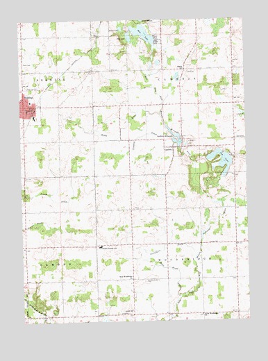
Reading, MI USGS Topographic Map
Click on map above to begin viewing in our Map Viewer.

This topographic map contains these locations and features:
Feature Name Type Latitude Longitude GNIS ID View Map
Adams SchoolSchoolN41.8548°W84.6583°619828View Map
Amish CemeteryCemeteryN41.7545°W84.7092°2419745View Map
Amish SchoolSchoolN41.7545°W84.6894°620067View Map
Bear LakeLakeN41.8692°W84.6808°620848View Map
Broom LakeLakeN41.8714°W84.6933°622056View Map
CambriaPopulated PlaceN41.8220°W84.6650°622501View Map
Cambria Baptist ChurchChurchN41.8222°W84.6658°2418354View Map
Cambria DrainStreamN41.8292°W84.6669°622502View Map
Cambria MillpondReservoirN41.8250°W84.6647°622503View Map
Cambria Post Office (historical)Post OfficeN41.8222°W84.6653°2418318View Map
Cambria Post Office (historical)Post OfficeN41.7819°W84.6506°2418319View Map
Camden-Frontier SchoolSchoolN41.7814°W84.7063°622510View Map
Carruthers DrainStreamN41.7764°W84.6536°622794View Map
Church of the NazareneChurchN41.8356°W84.7483°2418415View Map
City of ReadingCivilN41.8396°W84.7478°1626956View Map
Cub LakeLakeN41.8147°W84.6398°624190View Map
Devine CemeteryCemeteryN41.7967°W84.6844°624611View Map
Dow CemeteryCemeteryN41.8578°W84.6311°624836View Map
Jonas Brown DrainStreamN41.7589°W84.6638°629361View Map
Maple Lawn CemeteryCemeteryN41.8478°W84.7469°631477View Map
Meade DrainStreamN41.8356°W84.6716°632045View Map
New Cambria CemeteryCemeteryN41.8403°W84.6606°2419722View Map
New Hope ChurchChurchN41.7819°W84.7094°2419706View Map
Old Cambria CemeteryCemeteryN41.8253°W84.6594°2419721View Map
Old Sebring CemeteryCemeteryN41.8333°W84.6319°2419720View Map
Pike LakeLakeN41.8680°W84.6889°634866View Map
ReadingPopulated PlaceN41.8395°W84.7480°635690View Map
Reading City HallBuildingN41.8403°W84.7478°2418417View Map
Reading Community Fire DepartmentBuildingN41.8399°W84.7464°2418412View Map
Reading Community LibraryBuildingN41.8414°W84.7483°2418419View Map
Reading Elementary SchoolSchoolN41.8414°W84.7442°2418420View Map
Reading Emergency Unit Ambulance Station Number 1BuildingN41.8432°W84.7483°2662073View Map
Reading Health ClinicHospitalN41.8400°W84.7483°2418418View Map
Reading High SchoolSchoolN41.8378°W84.7461°2418421View Map
Reading Police DepartmentBuildingN41.8395°W84.7477°2418416View Map
Reading Post OfficePost OfficeN41.8394°W84.7475°2418413View Map
Reading StationLocaleN41.8383°W84.7417°2418411View Map
Reading United Methodist ChurchChurchN41.8400°W84.7439°2418414View Map
Rotary ParkParkN41.8378°W84.7467°2418395View Map
Sebring CemeteryCemeteryN41.8256°W84.6308°1623741View Map
Sheldon CemeteryCemeteryN41.7821°W84.6464°637715View Map
South Woodbridge ChurchChurchN41.7525°W84.6508°638429View Map
Southern Belle Mobile CommunityPopulated PlaceN41.8722°W84.6764°2418363View Map
Township of CambriaCivilN41.8544°W84.6510°1626025View Map
Township of WoodbridgeCivilN41.7746°W84.6507°1627286View Map
Water Works ParkParkN41.8431°W84.7481°2418396View Map
West Woodbridge CemeteryCemeteryN41.7667°W84.6819°1616195View Map
West Woodbridge ChurchChurchN41.7678°W84.6894°1616196View Map
Willits CemeteryCemeteryN41.8545°W84.6941°1616525View Map

Note: Coordinates in the location and feature list above are referenced to NAD83 datum.


Copyright (C) 2008-2024 Ryan Niemi / Sunset Dynamics ... All Rights Reserved