TopoQuest Logo
Do you find TopoQuest useful?
Help keep TopoQuest running and adding new maps/features by donating!
Bitcoin:  19c7KJd3qBynnjoSw5npx9KScwjBe4ifkT
Litecoin:  LXs6TkuXGGXo1vDsWCkWVdjQX94eUKd6ui
Home View Maps Find Maps Find Places Resources & Links


Nettle Lake, Ohio Topographic Map

USGS Map Title: Nettle Lake, OH
USGS Map MRC: 41084F6
DRG (GeoTIFF) Download: o41084f6.tif


Neighboring USGS Topographic Map Quads:


  Camden, MI  
41084G7
 

  Reading, MI  
41084G6
 

  Frontier, MI  
41084G5
 

  Clear Lake, IN  
41084F7
 

  Nettle Lake, OH  
41084F6
 

  Pioneer, OH  
41084F5
 

  Edon, OH  
41084E7
 

  Blakeslee, OH  
41084E6
 

  Montpelier, OH  
41084E5


Map MRC Location:

N42°
W85°
N42°
W84°
H8 H7 H6 H5 H4 H3 H2 H1
G8 G7 G6 G5 G4 G3 G2 G1
F8 F7 F6 F5 F4 F3 F2 F1
E8 E7 E6 E5 E4 E3 E2 E1
D8 D7 D6 D5 D4 D3 D2 D1
C8 C7 C6 C5 C4 C3 C2 C1
B8 B7 B6 B5 B4 B3 B2 B1
A8 A7 A6 A5 A4 A3 A2 A1
N41°
W85°
N41°
W84°

Nettle Lake, OH USGS 1:24K Topographic Map Preview:
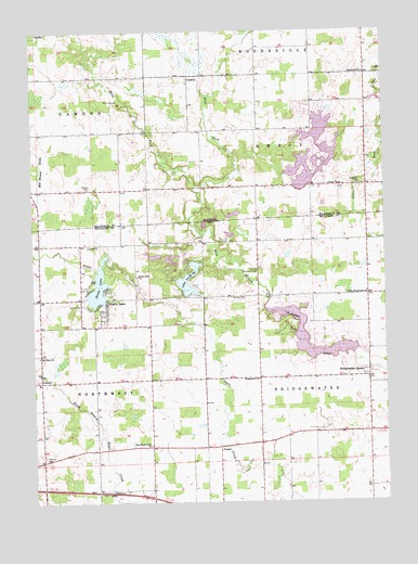
Nettle Lake, OH USGS Topographic Map
Click on map above to begin viewing in our Map Viewer.

This topographic map contains these locations and features:
Feature Name Type Latitude Longitude GNIS ID View Map
AingerPopulated PlaceN41.6398°W84.6838°1056197View Map
AustinPopulated PlaceN41.7373°W84.6941°620354View Map
Bridgewater CenterPopulated PlaceN41.6581°W84.6308°1064488View Map
Bridgewater ChurchChurchN41.6576°W84.6700°1038305View Map
Bridgewater DairyLocaleN41.6331°W84.6569°2704740View Map
Cellars CemeteryCemeteryN41.7306°W84.6361°2419737View Map
Clems PondReservoirN41.6875°W84.6955°1955088View Map
CooneyPopulated PlaceN41.6573°W84.7475°1056250View Map
East Fork West Branch Saint Joseph RiverStreamN41.7070°W84.6900°625185View Map
Eds PondReservoirN41.6826°W84.6921°1955089View Map
Gardner CemeteryCemeteryN41.6794°W84.6795°1040761View Map
Hagaman CemeteryCemeteryN41.7091°W84.6341°627590View Map
Hageman Post Office (historical)Post OfficeN41.7089°W84.6308°2418316View Map
Hay Jay Community HallLocaleN41.6859°W84.6697°1041418View Map
Hays LakeReservoirN41.6850°W84.7050°1079511View Map
Hays Lake DamDamN41.6850°W84.7050°1079510View Map
Hogback PondReservoirN41.6894°W84.6955°1955090View Map
Jerrys PondReservoirN41.6911°W84.6957°1955091View Map
Kohl LakeReservoirN41.6850°W84.7066°1079513View Map
Kohl Lake DamDamN41.6850°W84.7066°1079512View Map
Lake AReservoirN41.6950°W84.6816°1078285View Map
Lake A DamDamN41.6950°W84.6816°1078284View Map
Lake AnnReservoirN41.6904°W84.6994°1955083View Map
Lake CReservoirN41.6999°W84.6866°1078287View Map
Lake C DamDamN41.6984°W84.6883°1078286View Map
Lake La Su AnLakeN41.6839°W84.6946°1070808View Map
Lake La Su An DamDamN41.6884°W84.6900°1078281View Map
Lake La Su An Wildlife AreaParkN41.6812°W84.6986°1055254View Map
Lake La VereReservoirN41.6905°W84.7070°1955092View Map
Lake SenecaReservoirN41.6645°W84.6513°1078283View Map
Lake SenecaPopulated PlaceN41.6700°W84.6441°2633228View Map
Lake Seneca Census Designated PlaceCensusN41.6695°W84.6516°2633227View Map
Lake Seneca DamDamN41.6651°W84.6366°1078282View Map
Lake SueReservoirN41.6892°W84.7009°1955095View Map
Lous PondReservoirN41.6839°W84.6946°1955093View Map
Malcom CemeteryCemeteryN41.6373°W84.7463°1042903View Map
Morganville Post Office (historical)Post OfficeN41.7083°W84.6889°2418309View Map
Mount Union ChurchChurchN41.6639°W84.7477°1043636View Map
Nettle LakeLakeN41.6825°W84.7266°1043808View Map
Nettle LakePopulated PlaceN41.6792°W84.7233°1057864View Map
Nettle Lake CemeteryCemeteryN41.6850°W84.7136°1065867View Map
Nettle Lake Census Designated PlaceCensusN41.6786°W84.7270°2628938View Map
Nettle Lake United Brethren ChurchChurchN41.6850°W84.7122°1066108View Map
North Bridgewater ChurchChurchN41.6801°W84.6308°1043922View Map
NorthwestPopulated PlaceN41.6917°W84.7333°1058181View Map
Northwest Township Fire And RescueBuildingN41.6567°W84.7489°2549362View Map
Osborn CemeteryCemeteryN41.7085°W84.6414°2418466View Map
Osborn ChurchChurchN41.7087°W84.6413°634121View Map
Palmer CemeteryCemeteryN41.7084°W84.7300°634309View Map
Pentecostal ChurchChurchN41.7387°W84.6311°634607View Map
Robinson Family CemeteryCemeteryN41.7083°W84.6605°2419736View Map
School Number 10 (historical)SchoolN41.6409°W84.6697°1080885View Map
School Number 2 (historical)SchoolN41.6870°W84.6316°1080883View Map
School Number 4 (historical)SchoolN41.6581°W84.6702°1080884View Map
School Number 4 (historical)SchoolN41.6364°W84.7475°1080890View Map
School Number 6 (historical)SchoolN41.6862°W84.7472°1080889View Map
School Number 7 (historical)SchoolN41.6862°W84.7138°1080888View Map
School Number 8 (historical)SchoolN41.6303°W84.6313°1080882View Map
School Number 8 (historical)SchoolN41.6589°W84.7088°1080887View Map
School Number 9 (historical)SchoolN41.6284°W84.7088°1080886View Map
Spring PondLakeN41.6892°W84.6652°1955094View Map
Township of BridgewaterCivilN41.6600°W84.6315°1087166View Map
Township of NorthwestCivilN41.6584°W84.7471°1087173View Map
West Eagle Creek ChurchChurchN41.6401°W84.7088°1047746View Map
West Fork West Branch Saint Joseph RiverStreamN41.7072°W84.6900°2678707View Map
White Post Office (historical)Post OfficeN41.7369°W84.6931°2418292View Map

Note: Coordinates in the location and feature list above are referenced to NAD83 datum.


Copyright (C) 2008-2024 Ryan Niemi / Sunset Dynamics ... All Rights Reserved