TopoQuest Logo
Do you find TopoQuest useful?
Help keep TopoQuest running and adding new maps/features by donating!
Bitcoin:  19c7KJd3qBynnjoSw5npx9KScwjBe4ifkT
Litecoin:  LXs6TkuXGGXo1vDsWCkWVdjQX94eUKd6ui
Home View Maps Find Maps Find Places Resources & Links


Big Lake, Texas Topographic Map

USGS Map Title: Big Lake, TX
USGS Map MRC: 31101B4
DRG (GeoTIFF) Download: o31101b4.tif


Neighboring USGS Topographic Map Quads:


  Gardener Draw, TX  
31101C5
 

  Divide Draw, TX  
31101C4
 

  South Mustang Draw SE, TX  
31101C3
 

  Best, TX  
31101B5
 

  Big Lake, TX  
31101B4
 

  Witco, TX  
31101B3
 

  Texon SE, TX  
31101A5
 

  Big Lake SW, TX  
31101A4
 

  Big Lake SE, TX  
31101A3


Map MRC Location:

N32°
W102°
N32°
W101°
H8 H7 H6 H5 H4 H3 H2 H1
G8 G7 G6 G5 G4 G3 G2 G1
F8 F7 F6 F5 F4 F3 F2 F1
E8 E7 E6 E5 E4 E3 E2 E1
D8 D7 D6 D5 D4 D3 D2 D1
C8 C7 C6 C5 C4 C3 C2 C1
B8 B7 B6 B5 B4 B3 B2 B1
A8 A7 A6 A5 A4 A3 A2 A1
N31°
W102°
N31°
W101°

Big Lake, TX USGS 1:24K Topographic Map Preview:
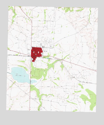
Big Lake, TX USGS Topographic Map
Click on map above to begin viewing in our Map Viewer.

This topographic map contains these locations and features:
Feature Name Type Latitude Longitude GNIS ID View Map
Apostolic ChurchChurchN31.1890°W101.4621°2023693View Map
Big LakeLakeN31.1671°W101.4805°1352088View Map
Big LakePopulated PlaceN31.1915°W101.4604°1352089View Map
Big Lake City HallBuildingN31.1919°W101.4609°2753944View Map
Big Lake DrawValleyN31.1690°W101.4943°1352093View Map
Big Lake Post OfficePost OfficeN31.1912°W101.4635°2731888View Map
Big Lake Volunteer Fire DepartmentBuildingN31.1923°W101.4609°2552076View Map
Church of Christ Big LakeChurchN31.1935°W101.4618°2023695View Map
City of Big LakeCivilN31.1935°W101.4600°2409844View Map
Faith Temple United Pentecostal ChurchChurchN31.1996°W101.4615°2023696View Map
First Baptist ChurchChurchN31.1963°W101.4604°2023694View Map
Glen Rest CemeteryCemeteryN31.1870°W101.4655°1358054View Map
John Scott Oil FieldOilfieldN31.2296°W101.4454°1360307View Map
KWGH-AM (Big Lake)TowerN31.1902°W101.4521°1385503View Map
Price Northwest Oil FieldOilfieldN31.2082°W101.4529°1365775View Map
Price Oil FieldOilfieldN31.1646°W101.4018°1365776View Map
Reagan County AirportAirportN31.1938°W101.4704°1386247View Map
Reagan County Elementary SchoolSchoolN31.1860°W101.4637°2008069View Map
Reagan County High SchoolSchoolN31.2013°W101.4535°2008070View Map
Reagan County Middle SchoolSchoolN31.1946°W101.4587°2007998View Map
Reagan County Sheriff's OfficeBuildingN31.1932°W101.4598°2750528View Map
Reagan Memorial HospitalHospitalN31.1979°W101.4620°2015747View Map

Note: Coordinates in the location and feature list above are referenced to NAD83 datum.


Copyright (C) 2008-2024 Ryan Niemi / Sunset Dynamics ... All Rights Reserved