TopoQuest Logo
Do you find TopoQuest useful?
Help keep TopoQuest running and adding new maps/features by donating!
Bitcoin:  19c7KJd3qBynnjoSw5npx9KScwjBe4ifkT
Litecoin:  LXs6TkuXGGXo1vDsWCkWVdjQX94eUKd6ui
Home View Maps Find Maps Find Places Resources & Links


South Mustang Draw SE, Texas Topographic Map

USGS Map Title: South Mustang Draw SE, TX
USGS Map MRC: 31101C3
DRG (GeoTIFF) Download: o31101c3.tif


Neighboring USGS Topographic Map Quads:


  Moore Hill, TX  
31101D4
 

  South Mustang Draw NE, TX  
31101D3
 

  Causey Draw, TX  
31101D2
 

  Divide Draw, TX  
31101C4
 

  South Mustang Draw SE, TX  
31101C3
 

  Rocker B Ranch, TX  
31101C2
 

  Big Lake, TX  
31101B4
 

  Witco, TX  
31101B3
 

  Barnhart, TX  
31101B2


Map MRC Location:

N32°
W102°
N32°
W101°
H8 H7 H6 H5 H4 H3 H2 H1
G8 G7 G6 G5 G4 G3 G2 G1
F8 F7 F6 F5 F4 F3 F2 F1
E8 E7 E6 E5 E4 E3 E2 E1
D8 D7 D6 D5 D4 D3 D2 D1
C8 C7 C6 C5 C4 C3 C2 C1
B8 B7 B6 B5 B4 B3 B2 B1
A8 A7 A6 A5 A4 A3 A2 A1
N31°
W102°
N31°
W101°

South Mustang Draw SE, TX USGS 1:24K Topographic Map Preview:
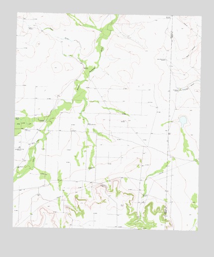
South Mustang Draw SE, TX USGS Topographic Map
Click on map above to begin viewing in our Map Viewer.

This topographic map contains these locations and features:
Feature Name Type Latitude Longitude GNIS ID View Map
Basin WellWellN31.3063°W101.2718°1351574View Map
Big Jim DrawValleyN31.3126°W101.3523°1352085View Map
Cat Claw WindmillLocaleN31.3735°W101.2712°1353951View Map
Chili WindmillLocaleN31.3135°W101.3007°1354395View Map
Divide DrawValleyN31.3127°W101.3713°1356052View Map
Greasewood WindmillLocaleN31.2849°W101.3248°1358363View Map
Isaac DrawValleyN31.3127°W101.3522°1374239View Map
Lewis DrawValleyN31.3464°W101.3279°1361127View Map
Lewis WindmillLocaleN31.3660°W101.3673°1361135View Map
Old Antelope WindmillLocaleN31.3315°W101.2646°1364383View Map
Shot WindmillLocaleN31.2849°W101.3732°1368239View Map
South Mustang WindmillLocaleN31.3107°W101.3262°1368725View Map
Twentyfoot WindmillLocaleN31.2707°W101.2879°1370330View Map
Upper West Hollow WindmillLocaleN31.3493°W101.2740°1370529View Map
West Line CampLocaleN31.3068°W101.3682°1371176View Map
West Line Trap WindmillLocaleN31.2952°W101.3734°1371177View Map
Whatley WindmillLocaleN31.3435°W101.3293°1371322View Map

Note: Coordinates in the location and feature list above are referenced to NAD83 datum.


Copyright (C) 2008-2024 Ryan Niemi / Sunset Dynamics ... All Rights Reserved