TopoQuest Logo
Do you find TopoQuest useful?
Help keep TopoQuest running and adding new maps/features by donating!
Bitcoin:  19c7KJd3qBynnjoSw5npx9KScwjBe4ifkT
Litecoin:  LXs6TkuXGGXo1vDsWCkWVdjQX94eUKd6ui
Home View Maps Find Maps Find Places Resources & Links


Riverside, Oregon Topographic Map

USGS Map Title: Riverside, OR
USGS Map MRC: 44123E2
DRG (GeoTIFF) Download: o44123e2.tif


Neighboring USGS Topographic Map Quads:


  Airlie South, OR  
44123F3
 

  Lewisburg, OR  
44123F2
 

  Albany, OR  
44123F1
 

  Corvallis, OR  
44123E3
 

  Riverside, OR  
44123E2
 

  Tangent, OR  
44123E1
 

  Greenberry, OR  
44123D3
 

  Peoria, OR  
44123D2
 

  Halsey, OR  
44123D1


Map MRC Location:

N45°
W124°
N45°
W123°
H8 H7 H6 H5 H4 H3 H2 H1
G8 G7 G6 G5 G4 G3 G2 G1
F8 F7 F6 F5 F4 F3 F2 F1
E8 E7 E6 E5 E4 E3 E2 E1
D8 D7 D6 D5 D4 D3 D2 D1
C8 C7 C6 C5 C4 C3 C2 C1
B8 B7 B6 B5 B4 B3 B2 B1
A8 A7 A6 A5 A4 A3 A2 A1
N44°
W124°
N44°
W123°

Riverside, OR USGS 1:24K Topographic Map Preview:
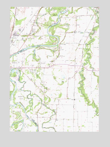
Riverside, OR USGS Topographic Map
Click on map above to begin viewing in our Map Viewer.

This topographic map contains these locations and features:
Feature Name Type Latitude Longitude GNIS ID View Map
AsbahrLocaleN44.6096°W123.2248°1130303View Map
Asbahr LakeLakeN44.6168°W123.2036°1117056View Map
Beaver LakeLakeN44.5512°W123.1791°1117449View Map
Bowers Rocks State ParkParkN44.6143°W123.1818°1851896View Map
Cheldelin Middle SchoolSchoolN44.6009°W123.2368°1117483View Map
Childrens Farm HomeSchoolN44.6094°W123.2164°1128565View Map
Colorado LakeLakeN44.5789°W123.2170°1119157View Map
Colorado Lake (historical)LocaleN44.5643°W123.2109°1637823View Map
Corvallis Waldorf SchoolSchoolN44.5978°W123.2225°1120565View Map
Dead RiverStreamN44.5865°W123.1843°1119748View Map
Dixie School (historical)SchoolN44.5518°W123.2209°1119972View Map
Dunlap (historical)LocaleN44.5965°W123.2387°1166529View Map
Dunning Vineyards AirportAirportN44.6146°W123.2367°2645990View Map
East Channel Willamette RiverChannelN44.5412°W123.2326°1141515View Map
Ehlen-Van Waters and RogersLocaleN44.5671°W123.1607°1637772View Map
Fischer IslandIslandN44.5557°W123.2440°1142145View Map
Fisher Island PondLakeN44.5594°W123.2460°1130306View Map
Frazier CreekStreamN44.6068°W123.2359°1142421View Map
Frazier Creek DitchCanalN44.6212°W123.2198°1120962View Map
GrangerLocaleN44.6162°W123.2173°1158264View Map
Granger Post Office (historical)Post OfficeN44.6162°W123.2173°1165336View Map
Gray (historical)LocaleN44.5710°W123.1626°1637771View Map
Half Moon BendBendN44.5921°W123.1832°1121515View Map
Holiday Airport (historical)AirportN44.5682°W123.1701°1131656View Map
Horseshoe LakeLakeN44.6048°W123.1687°1122043View Map
Hulburt School (historical)SchoolN44.5532°W123.1687°1122121View Map
Jackson CreekStreamN44.6143°W123.2448°1144202View Map
Jackson Frazier WetlandParkN44.6054°W123.2387°1966195View Map
John Smith IslandIslandN44.5012°W123.2482°1144308View Map
KEJO-FMTowerN44.5954°W123.2495°1131180View Map
KFLY-AMTowerN44.5954°W123.2495°1131245View Map
Kiger IslandIslandN44.5126°W123.2343°1144599View Map
Knoll Terrace Mobile Home Community Wastewater Treatment FacilityLocaleN44.6237°W123.2269°2660668View Map
Lake CreekStreamN44.5715°W123.1401°1122895View Map
Lower Kiger IslandIslandN44.6218°W123.1826°1123567View Map
Middle Channel Willamette RiverChannelN44.5048°W123.2326°1146131View Map
Muddy CreekStreamN44.5373°W123.2220°1124505View Map
Oak CreekStreamN44.6140°W123.1276°1124900View Map
Oakville (historical)LocaleN44.5123°W123.1865°1124927View Map
Oakville CemeteryCemeteryN44.5218°W123.1895°1124928View Map
Oakville Post Office (historical)Post OfficeN44.5123°W123.1865°1165729View Map
Oakville School (historical)SchoolN44.5110°W123.1873°1162117View Map
Oakville Station 54BuildingN44.5102°W123.1870°2577091View Map
Oregon State University Experimental FarmLocaleN44.5676°W123.2451°1163755View Map
OrleansLocaleN44.5701°W123.1907°1125044View Map
Orleans CemeteryCemeteryN44.5697°W123.1913°1130305View Map
Owl CreekStreamN44.5732°W123.2184°1125085View Map
Pirtle Station (historical)LocaleN44.5993°W123.1462°1637770View Map
RiversidePopulated PlaceN44.6068°W123.1576°1136690View Map
Riverside HallBuildingN44.5998°W123.1551°1126066View Map
Riverside School (historical)SchoolN44.5993°W123.1607°1126070View Map
Stahlbusch IslandIslandN44.5337°W123.2362°1150319View Map
Stahlbush Island FarmsLocaleN44.5348°W123.2445°2697240View Map
Stewart LakeLakeN44.5872°W123.2440°1127600View Map
Stewart SloughGutN44.5960°W123.2259°1127602View Map
Tangent Sewage Treatment FacilityLocaleN44.5533°W123.1422°2697052View Map
Truax IslandIslandN44.5840°W123.2001°1128251View Map
Twin Oaks Memorial GardensCemeteryN44.5753°W123.1821°1128358View Map
VerdureLocaleN44.5323°W123.1609°1637868View Map
Village Green City ParkParkN44.5985°W123.2387°1966226View Map
Winn AirportAirportN44.5958°W123.2063°1131146View Map
Woodland Meadows City ParkParkN44.5840°W123.2101°1966227View Map

Note: Coordinates in the location and feature list above are referenced to NAD83 datum.


Copyright (C) 2008-2024 Ryan Niemi / Sunset Dynamics ... All Rights Reserved