TopoQuest Logo
Do you find TopoQuest useful?
Help keep TopoQuest running and adding new maps/features by donating!
Bitcoin:  19c7KJd3qBynnjoSw5npx9KScwjBe4ifkT
Litecoin:  LXs6TkuXGGXo1vDsWCkWVdjQX94eUKd6ui
Home View Maps Find Maps Find Places Resources & Links


Greenberry, Oregon Topographic Map

USGS Map Title: Greenberry, OR
USGS Map MRC: 44123D3
DRG (GeoTIFF) Download: o44123d3.tif


Neighboring USGS Topographic Map Quads:


  Wren, OR  
44123E4
 

  Corvallis, OR  
44123E3
 

  Riverside, OR  
44123E2
 

  Flat Mountain, OR  
44123D4
 

  Greenberry, OR  
44123D3
 

  Peoria, OR  
44123D2
 

  Glenbrook, OR  
44123C4
 

  Monroe, OR  
44123C3
 

  Harrisburg, OR  
44123C2


Map MRC Location:

N45°
W124°
N45°
W123°
H8 H7 H6 H5 H4 H3 H2 H1
G8 G7 G6 G5 G4 G3 G2 G1
F8 F7 F6 F5 F4 F3 F2 F1
E8 E7 E6 E5 E4 E3 E2 E1
D8 D7 D6 D5 D4 D3 D2 D1
C8 C7 C6 C5 C4 C3 C2 C1
B8 B7 B6 B5 B4 B3 B2 B1
A8 A7 A6 A5 A4 A3 A2 A1
N44°
W124°
N44°
W123°

Greenberry, OR USGS 1:24K Topographic Map Preview:
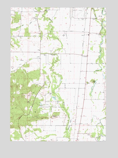
Greenberry, OR USGS Topographic Map
Click on map above to begin viewing in our Map Viewer.

This topographic map contains these locations and features:
Feature Name Type Latitude Longitude GNIS ID View Map
Armstrong CemeteryCemeteryN44.4893°W123.3438°1117044View Map
Baker LakeLakeN44.4790°W123.2575°1117158View Map
Barclay (historical)LocaleN44.3776°W123.2887°1130390View Map
Beaver CreekStreamN44.4585°W123.3187°1137819View Map
BoonevilleLocaleN44.4896°W123.2654°1117941View Map
Brown CreekStreamN44.4223°W123.3229°1158143View Map
BruceLocaleN44.3915°W123.2915°1161621View Map
Bruce Post Office (historical)Post OfficeN44.3915°W123.2915°1164976View Map
BuchananLocaleN44.4401°W123.2762°1161624View Map
Bull Run CreekStreamN44.4921°W123.3351°1138917View Map
Butte CemeteryCemeteryN44.4304°W123.2679°1130391View Map
Buttes (historical)LocaleN44.4321°W123.2854°1166544View Map
Cabell MarshSwampN44.4152°W123.3395°1158660View Map
Coca Cola AirportAirportN44.4217°W123.2584°2650878View Map
Corvallis Army Air Field (historical)MilitaryN44.4972°W123.2883°2091846View Map
Fern Post Office (historical)Post OfficeN44.4726°W123.3662°1165247View Map
Gray CreekStreamN44.4146°W123.3193°1121344View Map
GreenberryLocaleN44.4548°W123.2757°1121409View Map
Hughes (historical)LocaleN44.4248°W123.2873°1161623View Map
Hull CreekStreamN44.4085°W123.3207°1158296View Map
Hull SpringSpringN44.4110°W123.3540°1122123View Map
Inavale Post Office (historical)Post OfficeN44.4573°W123.3326°1165435View Map
Irwin CemeteryCemeteryN44.4290°W123.2776°1130422View Map
Jennyopolis Post Office (historical)Post OfficeN44.4471°W123.2762°1165453View Map
Maple KnollSummitN44.3958°W123.3346°1156654View Map
McBee LakeLakeN44.4620°W123.2578°1123888View Map
McFadden MarshSwampN44.3923°W123.2976°1158356View Map
Mill HillSummitN44.4018°W123.3448°1158374View Map
Muddy Creek AirportAirportN44.4377°W123.3097°2645991View Map
Muddy Creek Charter SchoolSchoolN44.4598°W123.3378°1122192View Map
Oakridge CemeteryCemeteryN44.4754°W123.3365°1124926View Map
P M Delaubenfelds DamDamN44.4398°W123.3579°1131610View Map
P M Delaubenfelds ReservoirReservoirN44.4385°W123.3573°1131609View Map
Philomath Fire and Rescue Station 203BuildingN44.4727°W123.3489°2577054View Map
Pigeon ButteSummitN44.3977°W123.3176°1158420View Map
Reckards (historical)LocaleN44.4123°W123.2895°1166545View Map
RickardLocaleN44.4068°W123.2901°1161622View Map
Rickard Post Office (historical)Post OfficeN44.4068°W123.2901°1165854View Map
Saxton County ParkParkN44.4562°W123.3184°1116802View Map
ShrockLocaleN44.4743°W123.2801°1161510View Map
Southeast Benton DivisionCivilN44.3852°W123.3279°1938125View Map
Starr CreekStreamN44.4490°W123.3579°1150352View Map
Statesman Post Office (historical)Post OfficeN44.4573°W123.3095°1164701View Map
Venell AirportAirportN44.4733°W123.3027°1131734View Map
Whitaker LakeLakeN44.4417°W123.2612°1128964View Map
Whitby DitchCanalN44.4712°W123.3065°1136901View Map
William L Finley National Wildlife RefugeParkN44.4070°W123.3089°1129106View Map
Winfield (historical)LocaleN44.4165°W123.2873°1166546View Map
Winkle ButteSummitN44.4304°W123.2690°1136919View Map
Winkle CemeteryCemeteryN44.4304°W123.2762°1130421View Map
Winkle LakeLakeN44.4263°W123.2673°1129235View Map

Note: Coordinates in the location and feature list above are referenced to NAD83 datum.


Copyright (C) 2008-2024 Ryan Niemi / Sunset Dynamics ... All Rights Reserved