TopoQuest Logo
Do you find TopoQuest useful?
Help keep TopoQuest running and adding new maps/features by donating!
Bitcoin:  19c7KJd3qBynnjoSw5npx9KScwjBe4ifkT
Litecoin:  LXs6TkuXGGXo1vDsWCkWVdjQX94eUKd6ui
Home View Maps Find Maps Find Places Resources & Links


Rolling Fork West, Mississippi Topographic Map

USGS Map Title: Rolling Fork West, MS
USGS Map MRC: 32090H8
DRG (GeoTIFF) Download: o32090h8.tif


Neighboring USGS Topographic Map Quads:


  Glen Allan, MS  
33091A1
 

  Percy, MS  
33090A8
 

  Delta City, MS  
33090A7
 

  Mayersville, MS  
32091H1
 

  Rolling Fork West, MS  
32090H8
 

  Rolling Fork East, MS  
32090H7
 

  Whiting Bayou, MS  
32091G1
 

  Cary, MS  
32090G8
 

  Red Rock, MS  
32090G7


Map MRC Location:

N33°
W91°
N33°
W90°
H8 H7 H6 H5 H4 H3 H2 H1
G8 G7 G6 G5 G4 G3 G2 G1
F8 F7 F6 F5 F4 F3 F2 F1
E8 E7 E6 E5 E4 E3 E2 E1
D8 D7 D6 D5 D4 D3 D2 D1
C8 C7 C6 C5 C4 C3 C2 C1
B8 B7 B6 B5 B4 B3 B2 B1
A8 A7 A6 A5 A4 A3 A2 A1
N32°
W91°
N32°
W90°

Rolling Fork West, MS USGS 1:24K Topographic Map Preview:
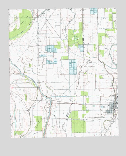
Rolling Fork West, MS USGS Topographic Map
Click on map above to begin viewing in our Map Viewer.

This topographic map contains these locations and features:
Feature Name Type Latitude Longitude GNIS ID View Map
Bethlehem ChurchChurchN32.9773°W90.9787°667003View Map
BoothPopulated PlaceN32.9607°W90.9318°691719View Map
Carson Seale Vocational ComplexSchoolN32.9015°W90.8793°709218View Map
City of Rolling ForkCivilN32.9073°W90.8769°2404646View Map
Elmwood CemeteryCemeteryN32.8932°W90.8948°669754View Map
First Baptist ChurchChurchN32.9060°W90.8807°687109View Map
Flag LakeSwampN32.9684°W90.9227°670015View Map
Friendship ChurchChurchN32.9582°W90.9662°670229View Map
GracePopulated PlaceN32.9996°W90.9565°670560View Map
Grace ChurchChurchN32.9932°W90.9637°670564View Map
Grace Fire DepartmentBuildingN32.9689°W90.9658°2665800View Map
Grace Post OfficePost OfficeN32.9948°W90.9598°2768856View Map
Gross BayouGutN32.9198°W90.9512°670753View Map
Happy Home ChurchChurchN32.9251°W90.9651°670890View Map
Holly Grove ChurchChurchN32.9468°W90.9104°671320View Map
Indian Bayou State Wildlife AreaParkN32.8835°W90.9223°687111View Map
Lafayette LakeSwampN32.9902°W90.9822°672246View Map
LorenzenPopulated PlaceN32.9487°W90.9065°672867View Map
Mound BayouStreamN32.9882°W90.9740°673899View Map
Mount Hull ChurchChurchN32.8935°W90.8832°674040View Map
Mount Lula ChurchChurchN32.9143°W90.8795°674051View Map
Otter BayouStreamN32.9632°W90.9312°675326View Map
Paradise ChurchChurchN32.9218°W90.9220°675438View Map
Poindexter IslandIslandN32.8801°W90.9707°676164View Map
Rolling ForkPopulated PlaceN32.9065°W90.8782°694602View Map
Rolling Fork Elementary SchoolSchoolN32.9018°W90.8795°709225View Map
Rolling Fork Fire DepartmentBuildingN32.9021°W90.8795°2665857View Map
Rolling Fork High SchoolSchoolN32.9012°W90.8795°709226View Map
Rolling Fork Methodist ChurchChurchN32.9057°W90.8801°687112View Map
Rolling Fork Police DepartmentBuildingN32.9079°W90.8761°2754233View Map
Rolling Fork Post OfficePost OfficeN32.9082°W90.8759°2768733View Map
Salem ChurchChurchN32.9468°W90.8990°677281View Map
Sam Harris Catfish Ponds DamDamN32.9951°W90.9018°681779View Map
Sharkey - Issaquena Community HospitalHospitalN32.9047°W90.8846°709227View Map
Sharkey County Sheriff's OfficeBuildingN32.9079°W90.8773°2754165View Map
Steele Bayou CutoffCanalN32.8801°W90.9618°678261View Map
Supervisor District 5CivilN32.9706°W90.9657°711894View Map
Sweet Home ChurchChurchN32.9065°W90.8954°678473View Map
Tillman BayouStreamN32.9346°W90.9793°678761View Map
Wade AirportAirportN32.9781°W90.9647°680361View Map
Weathers CemeteryCemeteryN32.8929°W90.9059°679405View Map

Note: Coordinates in the location and feature list above are referenced to NAD83 datum.


Copyright (C) 2008-2024 Ryan Niemi / Sunset Dynamics ... All Rights Reserved