TopoQuest Logo
Do you find TopoQuest useful?
Help keep TopoQuest running and adding new maps/features by donating!
Bitcoin:  19c7KJd3qBynnjoSw5npx9KScwjBe4ifkT
Litecoin:  LXs6TkuXGGXo1vDsWCkWVdjQX94eUKd6ui
Home View Maps Find Maps Find Places Resources & Links


Delta City, Mississippi Topographic Map

USGS Map Title: Delta City, MS
USGS Map MRC: 33090A7
DRG (GeoTIFF) Download: o33090a7.tif


Neighboring USGS Topographic Map Quads:


  Swan Lake NW, MS  
33090B8
 

  Hollandale, MS  
33090B7
 

  Midnight NW, MS  
33090B6
 

  Percy, MS  
33090A8
 

  Delta City, MS  
33090A7
 

  Richey, MS  
33090A6
 

  Rolling Fork West, MS  
32090H8
 

  Rolling Fork East, MS  
32090H7
 

  Bayland, MS  
32090H6


Map MRC Location:

N34°
W91°
N34°
W90°
H8 H7 H6 H5 H4 H3 H2 H1
G8 G7 G6 G5 G4 G3 G2 G1
F8 F7 F6 F5 F4 F3 F2 F1
E8 E7 E6 E5 E4 E3 E2 E1
D8 D7 D6 D5 D4 D3 D2 D1
C8 C7 C6 C5 C4 C3 C2 C1
B8 B7 B6 B5 B4 B3 B2 B1
A8 A7 A6 A5 A4 A3 A2 A1
N33°
W91°
N33°
W90°

Delta City, MS USGS 1:24K Topographic Map Preview:
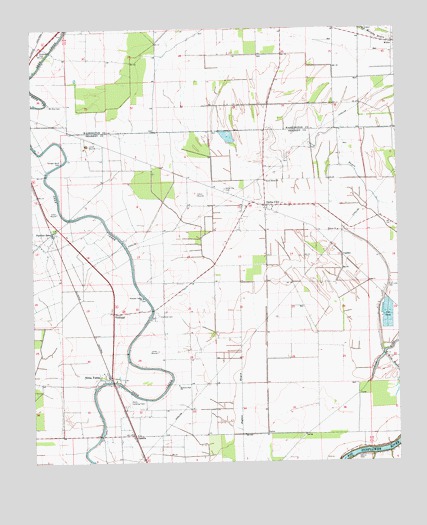
Delta City, MS USGS Topographic Map
Click on map above to begin viewing in our Map Viewer.

This topographic map contains these locations and features:
Feature Name Type Latitude Longitude GNIS ID View Map
A B Williams Catfish Ponds DamDamN33.0385°W90.7551°681804View Map
CametaPopulated PlaceN33.0079°W90.8412°667963View Map
Delta CityPopulated PlaceN33.0740°W90.7951°669216View Map
Delta City CemeteryCemeteryN33.0787°W90.8090°669217View Map
Delta City Post OfficePost OfficeN33.0740°W90.7940°712640View Map
Eastern Star ChurchChurchN33.0223°W90.8259°669622View Map
Fish LakeLakeN33.0301°W90.7557°669985View Map
Fish Lake CemeteryCemeteryN33.0512°W90.7523°669990View Map
Georgia Bend CemeteryCemeteryN33.0873°W90.8648°670361View Map
Harris CemeteryCemeteryN33.0015°W90.7643°670971View Map
Hebron ChurchChurchN33.0668°W90.7704°671071View Map
Mount Zion CemeteryCemeteryN33.1032°W90.8690°674318View Map
Nitta YumaPopulated PlaceN33.0243°W90.8493°674927View Map
Nitta Yuma Post OfficePost OfficeN33.0246°W90.8518°712641View Map
Panther BurnPopulated PlaceN33.0662°W90.8684°675431View Map
Pleasant Valley ChurchChurchN33.0476°W90.8373°676142View Map
Saint Paul ChurchChurchN33.0065°W90.8454°687113View Map
ShradervillePopulated PlaceN33.0637°W90.8073°709228View Map
Supervisor District 5CivilN33.0506°W90.8163°712064View Map
Sweet Home ChurchChurchN33.0810°W90.7951°678474View Map
UpdikePopulated PlaceN33.0596°W90.7687°692287View Map
VicklandPopulated PlaceN33.0429°W90.8479°679214View Map
Vickland CemeteryCemeteryN33.0423°W90.8320°679215View Map
WilletPopulated PlaceN33.1204°W90.7509°692323View Map

Note: Coordinates in the location and feature list above are referenced to NAD83 datum.


Copyright (C) 2008-2024 Ryan Niemi / Sunset Dynamics ... All Rights Reserved