TopoQuest Logo
Do you find TopoQuest useful?
Help keep TopoQuest running and adding new maps/features by donating!
Bitcoin:  19c7KJd3qBynnjoSw5npx9KScwjBe4ifkT
Litecoin:  LXs6TkuXGGXo1vDsWCkWVdjQX94eUKd6ui
Home View Maps Find Maps Find Places Resources & Links


Rosemont, West Virginia Topographic Map

USGS Map Title: Rosemont, WV
USGS Map MRC: 39080C2
DRG (GeoTIFF) Download: o39080c2.tif


Neighboring USGS Topographic Map Quads:


  Shinnston, WV  
39080D3
 

  Fairmont West, WV  
39080D2
 

  Fairmont East, WV  
39080D1
 

  Clarksburg, WV  
39080C3
 

  Rosemont, WV  
39080C2
 

  Grafton, WV  
39080C1
 

  Mount Clare, WV  
39080B3
 

  Brownton, WV  
39080B2
 

  Philippi, WV  
39080B1


Map MRC Location:

N40°
W81°
N40°
W80°
H8 H7 H6 H5 H4 H3 H2 H1
G8 G7 G6 G5 G4 G3 G2 G1
F8 F7 F6 F5 F4 F3 F2 F1
E8 E7 E6 E5 E4 E3 E2 E1
D8 D7 D6 D5 D4 D3 D2 D1
C8 C7 C6 C5 C4 C3 C2 C1
B8 B7 B6 B5 B4 B3 B2 B1
A8 A7 A6 A5 A4 A3 A2 A1
N39°
W81°
N39°
W80°

Rosemont, WV USGS 1:24K Topographic Map Preview:
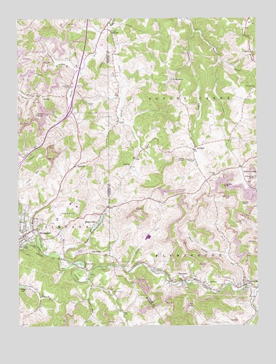
Rosemont, WV USGS Topographic Map
Click on map above to begin viewing in our Map Viewer.

This topographic map contains these locations and features:
Feature Name Type Latitude Longitude GNIS ID View Map
Ann Run School (historical)SchoolN39.3109°W80.2254°1718362View Map
Bailey Memorial CemeteryCemeteryN39.2679°W80.1506°1689762View Map
Bailey Memorial United Methodist ChurchChurchN39.2673°W80.1506°1535132View Map
Bald KnobSummitN39.3362°W80.2395°1535165View Map
Beards RunStreamN39.2501°W80.1945°1535412View Map
Benedum Industrial ParkLocaleN39.2990°W80.2206°1718332View Map
Berry RunStreamN39.2654°W80.1326°1535669View Map
Bridgeport CemeteryCemeteryN39.2940°W80.2409°1718334View Map
City of BridgeportCivilN39.3036°W80.2476°2390568View Map
Copeland KnobSummitN39.3068°W80.1429°1554189View Map
Corbin BranchStreamN39.3715°W80.2026°1537680View Map
Corbin School (historical)SchoolN39.3501°W80.1692°1689776View Map
Crosswind Corporate ParkLocaleN39.2987°W80.2309°1718341View Map
Cubbys Child Care CenterSchoolN39.2895°W80.2438°2631509View Map
Curry RidgeRidgeN39.3643°W80.1301°1537933View Map
Deegan Lake DamDamN39.2668°W80.2498°1558901View Map
Dennis Cather SpringSpringN39.2884°W80.1470°1678159View Map
Dollie Spring School (historical)SchoolN39.3231°W80.2381°1718373View Map
Douglas RunStreamN39.2656°W80.2115°1538297View Map
Douglas Run School (historical)SchoolN39.2520°W80.2159°1718342View Map
Faris School (historical)SchoolN39.2629°W80.2393°1718236View Map
FlemingtonPopulated PlaceN39.2665°W80.1320°1554472View Map
Flemington Area Emergency Management Service Company 39BuildingN39.2657°W80.1302°2581149View Map
Flemington Post OfficePost OfficeN39.2659°W80.1319°1689788View Map
Flemington Volunteer Fire DepartmentBuildingN39.2660°W80.1313°2577933View Map
Gore School (historical)SchoolN39.3568°W80.2165°1718381View Map
Green Valley ChurchChurchN39.2643°W80.2006°1539694View Map
Harmony Grove CemeteryCemeteryN39.3456°W80.1265°1689802View Map
Harmony Grove ChurchChurchN39.3456°W80.1251°1539982View Map
Harmony Grove School (historical)SchoolN39.3487°W80.1459°1689803View Map
HepzibahPopulated PlaceN39.3501°W80.1690°1549734View Map
Hepzibah Baptist ChurchChurchN39.3493°W80.1706°1689805View Map
Hepzibah CemeteryCemeteryN39.3490°W80.1712°1689806View Map
Hepzibah Elementary SchoolSchoolN39.3503°W80.1681°1689808View Map
Hinkle-Deegan ParkParkN39.2662°W80.2456°1718347View Map
Interchange 125CrossingN39.3379°W80.2226°1718388View Map
Jerry RunStreamN39.2737°W80.1956°1540875View Map
Lake RidgePopulated PlaceN39.2798°W80.2143°1554903View Map
Maple LakePopulated PlaceN39.2954°W80.2070°1555042View Map
Maple Lake DamDamN39.2918°W80.2081°1558905View Map
McAlpinPopulated PlaceN39.3437°W80.2370°1555074View Map
McGeePopulated PlaceN39.3609°W80.1276°1542997View Map
MeadlandPopulated PlaceN39.3218°W80.1581°1543045View Map
Meadland School (historical)SchoolN39.3240°W80.1520°1689817View Map
MiddlevillePopulated PlaceN39.3145°W80.1909°1689818View Map
Middleville CemeteryCemeteryN39.3145°W80.1917°1689819View Map
Middleville ChurchChurchN39.3151°W80.1912°1543231View Map
Middleville School (historical)SchoolN39.3137°W80.1915°1689820View Map
Moss Run School (historical)SchoolN39.2701°W80.2140°1718353View Map
North Central West Virginia AirportAirportN39.2989°W80.2317°1558785View Map
Old Side CemeteryCemeteryN39.3117°W80.1470°1544370View Map
Old Side Church (historical)ChurchN39.3115°W80.1476°1689824View Map
Oral LakePopulated PlaceN39.2754°W80.2156°1555268View Map
OreidePopulated PlaceN39.3612°W80.1998°1555269View Map
Patton KnobSummitN39.3173°W80.1670°1555316View Map
Peddler RunStreamN39.2787°W80.2281°1544682View Map
Pewee KnobSummitN39.2995°W80.1326°1555336View Map
Plummer KnobSummitN39.3101°W80.1259°1545073View Map
Plummer RunStreamN39.3693°W80.1581°1545074View Map
Right Fork Simpson CreekStreamN39.2634°W80.1273°1545701View Map
RosemontPopulated PlaceN39.2687°W80.1629°1546081View Map
Rosemont Post OfficePost OfficeN39.2691°W80.1590°1689840View Map
RyanvillePopulated PlaceN39.3145°W80.2212°1555548View Map
SantiagoPopulated PlaceN39.3698°W80.2015°1546427View Map
Stout HollowValleyN39.2793°W80.1423°1547516View Map
Sugarcamp RunStreamN39.3531°W80.2190°1547687View Map
Taylor School (historical)SchoolN39.3656°W80.1915°1689859View Map
Terra Alta School (historical)SchoolN39.3726°W80.2443°1718420View Map
Thomas ForkStreamN39.3718°W80.2026°1548029View Map
Town of FlemingtonCivilN39.2666°W80.1285°2390185View Map
Turkey RunStreamN39.3748°W80.1604°1548364View Map
United Hospital CenterHospitalN39.3283°W80.2395°2775523View Map
Victory Valley ChurchChurchN39.2681°W80.1556°1689864View Map
West Taylor Elementary SchoolSchoolN39.3224°W80.1531°2487440View Map
Western DistrictCivilN39.3124°W80.1416°1928416View Map

Note: Coordinates in the location and feature list above are referenced to NAD83 datum.


Copyright (C) 2008-2024 Ryan Niemi / Sunset Dynamics ... All Rights Reserved