TopoQuest Logo
Do you find TopoQuest useful?
Help keep TopoQuest running and adding new maps/features by donating!
Bitcoin:  19c7KJd3qBynnjoSw5npx9KScwjBe4ifkT
Litecoin:  LXs6TkuXGGXo1vDsWCkWVdjQX94eUKd6ui
Home View Maps Find Maps Find Places Resources & Links


Starks, Wisconsin Topographic Map

USGS Map Title: Starks, WI
USGS Map MRC: 45089F2
DRG (GeoTIFF) Download: o45089f2.tif


Neighboring USGS Topographic Map Quads:


  Sugar Camp, WI  
45089G3
 

  Three Lakes, WI  
45089G2
 

  Julia Lake, WI  
45089G1
 

  Moen Lake, WI  
45089F3
 

  Starks, WI  
45089F2
 

  Monico NE, WI  
45089F1
 

  George Lake, WI  
45089E3
 

  Monico, WI  
45089E2
 

  Nashville, WI  
45089E1


Map MRC Location:

N46°
W90°
N46°
W89°
H8 H7 H6 H5 H4 H3 H2 H1
G8 G7 G6 G5 G4 G3 G2 G1
F8 F7 F6 F5 F4 F3 F2 F1
E8 E7 E6 E5 E4 E3 E2 E1
D8 D7 D6 D5 D4 D3 D2 D1
C8 C7 C6 C5 C4 C3 C2 C1
B8 B7 B6 B5 B4 B3 B2 B1
A8 A7 A6 A5 A4 A3 A2 A1
N45°
W90°
N45°
W89°

Starks, WI USGS 1:24K Topographic Map Preview:
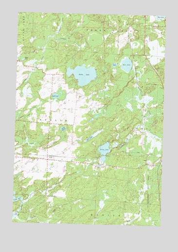
Starks, WI USGS Topographic Map
Click on map above to begin viewing in our Map Viewer.

This topographic map contains these locations and features:
Feature Name Type Latitude Longitude GNIS ID View Map
Angelo LakeLakeN45.7010°W89.2160°1560870View Map
Dollar LakeLakeN45.7219°W89.2451°1564042View Map
GagenPopulated PlaceN45.6625°W89.1382°1577607View Map
Ginty LakeLakeN45.6688°W89.1743°1565549View Map
Gust LakeLakeN45.7199°W89.1676°1565947View Map
Hiles Junction (historical)LocaleN45.7066°W89.1448°1845359View Map
Hutchinson CreekStreamN45.7361°W89.2207°1566835View Map
Mud LakeLakeN45.6760°W89.1870°1569964View Map
North Pelican Lake 1909C361 DamDamN45.6350°W89.2435°1793018View Map
North Pelican Reservoir 71ReservoirN45.6350°W89.2435°1793019View Map
Piehl Lookout TowerTowerN45.7186°W89.1318°1581313View Map
Piehl TownhallBuildingN45.6616°W89.1401°1843888View Map
Spring CreekStreamN45.6283°W89.2471°1574623View Map
Spur LakeLakeN45.7202°W89.1573°1574745View Map
Spur Number 225 (historical)LocaleN45.6661°W89.2487°1845362View Map
StarksPopulated PlaceN45.6630°W89.2218°1574816View Map
Starks SpringSpringN45.6813°W89.2096°1574819View Map
Stella LakeLakeN45.7138°W89.1942°1574854View Map
Stella SchoolSchoolN45.6636°W89.2254°1574856View Map
Stella Volunteer Fire DepartmentBuildingN45.6632°W89.2209°2696969View Map
Town of StellaCivilN45.6855°W89.2401°1584216View Map
Twin Lakes CreekStreamN45.6375°W89.2421°1575817View Map
WJFW-TV (Rhinelander)TowerN45.6672°W89.2076°1582521View Map

Note: Coordinates in the location and feature list above are referenced to NAD83 datum.


Copyright (C) 2008-2024 Ryan Niemi / Sunset Dynamics ... All Rights Reserved