TopoQuest Logo
Do you find TopoQuest useful?
Help keep TopoQuest running and adding new maps/features by donating!
Bitcoin:  19c7KJd3qBynnjoSw5npx9KScwjBe4ifkT
Litecoin:  LXs6TkuXGGXo1vDsWCkWVdjQX94eUKd6ui
Home View Maps Find Maps Find Places Resources & Links


Blairstown, Iowa Topographic Map

USGS Map Title: Blairstown, IA
USGS Map MRC: 41092H1
DRG (GeoTIFF) Download: o41092h1.tif


Neighboring USGS Topographic Map Quads:


  Keystone North, IA  
42092A2
 

  Van Horne, IA  
42092A1
 

  Center Point SW, IA  
42091A8
 

  Keystone South, IA  
41092H2
 

  Blairstown, IA  
41092H1
 

  Newhall, IA  
41091H8
 

  Ladora, IA  
41092G2
 

  Marengo, IA  
41092G1
 

  Middle Amana, IA  
41091G8


Map MRC Location:

N42°
W93°
N42°
W92°
H8 H7 H6 H5 H4 H3 H2 H1
G8 G7 G6 G5 G4 G3 G2 G1
F8 F7 F6 F5 F4 F3 F2 F1
E8 E7 E6 E5 E4 E3 E2 E1
D8 D7 D6 D5 D4 D3 D2 D1
C8 C7 C6 C5 C4 C3 C2 C1
B8 B7 B6 B5 B4 B3 B2 B1
A8 A7 A6 A5 A4 A3 A2 A1
N41°
W93°
N41°
W92°

Blairstown, IA USGS 1:24K Topographic Map Preview:
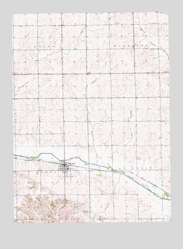
Blairstown, IA USGS Topographic Map
Click on map above to begin viewing in our Map Viewer.

This topographic map contains these locations and features:
Feature Name Type Latitude Longitude GNIS ID View Map
BlairstownPopulated PlaceN41.9094°W92.0843°454677View Map
BlairstownLocaleN41.9094°W92.0841°2000307View Map
Blairstown Ambulance ServiceBuildingN41.9105°W92.0831°2599739View Map
Blairstown City HallBuildingN41.9042°W92.0838°2000301View Map
Blairstown Fire StationBuildingN41.9094°W92.0863°2000298View Map
Blairstown Post OfficePost OfficeN41.9042°W92.0838°2000300View Map
Blairstown Public LibraryBuildingN41.9089°W92.0846°2000299View Map
Blairstown SchoolsSchoolN41.9069°W92.0821°2000306View Map
Buffalo CreekStreamN41.9075°W92.0474°454954View Map
Calvary Catholic CemeteryCemeteryN41.9641°W92.1140°455073View Map
Calvary United Methodist ChurchChurchN41.9075°W92.0852°2000305View Map
City of BlairstownCivilN41.9063°W92.0817°2394186View Map
Grace Lutheran ChurchChurchN41.9067°W92.0838°2000302View Map
Mud CreekStreamN41.9775°W92.0046°459375View Map
Pleasant Hill CemeteryCemeteryN41.8861°W92.0852°460245View Map
Prairie Lutheran CemeteryCemeteryN41.9628°W92.0277°460383View Map
Presbyterian ChurchChurchN41.9078°W92.0830°2000304View Map
Saint John's Catholic ChurchChurchN41.9067°W92.0863°2000303View Map
Saint Johns Lutheran CemeteryCemeteryN41.9933°W92.0097°461020View Map
Salem CemeteryCemeteryN41.9930°W92.0425°461359View Map
Stringtown Cemetery (historical)CemeteryN41.9417°W92.0863°2000362View Map
Township of EldoradoCivilN41.9925°W92.0085°467771View Map
Township of LeroyCivilN41.9060°W92.1232°468206View Map
Township of Saint ClairCivilN41.9057°W92.0069°468653View Map
Township of UnionCivilN41.9928°W92.1243°468808View Map
Weasel CreekStreamN41.9094°W92.0588°462767View Map
Williams Post Office (historical)Post OfficeN41.9633°W92.0641°2000194View Map

Note: Coordinates in the location and feature list above are referenced to NAD83 datum.


Copyright (C) 2008-2024 Ryan Niemi / Sunset Dynamics ... All Rights Reserved