TopoQuest Logo
Do you find TopoQuest useful?
Help keep TopoQuest running and adding new maps/features by donating!
Bitcoin:  19c7KJd3qBynnjoSw5npx9KScwjBe4ifkT
Litecoin:  LXs6TkuXGGXo1vDsWCkWVdjQX94eUKd6ui
Home View Maps Find Maps Find Places Resources & Links


Marengo, Iowa Topographic Map

USGS Map Title: Marengo, IA
USGS Map MRC: 41092G1
DRG (GeoTIFF) Download: o41092g1.tif


Neighboring USGS Topographic Map Quads:


  Keystone South, IA  
41092H2
 

  Blairstown, IA  
41092H1
 

  Newhall, IA  
41091H8
 

  Ladora, IA  
41092G2
 

  Marengo, IA  
41092G1
 

  Middle Amana, IA  
41091G8
 

  Williamsburg NW, IA  
41092F2
 

  Williamsburg, IA  
41092F1
 

  Conroy, IA  
41091F8


Map MRC Location:

N42°
W93°
N42°
W92°
H8 H7 H6 H5 H4 H3 H2 H1
G8 G7 G6 G5 G4 G3 G2 G1
F8 F7 F6 F5 F4 F3 F2 F1
E8 E7 E6 E5 E4 E3 E2 E1
D8 D7 D6 D5 D4 D3 D2 D1
C8 C7 C6 C5 C4 C3 C2 C1
B8 B7 B6 B5 B4 B3 B2 B1
A8 A7 A6 A5 A4 A3 A2 A1
N41°
W93°
N41°
W92°

Marengo, IA USGS 1:24K Topographic Map Preview:
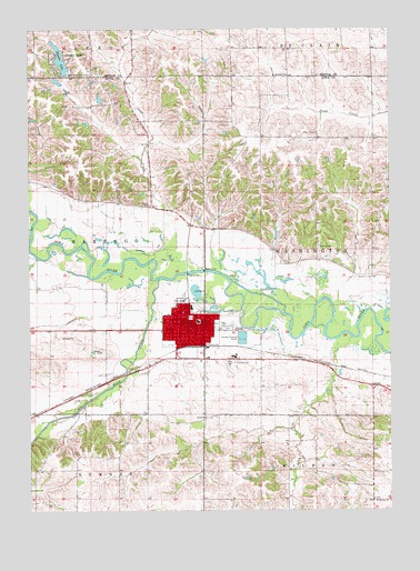
Marengo, IA USGS Topographic Map
Click on map above to begin viewing in our Map Viewer.

This topographic map contains these locations and features:
Feature Name Type Latitude Longitude GNIS ID View Map
Big Bear CreekStreamN41.8100°W92.0802°454598View Map
Bishop CemeteryCemeteryN41.8183°W92.0249°454647View Map
Calvary CemeteryCemeteryN41.7881°W92.0541°455071View Map
Church of the NazareneChurchN41.7978°W92.0643°1999810View Map
City of MarengoCivilN41.7966°W92.0679°2395005View Map
Compass Memorial Healthcare Medical CenterHospitalN41.8021°W92.0735°1999804View Map
Conn CemeteryCemeteryN41.8481°W92.0255°455628View Map
Coon CreekStreamN41.8153°W92.0824°455607View Map
Hannen LakeReservoirN41.8672°W92.1141°457232View Map
Hannen Lake DamDamN41.8628°W92.1121°463491View Map
Hannen ParkParkN41.8672°W92.1113°457233View Map
Hilton CreekStreamN41.7950°W92.0135°457518View Map
International Order of Odd Fellows CemeteryCemeteryN41.7886°W92.0557°2047403View Map
Iowa County Ambulance ServiceBuildingN41.8025°W92.0735°2599811View Map
Iowa County CourthouseBuildingN41.7981°W92.0707°1999812View Map
Iowa County FairgroundsLocaleN41.7972°W92.0591°1999793View Map
Iowa County Geneology LibraryBuildingN41.7992°W92.0685°1999794View Map
Iowa County Sheriff's OfficeBuildingN41.7984°W92.0711°1999813View Map
Iowa Valley Elementary SchoolSchoolN41.8026°W92.0691°457845View Map
Iowa Valley Junior - Senior High SchoolSchoolN41.7990°W92.0675°455189View Map
Kingdom Hall of Jehovahs WitnessesBuildingN41.7997°W92.0677°1999809View Map
MarengoPopulated PlaceN41.7981°W92.0707°458801View Map
MarengoLocaleN41.7928°W92.0696°1999800View Map
Marengo City HallBuildingN41.8011°W92.0685°1999795View Map
Marengo City Lions ParkParkN41.8000°W92.0693°1999796View Map
Marengo Elevator Company ElevatorLocaleN41.7928°W92.0696°1999797View Map
Marengo Fire DepartmentBuildingN41.8010°W92.0693°2577343View Map
Marengo Medical CenterHospitalN41.8025°W92.0724°1999803View Map
Marengo Post OfficePost OfficeN41.7997°W92.0713°1999799View Map
Marengo Water Treatment PlantLocaleN41.7934°W92.0752°2729135View Map
Memorial ParkParkN41.7975°W92.0568°458969View Map
Methodist ChurchChurchN41.7975°W92.0705°1999805View Map
Norwegian CemeteryCemeteryN41.7531°W92.0063°1999850View Map
Oldest Log House in Iowa County Historical MarkerParkN41.7969°W92.0616°1999801View Map
Pioneer Heritage MuseumBuildingN41.7969°W92.0616°1999798View Map
Presbyterian ChurchChurchN41.7978°W92.0685°1999808View Map
Rose Haven Nurse HomeHospitalN41.8044°W92.0721°1999802View Map
Saint Johns Lutheran ChurchChurchN41.7967°W92.0696°1999806View Map
Saint Martin ChurchChurchN41.8631°W92.0357°461149View Map
Saint Patricks ChurchChurchN41.7983°W92.0746°1999807View Map
Taylor's Grove Post Office (historical)Post OfficeN41.8650°W92.0057°2000199View Map
Taylors GroveLocaleN41.8650°W92.0057°466178View Map
Titler CemeteryCemeteryN41.8294°W92.0830°462263View Map
Township of MarengoCivilN41.8190°W92.1230°468347View Map
Township of WashingtonCivilN41.8184°W92.0065°468920View Map

Note: Coordinates in the location and feature list above are referenced to NAD83 datum.


Copyright (C) 2008-2024 Ryan Niemi / Sunset Dynamics ... All Rights Reserved