TopoQuest Logo
Do you find TopoQuest useful?
Help keep TopoQuest running and adding new maps/features by donating!
Bitcoin:  19c7KJd3qBynnjoSw5npx9KScwjBe4ifkT
Litecoin:  LXs6TkuXGGXo1vDsWCkWVdjQX94eUKd6ui
Home View Maps Find Maps Find Places Resources & Links


Swisher, Iowa Topographic Map

USGS Map Title: Swisher, IA
USGS Map MRC: 41091G6
DRG (GeoTIFF) Download: o41091g6.tif


Neighboring USGS Topographic Map Quads:


  Fairfax, IA  
41091H7
 

  Cedar Rapids South, IA  
41091H6
 

  Bertram, IA  
41091H5
 

  Amana, IA  
41091G7
 

  Swisher, IA  
41091G6
 

  Ely, IA  
41091G5
 

  Oxford, IA  
41091F7
 

  Tiffin, IA  
41091F6
 

  Iowa City West, IA  
41091F5


Map MRC Location:

N42°
W92°
N42°
W91°
H8 H7 H6 H5 H4 H3 H2 H1
G8 G7 G6 G5 G4 G3 G2 G1
F8 F7 F6 F5 F4 F3 F2 F1
E8 E7 E6 E5 E4 E3 E2 E1
D8 D7 D6 D5 D4 D3 D2 D1
C8 C7 C6 C5 C4 C3 C2 C1
B8 B7 B6 B5 B4 B3 B2 B1
A8 A7 A6 A5 A4 A3 A2 A1
N41°
W92°
N41°
W91°

Swisher, IA USGS 1:24K Topographic Map Preview:
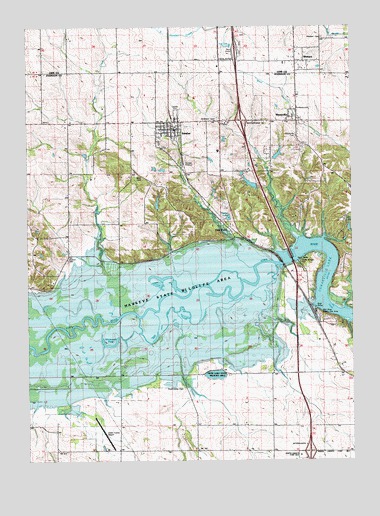
Swisher, IA USGS Topographic Map
Click on map above to begin viewing in our Map Viewer.

This topographic map contains these locations and features:
Feature Name Type Latitude Longitude GNIS ID View Map
Anderson CemeteryCemeteryN41.8486°W91.6766°454178View Map
Blain CemeteryCemeteryN41.8314°W91.7055°454672View Map
Castek ParkParkN41.8506°W91.6918°465923View Map
Cedar Rapids North Bound Rest AreaLocaleN41.8683°W91.6688°2048143View Map
Cedar Rapids South Bound Rest AreaLocaleN41.8675°W91.6713°2048142View Map
Chase (historical)LocaleN41.7753°W91.6907°466090View Map
Chase Post Office (historical)Post OfficeN41.7753°W91.6752°2002263View Map
City of ShueyvilleCivilN41.8463°W91.6512°2395879View Map
City of SwisherCivilN41.8442°W91.6938°2396017View Map
Cou FallsLocaleN41.8172°W91.6727°2002261View Map
Cou FallsPopulated PlaceN41.8172°W91.6727°464509View Map
Cou Falls Post Office (historical)Post OfficeN41.8172°W91.6727°2002262View Map
Curtis (historical)Populated PlaceN41.8042°W91.6496°464230View Map
Curtis Hill Indian MuseumBuildingN41.8417°W91.6418°2002533View Map
Curtis Post Office (historical)Post OfficeN41.8042°W91.6496°2002260View Map
Dance-Mor BallroomBuildingN41.8445°W91.6988°2002532View Map
Danforth (historical)LocaleN41.8478°W91.7335°466092View Map
Dupont CemeteryCemeteryN41.8078°W91.7349°456072View Map
Green Castle (historical)Populated PlaceN41.7745°W91.6663°465429View Map
Green Castle AirportAirportN41.7541°W91.7185°466912View Map
Greencastle CemeteryCemeteryN41.7708°W91.6905°457118View Map
Gregg Post Office (historical)Post OfficeN41.8250°W91.7349°2047429View Map
Hawkeye State Wildlife AreaParkN41.8008°W91.6916°457334View Map
Interchange 10CrossingN41.8481°W91.6671°2002589View Map
Interchange 4CrossingN41.7528°W91.6418°2002590View Map
Jefferson Monroe Fire DepartmentBuildingN41.8473°W91.6802°2577362View Map
Lake LavonReservoirN41.8135°W91.6279°2791361View Map
McAllister CreekStreamN41.8136°W91.6460°458880View Map
Mid River Public Use AreaParkN41.7911°W91.6349°459022View Map
Plum CreekStreamN41.8064°W91.7210°465921View Map
ShueyvillePopulated PlaceN41.8506°W91.6466°461591View Map
Shueyville CemeteryCemeteryN41.8436°W91.6465°461592View Map
Shueyville Civic CenterBuildingN41.8472°W91.6493°2002534View Map
Shueyville Post Office (historical)Post OfficeN41.8472°W91.6493°2002536View Map
Shueyville United Methodist ChurchChurchN41.8481°W91.6502°2002535View Map
Swan LakeLakeN41.7747°W91.6781°462132View Map
Swan Lake State Wildlife AreaAreaN41.7764°W91.6788°466693View Map
SwisherLocaleN41.8458°W91.6932°2002529View Map
SwisherPopulated PlaceN41.8456°W91.6930°462157View Map
Swisher City HallBuildingN41.8458°W91.6985°2002531View Map
Swisher CreekStreamN41.8058°W91.6632°462158View Map
Swisher Post OfficePost OfficeN41.8472°W91.6946°2002530View Map
Timber LakeReservoirN41.8199°W91.6726°465922View Map
Township of JeffersonCivilN41.8293°W91.6564°468138View Map
Township of MadisonCivilN41.7653°W91.6655°468322View Map
Twin LakeLakeN41.8168°W91.6262°462399View Map
Walton Picnic Area (historical)ParkN41.8167°W91.6693°465948View Map
WesternPopulated PlaceN41.8653°W91.6432°462931View Map
Western CemeteryCemeteryN41.8717°W91.6363°462932View Map
Western College Post Office (historical)Post OfficeN41.8653°W91.6363°2046634View Map
Wisniewski PondLakeN41.7833°W91.7187°463146View Map

Note: Coordinates in the location and feature list above are referenced to NAD83 datum.


Copyright (C) 2008-2024 Ryan Niemi / Sunset Dynamics ... All Rights Reserved