TopoQuest Logo
Do you find TopoQuest useful?
Help keep TopoQuest running and adding new maps/features by donating!
Bitcoin:  19c7KJd3qBynnjoSw5npx9KScwjBe4ifkT
Litecoin:  LXs6TkuXGGXo1vDsWCkWVdjQX94eUKd6ui
Home View Maps Find Maps Find Places Resources & Links


Tiffin, Iowa Topographic Map

USGS Map Title: Tiffin, IA
USGS Map MRC: 41091F6
DRG (GeoTIFF) Download: o41091f6.tif


Neighboring USGS Topographic Map Quads:


  Amana, IA  
41091G7
 

  Swisher, IA  
41091G6
 

  Ely, IA  
41091G5
 

  Oxford, IA  
41091F7
 

  Tiffin, IA  
41091F6
 

  Iowa City West, IA  
41091F5
 

  Amish, IA  
41091E7
 

  Williamstown, IA  
41091E6
 

  Hills, IA  
41091E5


Map MRC Location:

N42°
W92°
N42°
W91°
H8 H7 H6 H5 H4 H3 H2 H1
G8 G7 G6 G5 G4 G3 G2 G1
F8 F7 F6 F5 F4 F3 F2 F1
E8 E7 E6 E5 E4 E3 E2 E1
D8 D7 D6 D5 D4 D3 D2 D1
C8 C7 C6 C5 C4 C3 C2 C1
B8 B7 B6 B5 B4 B3 B2 B1
A8 A7 A6 A5 A4 A3 A2 A1
N41°
W92°
N41°
W91°

Tiffin, IA USGS 1:24K Topographic Map Preview:
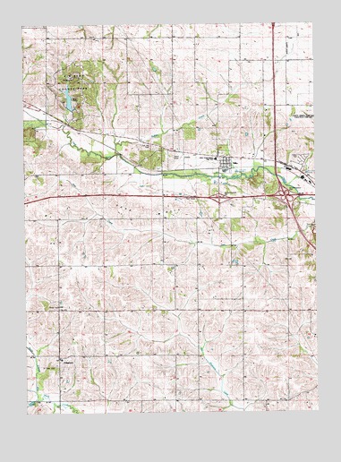
Tiffin, IA USGS Topographic Map
Click on map above to begin viewing in our Map Viewer.

This topographic map contains these locations and features:
Feature Name Type Latitude Longitude GNIS ID View Map
Bradley CreekStreamN41.6295°W91.7452°454800View Map
Buffalo CreekStreamN41.7083°W91.7096°454953View Map
City of TiffinCivilN41.7067°W91.6583°2397023View Map
Clear Creek Amana High SchoolSchoolN41.7064°W91.6745°2002526View Map
Clear Creek Amana Middle SchoolSchoolN41.7065°W91.6680°2720025View Map
Clear Creek Mobile Home ParkPopulated PlaceN41.7028°W91.6641°2002525View Map
Copi Post Office (historical)Post OfficeN41.7195°W91.7280°2002259View Map
Coralville LakeReservoirN41.7250°W91.6299°465646View Map
CosgrovePopulated PlaceN41.6428°W91.7357°455649View Map
Cosgrove Post Office (historical)Post OfficeN41.6428°W91.7357°2002258View Map
F W Kent County ParkParkN41.7306°W91.7293°2002558View Map
Historic Amana Colonies State Historical MarkerParkN41.6950°W91.6804°2002597View Map
Historic Iowa City State Historical MarkerParkN41.6936°W91.6824°2002596View Map
Hoover Historic Site State Historical MarkerParkN41.6936°W91.6824°2002594View Map
Interchange 237CrossingN41.6942°W91.6666°2002592View Map
Interchange 238CrossingN41.6945°W91.6385°2002591View Map
North Bend Elementary SchoolSchoolN41.7389°W91.6335°2720057View Map
Oak Hill CemeteryCemeteryN41.7108°W91.6954°2002557View Map
Saint Peter CemeteryCemeteryN41.6400°W91.7371°461310View Map
Saint Peters Catholic ChurchChurchN41.6422°W91.7354°2002495View Map
Sand HillSummitN41.6886°W91.7013°461400View Map
Summerhays CemeteryCemeteryN41.6889°W91.6863°2002538View Map
TiffinLocaleN41.7036°W91.6641°2002523View Map
TiffinPopulated PlaceN41.7058°W91.6629°462241View Map
Tiffin East Bound Rest AreaLocaleN41.6936°W91.6824°2002595View Map
Tiffin Fire Department and First RespondersBuildingN41.7053°W91.6634°2002524View Map
Tiffin Post OfficePost OfficeN41.7067°W91.6641°2002283View Map
Tiffin School Community LibraryBuildingN41.7064°W91.6677°2002527View Map
Tiffin West Bound Rest AreaLocaleN41.6950°W91.6804°2002598View Map
Township of Clear CreekCivilN41.7009°W91.6592°467616View Map
Township of UnionCivilN41.6331°W91.6598°468826View Map
Unity ChurchChurchN41.6250°W91.6479°462480View Map
Unity Post Office (historical)Post OfficeN41.6572°W91.6585°466488View Map
Western Hills Mobine EstatesPopulated PlaceN41.7056°W91.6307°2002415View Map

Note: Coordinates in the location and feature list above are referenced to NAD83 datum.


Copyright (C) 2008-2024 Ryan Niemi / Sunset Dynamics ... All Rights Reserved