TopoQuest Logo
Do you find TopoQuest useful?
Help keep TopoQuest running and adding new maps/features by donating!
Bitcoin:  19c7KJd3qBynnjoSw5npx9KScwjBe4ifkT
Litecoin:  LXs6TkuXGGXo1vDsWCkWVdjQX94eUKd6ui
Home View Maps Find Maps Find Places Resources & Links


Turtle Lake, Michigan Topographic Map

USGS Map Title: Turtle Lake, MI
USGS Map MRC: 44084H5
DRG (GeoTIFF) Download: o44084h5.tif


Neighboring USGS Topographic Map Quads:


  Gaylord, MI  
45084A6
 

  Sparr, MI  
45084A5
 

  Saunders Creek, MI  
45084A4
 

  Otsego Lake, MI  
44084H6
 

  Turtle Lake, MI  
44084H5
 

  Johannesburg, MI  
44084H4
 

  Big Bradford Lake, MI  
44084G6
 

  K P Lake, MI  
44084G5
 

  Lovells, MI  
44084G4


Map MRC Location:

N45°
W85°
N45°
W84°
H8 H7 H6 H5 H4 H3 H2 H1
G8 G7 G6 G5 G4 G3 G2 G1
F8 F7 F6 F5 F4 F3 F2 F1
E8 E7 E6 E5 E4 E3 E2 E1
D8 D7 D6 D5 D4 D3 D2 D1
C8 C7 C6 C5 C4 C3 C2 C1
B8 B7 B6 B5 B4 B3 B2 B1
A8 A7 A6 A5 A4 A3 A2 A1
N44°
W85°
N44°
W84°

Turtle Lake, MI USGS 1:24K Topographic Map Preview:
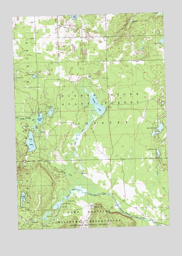
Turtle Lake, MI USGS Topographic Map
Click on map above to begin viewing in our Map Viewer.

This topographic map contains these locations and features:
Feature Name Type Latitude Longitude GNIS ID View Map
Bell Marie LakeReservoirN44.9320°W84.6053°621037View Map
Big Bass LakeLakeN44.9315°W84.5067°621282View Map
Bob LakeLakeN44.9647°W84.6075°621670View Map
Chub CreekStreamN44.8981°W84.5750°623270View Map
Chub River RanchLocaleN44.8792°W84.6139°623273View Map
Emerald LakeLakeN44.9389°W84.6054°625559View Map
Farrar LandingPopulated PlaceN44.8767°W84.6045°1617552View Map
Finnegan LakeLakeN44.9956°W84.5270°625971View Map
Grass LakeLakeN44.8828°W84.6017°627203View Map
Jean LakeLakeN44.9349°W84.6176°629226View Map
Little Bass LakeLakeN44.9174°W84.5073°630549View Map
Lower Chub LakeLakeN44.8886°W84.5922°631164View Map
Lower Chub LandingPopulated PlaceN44.8908°W84.5845°1617690View Map
Oley LakeLakeN44.9991°W84.5737°634024View Map
Opal LakeLakeN44.9259°W84.6125°634076View Map
Range Line DamDamN44.9320°W84.6053°635634View Map
Rosecrans HillSummitN44.8850°W84.5586°636223View Map
Town Line LakeLakeN44.9433°W84.5952°1615000View Map
Township of ChesterCivilN44.9425°W84.5462°1626072View Map
Triple K RanchLocaleN44.8878°W84.5886°1615094View Map
Turtle CreekStreamN44.8983°W84.5734°1615196View Map
Turtle LakeLakeN44.9464°W84.5565°1615205View Map
Viking LakeLakeN44.8934°W84.6205°1615584View Map
Whites LandingPopulated PlaceN44.9072°W84.5725°1617942View Map

Note: Coordinates in the location and feature list above are referenced to NAD83 datum.


Copyright (C) 2008-2024 Ryan Niemi / Sunset Dynamics ... All Rights Reserved