TopoQuest Logo
Do you find TopoQuest useful?
Help keep TopoQuest running and adding new maps/features by donating!
Bitcoin:  19c7KJd3qBynnjoSw5npx9KScwjBe4ifkT
Litecoin:  LXs6TkuXGGXo1vDsWCkWVdjQX94eUKd6ui
Home View Maps Find Maps Find Places Resources & Links


Vilonia, Arkansas Topographic Map

USGS Map Title: Vilonia, AR
USGS Map MRC: 35092A2
DRG (GeoTIFF) Download: o35092a2.tif


Neighboring USGS Topographic Map Quads:


  Holland, AR  
35092B3
 

  Enola, AR  
35092B2
 

  Mount Vernon, AR  
35092B1
 

  Hamlet, AR  
35092A3
 

  Vilonia, AR  
35092A2
 

  Mountain Springs, AR  
35092A1
 

  Cato, AR  
34092H3
 

  Olmstead, AR  
34092H2
 

  Cabot, AR  
34092H1


Map MRC Location:

N36°
W93°
N36°
W92°
H8 H7 H6 H5 H4 H3 H2 H1
G8 G7 G6 G5 G4 G3 G2 G1
F8 F7 F6 F5 F4 F3 F2 F1
E8 E7 E6 E5 E4 E3 E2 E1
D8 D7 D6 D5 D4 D3 D2 D1
C8 C7 C6 C5 C4 C3 C2 C1
B8 B7 B6 B5 B4 B3 B2 B1
A8 A7 A6 A5 A4 A3 A2 A1
N35°
W93°
N35°
W92°

Vilonia, AR USGS 1:24K Topographic Map Preview:
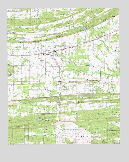
Vilonia, AR USGS Topographic Map
Click on map above to begin viewing in our Map Viewer.

This topographic map contains these locations and features:
Feature Name Type Latitude Longitude GNIS ID View Map
Air - Evacuation Lifeteam 30BuildingN35.0844°W92.2009°2119103View Map
Bailey LakeReservoirN35.0228°W92.2149°79405View Map
Bailey Lake DamDamN35.0234°W92.2151°79404View Map
Ballard HillSummitN35.0387°W92.1507°57320View Map
Belmont School (historical)SchoolN35.0362°W92.1910°62730View Map
Billy Goat HillSummitN35.0001°W92.2363°46626View Map
Birmingham BranchStreamN35.0518°W92.1618°46638View Map
Birmingham CemeteryCemeteryN35.0467°W92.1557°46639View Map
Birmingham GapGapN35.0448°W92.1560°46640View Map
Carmichael GapGapN35.0951°W92.2160°47473View Map
Center PointPopulated PlaceN35.0973°W92.1474°76107View Map
Center Point Baptist ChurchChurchN35.0984°W92.1449°76570View Map
Center Point School (historical)SchoolN35.1015°W92.1360°62754View Map
City of ViloniaCivilN35.0808°W92.2090°2405655View Map
Cypress Valley CemeteryCemeteryN35.0712°W92.1607°62775View Map
Cypress Valley Methodist ChurchChurchN35.0712°W92.1557°76739View Map
Dearmond GapGapN35.0381°W92.1690°48434View Map
Deihl LakeReservoirN35.1034°W92.2498°79393View Map
Duncan GapGapN35.0437°W92.1921°48701View Map
Duncan Gap CemeteryCemeteryN35.0454°W92.1960°48703View Map
Duncans Gap (historical)Populated PlaceN35.0445°W92.1918°62778View Map
Ebenezer School (historical)SchoolN35.0576°W92.1726°62780View Map
FunstonPopulated PlaceN35.0573°W92.1871°57780View Map
Hill Top Volunteer Fire DepartmentBuildingN35.0181°W92.2136°2116578View Map
Hilltop ChurchChurchN35.0026°W92.1346°50135View Map
Hinson GapGapN35.1048°W92.1626°50149View Map
House GapGapN35.1168°W92.1332°50353View Map
Lake OlaReservoirN35.0318°W92.2335°80428View Map
Lake Ola-Dale DamDamN35.0318°W92.2335°80427View Map
Marshall School (historical)SchoolN35.0295°W92.2440°62848View Map
Middle Fork Cypress BayouStreamN35.0668°W92.1896°51931View Map
Mount ArvaSummitN35.0654°W92.2488°76201View Map
Mount Carmel Methodist ChurchChurchN35.0420°W92.1913°77705View Map
Mount Olive CemeteryCemeteryN35.0551°W92.2446°52331View Map
Mount Olive Church (historical)ChurchN35.0551°W92.2432°62855View Map
North Fork Cypress BayouStreamN35.0670°W92.1899°52821View Map
OttoPopulated PlaceN35.0295°W92.1926°57146View Map
Powell GapGapN35.0990°W92.1913°53746View Map
Rattan BranchStreamN35.0576°W92.1404°53903View Map
Sharon Church (historical)ChurchN35.0379°W92.1388°62906View Map
Snow GapGapN35.0456°W92.1354°54987View Map
Snow HillSummitN35.0456°W92.1296°58652View Map
South Fork Cypress BayouStreamN35.0670°W92.1896°55021View Map
Township of CypressCivilN35.0620°W92.1704°66526View Map
ViloniaPopulated PlaceN35.0840°W92.2079°78658View Map
Vilonia Airport (historical)AirportN35.1187°W92.1893°83851View Map
Vilonia Baptist ChurchChurchN35.0834°W92.2071°76136View Map
Vilonia CemeteryCemeteryN35.0773°W92.2129°55918View Map
VILONIA ELEMENTARY SCHOOLSchoolN35.0815°W92.1942°62929View Map
Vilonia Freshman Academy SchoolSchoolN35.0853°W92.1976°2039173View Map
Vilonia High SchoolSchoolN35.0853°W92.1942°62930View Map
Vilonia Junior High SchoolSchoolN35.0852°W92.1965°2039172View Map
Vilonia Municipal Fire DepartmentBuildingN35.0839°W92.2002°2117256View Map
Vilonia Police DepartmentBuildingN35.0831°W92.2009°2118763View Map
Vilonia United Methodist ChurchChurchN35.0873°W92.1874°78659View Map
VILONIA VOLUNTEER FIRE DEPT. Station # 3BuildingN35.0784°W92.1417°2116380View Map
Waller GapGapN35.0406°W92.2393°55986View Map
Williams LakeReservoirN35.1070°W92.1633°79395View Map
Williams Lake DamDamN35.1068°W92.1635°79394View Map
Wilson BranchStreamN35.0623°W92.1357°56426View Map
Wilson HillSummitN35.0179°W92.2265°57246View Map
Woodrow ChurchChurchN35.0565°W92.1399°56527View Map
Woodrow School (historical)SchoolN35.0468°W92.1465°62936View Map

Note: Coordinates in the location and feature list above are referenced to NAD83 datum.


Copyright (C) 2008-2024 Ryan Niemi / Sunset Dynamics ... All Rights Reserved