TopoQuest Logo
Do you find TopoQuest useful?
Help keep TopoQuest running and adding new maps/features by donating!
Bitcoin:  19c7KJd3qBynnjoSw5npx9KScwjBe4ifkT
Litecoin:  LXs6TkuXGGXo1vDsWCkWVdjQX94eUKd6ui
Home View Maps Find Maps Find Places Resources & Links


Wahoo West, Nebraska Topographic Map

USGS Map Title: Wahoo West, NE
USGS Map MRC: 41096B6
DRG (GeoTIFF) Download: o41096b6.tif


Neighboring USGS Topographic Map Quads:


  Prague, NE  
41096C7
 

  Malmo, NE  
41096C6
 

  Colon, NE  
41096C5
 

  Touhy, NE  
41096B7
 

  Wahoo West, NE  
41096B6
 

  Wahoo East, NE  
41096B5
 

  Valparaiso, NE  
41096A7
 

  Ceresco, NE  
41096A6
 

  Wahoo SE, NE  
41096A5


Map MRC Location:

N42°
W97°
N42°
W96°
H8 H7 H6 H5 H4 H3 H2 H1
G8 G7 G6 G5 G4 G3 G2 G1
F8 F7 F6 F5 F4 F3 F2 F1
E8 E7 E6 E5 E4 E3 E2 E1
D8 D7 D6 D5 D4 D3 D2 D1
C8 C7 C6 C5 C4 C3 C2 C1
B8 B7 B6 B5 B4 B3 B2 B1
A8 A7 A6 A5 A4 A3 A2 A1
N41°
W97°
N41°
W96°

Wahoo West, NE USGS 1:24K Topographic Map Preview:
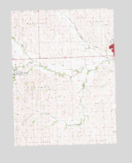
Wahoo West, NE USGS Topographic Map
Click on map above to begin viewing in our Map Viewer.

This topographic map contains these locations and features:
Feature Name Type Latitude Longitude GNIS ID View Map
Chapek DamDamN41.2350°W96.6520°1767262View Map
Chapek ReservoirReservoirN41.2363°W96.6521°1767263View Map
Cottonwood CreekStreamN41.2028°W96.6300°828380View Map
Cottonwood Creek Dam 23-ADamN41.2450°W96.7003°1766875View Map
Cottonwood Creek Reservoir 23-AReservoirN41.2446°W96.7012°1766876View Map
Czech CemeteryCemeteryN41.1558°W96.6864°828538View Map
Czech ChurchChurchN41.1761°W96.6981°828539View Map
Dunlap CreekStreamN41.1956°W96.7472°828892View Map
First Presbyterian ChurchChurchN41.2194°W96.6295°1897560View Map
Hackberry ParkParkN41.2131°W96.6322°1897530View Map
Haven HouseHospitalN41.2169°W96.6267°1897549View Map
Hilltop Country ClubLocaleN41.1928°W96.6303°836051View Map
John F Kennedy CollegeSchoolN41.2197°W96.6253°830382View Map
Kavan Dam 1DamN41.2233°W96.6736°1767260View Map
Kavan Dam 2DamN41.2300°W96.6803°1767258View Map
Kavan Reservoir 1ReservoirN41.2235°W96.6753°1767261View Map
Kavan Reservoir 2ReservoirN41.2303°W96.6813°1767259View Map
Lutheran CemeteryCemeteryN41.2483°W96.7222°830961View Map
Miller BranchStreamN41.1928°W96.6561°831312View Map
North Fork Wahoo CreekStreamN41.2028°W96.7245°831702View Map
Our Reddemer Lutheran ChurchChurchN41.2181°W96.6261°1897558View Map
Roberts DamDamN41.2217°W96.6553°1767256View Map
Roberts ReservoirReservoirN41.2232°W96.6562°1767257View Map
Saint John Elementary SchoolSchoolN41.1942°W96.7428°1897614View Map
Saint John Nepomucene Catholic ChurchChurchN41.1942°W96.7428°1897613View Map
Saint Wenceslaus CemeteryCemeteryN41.2350°W96.6325°833112View Map
Saunders CountyCivilN41.2264°W96.6374°835899View Map
Saunders County Care CenterHospitalN41.2150°W96.6284°1897552View Map
Saunders Medical CenterHospitalN41.1933°W96.6357°1897553View Map
School Number 44SchoolN41.2000°W96.6981°836740View Map
School Number 62SchoolN41.1622°W96.6497°836959View Map
School Number 7SchoolN41.1544°W96.7078°837024View Map
School Number 87SchoolN41.1986°W96.6603°837151View Map
South Center Public SchoolSchoolN41.2422°W96.6606°837040View Map
Swedeburg Dam 2B-2FDamN41.1567°W96.6253°1766855View Map
Swedeburg Reservoir 2B-2FReservoirN41.1567°W96.6254°1766856View Map
Thorston Dam B-2DamN41.1633°W96.6436°1766851View Map
Thorston Dam B-2ADamN41.1667°W96.6336°1766853View Map
Thorston Reservoir B-2ReservoirN41.1636°W96.6445°1766852View Map
Thorston Reservoir B-2AReservoirN41.1664°W96.6342°1766854View Map
Township of ChapmanCivilN41.1764°W96.7360°837916View Map
Triangle ParkParkN41.2181°W96.6289°1897529View Map
Village of WestonCivilN41.1931°W96.7420°2400155View Map
Wahoo High SchoolSchoolN41.2260°W96.6268°1897566View Map
Wahoo Medical ClinicHospitalN41.2150°W96.6264°1897547View Map
Wahoo Middle SchoolSchoolN41.2262°W96.6265°1897565View Map
Wahoo Physicians ClinicHospitalN41.2150°W96.6264°1897548View Map
West Ward Elementary SchoolSchoolN41.2128°W96.6270°834635View Map
WestonLocaleN41.1931°W96.7434°1897617View Map
WestonPopulated PlaceN41.1942°W96.7428°834651View Map
Weston CemeteryCemeteryN41.2017°W96.7422°834652View Map
Weston Fire and RescueBuildingN41.1916°W96.7437°2553422View Map
Weston Post OfficePost OfficeN41.1925°W96.7443°1897615View Map
Weston Public SchoolSchoolN41.1942°W96.7428°1897616View Map

Note: Coordinates in the location and feature list above are referenced to NAD83 datum.


Copyright (C) 2008-2024 Ryan Niemi / Sunset Dynamics ... All Rights Reserved