TopoQuest Logo
Do you find TopoQuest useful?
Help keep TopoQuest running and adding new maps/features by donating!
Bitcoin:  19c7KJd3qBynnjoSw5npx9KScwjBe4ifkT
Litecoin:  LXs6TkuXGGXo1vDsWCkWVdjQX94eUKd6ui
Home View Maps Find Maps Find Places Resources & Links


Prague, Nebraska Topographic Map

USGS Map Title: Prague, NE
USGS Map MRC: 41096C7
DRG (GeoTIFF) Download: o41096c7.tif


Neighboring USGS Topographic Map Quads:


  Rogers, NE  
41096D8
 

  North Bend, NE  
41096D7
 

  Malmo NW, NE  
41096D6
 

  Bruno, NE  
41096C8
 

  Prague, NE  
41096C7
 

  Malmo, NE  
41096C6
 

  Loma, NE  
41096B8
 

  Touhy, NE  
41096B7
 

  Wahoo West, NE  
41096B6


Map MRC Location:

N42°
W97°
N42°
W96°
H8 H7 H6 H5 H4 H3 H2 H1
G8 G7 G6 G5 G4 G3 G2 G1
F8 F7 F6 F5 F4 F3 F2 F1
E8 E7 E6 E5 E4 E3 E2 E1
D8 D7 D6 D5 D4 D3 D2 D1
C8 C7 C6 C5 C4 C3 C2 C1
B8 B7 B6 B5 B4 B3 B2 B1
A8 A7 A6 A5 A4 A3 A2 A1
N41°
W97°
N41°
W96°

Prague, NE USGS 1:24K Topographic Map Preview:
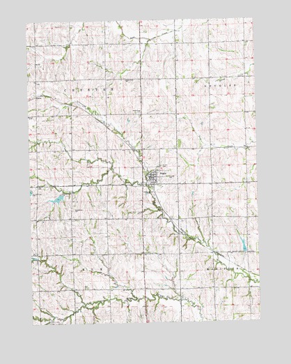
Prague, NE USGS Topographic Map
Click on map above to begin viewing in our Map Viewer.

This topographic map contains these locations and features:
Feature Name Type Latitude Longitude GNIS ID View Map
Bohemian National CemeteryCemeteryN41.3106°W96.8000°831566View Map
Cottonwood Creek Dam 41-ADamN41.2883°W96.7836°1766877View Map
Cottonwood Creek Dam 42-ADamN41.2783°W96.7586°1766867View Map
Cottonwood Creek Dam 6-BDamN41.3167°W96.8353°1769620View Map
Cottonwood Creek Dam 6-CDamN41.3033°W96.8586°1766871View Map
Cottonwood Creek Dam 6-DDamN41.3050°W96.8736°1766865View Map
Cottonwood Creek Dam 6-EDamN41.3117°W96.8720°1766879View Map
Cottonwood Creek Reservoir 41-AReservoirN41.2896°W96.7831°1766878View Map
Cottonwood Creek Reservoir 42-AReservoirN41.2809°W96.7584°1766868View Map
Cottonwood Creek Reservoir 6-BReservoirN41.3180°W96.8372°1769621View Map
Cottonwood Creek Reservoir 6-CReservoirN41.3017°W96.8598°1766872View Map
Cottonwood Creek Reservoir 6-EReservoirN41.3116°W96.8739°1766880View Map
Czechland LakeReservoirN41.3252°W96.8202°1897472View Map
Czechland Lake Recreation AreaParkN41.3236°W96.8156°1897624View Map
Czechland Lake TrailTrailN41.3236°W96.8164°1897470View Map
Farmers Co-op ElevatorLocaleN41.3103°W96.8084°1897476View Map
Koranda DamDamN41.2767°W96.8720°1767265View Map
Koranda ReservoirReservoirN41.2771°W96.8741°1767266View Map
Plasi ChurchChurchN41.2645°W96.8459°832154View Map
PraguePopulated PlaceN41.3103°W96.8084°832340View Map
Prague (historical)LocaleN41.3092°W96.8100°1897474View Map
Prague ClinicHospitalN41.3103°W96.8084°1897477View Map
Prague Post OfficePost OfficeN41.3099°W96.8087°1897475View Map
Prague Public SchoolsSchoolN41.3083°W96.8059°1897479View Map
Prague Rescue SquadBuildingN41.3093°W96.8098°2553688View Map
Prague Volunteer Fire DepartmentBuildingN41.3092°W96.8098°2553272View Map
Presbyterian ChurchChurchN41.2970°W96.8509°832388View Map
Rescue (historical)Populated PlaceN41.3445°W96.8698°1897433View Map
Rescue (historical)LocaleN41.3445°W96.8698°1897435View Map
Rescue Post Office (historical)Post OfficeN41.3445°W96.8698°1897434View Map
Saint Cyril and Methodius ChurchChurchN41.3103°W96.8084°1897473View Map
Saint John CemeteryCemeteryN41.3147°W96.8028°832879View Map
Saint Johns Catholic ChurchChurchN41.3103°W96.8084°1897478View Map
Township of ChesterCivilN41.3435°W96.8510°837919View Map
Township of ElkCivilN41.2638°W96.8513°837981View Map
Village of PragueCivilN41.3095°W96.8082°2399017View Map
Willow Creek CemeteryCemeteryN41.3367°W96.8136°834771View Map
Willow Creek Post Office (historical)Post OfficeN41.3500°W96.8214°1897424View Map
Willow Creek SchoolSchoolN41.3506°W96.8214°834772View Map

Note: Coordinates in the location and feature list above are referenced to NAD83 datum.


Copyright (C) 2008-2024 Ryan Niemi / Sunset Dynamics ... All Rights Reserved