TopoQuest Logo
Do you find TopoQuest useful?
Help keep TopoQuest running and adding new maps/features by donating!
Bitcoin:  19c7KJd3qBynnjoSw5npx9KScwjBe4ifkT
Litecoin:  LXs6TkuXGGXo1vDsWCkWVdjQX94eUKd6ui
Home View Maps Find Maps Find Places Resources & Links


Wallace West, North Carolina Topographic Map

USGS Map Title: Wallace West, NC
USGS Map MRC: 34078F1
DRG (GeoTIFF) Download: o34078f1.tif


Neighboring USGS Topographic Map Quads:


  Delway, NC  
34078G2
 

  Rose Hill, NC  
34078G1
 

  Charity, NC  
34077G8
 

  Harrells, NC  
34078F2
 

  Wallace West, NC  
34078F1
 

  Wallace East, NC  
34077F8
 

  Atkinson, NC  
34078E2
 

  Costin, NC  
34078E1
 

  Burgaw, NC  
34077E8


Map MRC Location:

N35°
W79°
N35°
W78°
H8 H7 H6 H5 H4 H3 H2 H1
G8 G7 G6 G5 G4 G3 G2 G1
F8 F7 F6 F5 F4 F3 F2 F1
E8 E7 E6 E5 E4 E3 E2 E1
D8 D7 D6 D5 D4 D3 D2 D1
C8 C7 C6 C5 C4 C3 C2 C1
B8 B7 B6 B5 B4 B3 B2 B1
A8 A7 A6 A5 A4 A3 A2 A1
N34°
W79°
N34°
W78°

Wallace West, NC USGS 1:24K Topographic Map Preview:
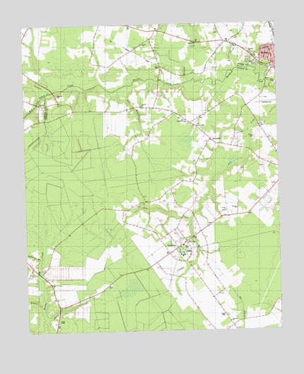
Wallace West, NC USGS Topographic Map
Click on map above to begin viewing in our Map Viewer.

This topographic map contains these locations and features:
Feature Name Type Latitude Longitude GNIS ID View Map
Alderman CemeteryCemeteryN34.7217°W78.1082°980083View Map
Antioch ChurchChurchN34.7171°W78.0664°980212View Map
Bull BranchStreamN34.7249°W78.0711°982194View Map
Bullhead BranchStreamN34.6546°W78.1180°982223View Map
Bulltail CreekStreamN34.6343°W78.1167°982239View Map
Canaan ChurchChurchN34.7143°W78.0511°982572View Map
Corinth ChurchChurchN34.6741°W78.0255°983553View Map
Crooked RunStreamN34.6704°W78.0430°983773View Map
Doctors CreekStreamN34.7271°W78.0433°984244View Map
Gurganus CemeteryCemeteryN34.6490°W78.1219°986267View Map
Henderson FieldAirportN34.7190°W78.0038°997859View Map
Laurel CreekStreamN34.6291°W78.1167°988184View Map
Meyer FieldParkN34.7257°W78.0003°1001098View Map
Mill CreekStreamN34.7218°W78.1147°1025533View Map
Mills Memorial ChurchChurchN34.7110°W78.0450°990027View Map
Newkirk CemeteryCemeteryN34.7176°W78.1172°991126View Map
Newkirk ChapelChurchN34.7088°W78.0400°1003677View Map
Newkirk SchoolSchoolN34.7082°W78.0380°991127View Map
PenderleaPopulated PlaceN34.6596°W78.0497°992017View Map
Penderlea ChurchChurchN34.6288°W78.0247°1003286View Map
Penderlea SchoolSchoolN34.6558°W78.0471°1003282View Map
Penderlea Volunteer Fire DepartmentBuildingN34.6610°W78.0473°2638197View Map
Penile ChurchChurchN34.7035°W78.0319°992026View Map
Potts Memorial ChurchChurchN34.6618°W78.0455°1003679View Map
Powers CemeteryCemeteryN34.7319°W78.0297°992776View Map
Rapture ChurchChurchN34.6749°W78.0205°1003678View Map
Rockfish CemeteryCemeteryN34.7432°W78.0405°1008028View Map
Rockfish ChurchChurchN34.7382°W78.0130°1003675View Map
SafePopulated PlaceN34.7474°W78.0594°1023463View Map
Safe FieldAirportN34.7494°W78.0580°2679276View Map
Saint John ChurchChurchN34.7418°W78.0655°1003676View Map
SunnysidePopulated PlaceN34.7032°W78.0330°1003680View Map
White CemeteryCemeteryN34.6436°W78.0847°997130View Map

Note: Coordinates in the location and feature list above are referenced to NAD83 datum.


Copyright (C) 2008-2024 Ryan Niemi / Sunset Dynamics ... All Rights Reserved