TopoQuest Logo
Do you find TopoQuest useful?
Help keep TopoQuest running and adding new maps/features by donating!
Bitcoin:  19c7KJd3qBynnjoSw5npx9KScwjBe4ifkT
Litecoin:  LXs6TkuXGGXo1vDsWCkWVdjQX94eUKd6ui
Home View Maps Find Maps Find Places Resources & Links


Williamsburg NW, Iowa Topographic Map

USGS Map Title: Williamsburg NW, IA
USGS Map MRC: 41092F2
DRG (GeoTIFF) Download: o41092f2.tif


Neighboring USGS Topographic Map Quads:


  Hartwick, IA  
41092G3
 

  Ladora, IA  
41092G2
 

  Marengo, IA  
41092G1
 

  Victor, IA  
41092F3
 

  Williamsburg NW, IA  
41092F2
 

  Williamsburg, IA  
41092F1
 

  Deep River, IA  
41092E3
 

  Millersburg, IA  
41092E2
 

  North English, IA  
41092E1


Map MRC Location:

N42°
W93°
N42°
W92°
H8 H7 H6 H5 H4 H3 H2 H1
G8 G7 G6 G5 G4 G3 G2 G1
F8 F7 F6 F5 F4 F3 F2 F1
E8 E7 E6 E5 E4 E3 E2 E1
D8 D7 D6 D5 D4 D3 D2 D1
C8 C7 C6 C5 C4 C3 C2 C1
B8 B7 B6 B5 B4 B3 B2 B1
A8 A7 A6 A5 A4 A3 A2 A1
N41°
W93°
N41°
W92°

Williamsburg NW, IA USGS 1:24K Topographic Map Preview:
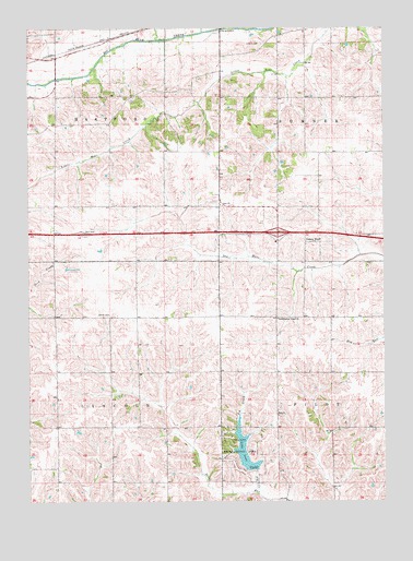
Williamsburg NW, IA USGS Topographic Map
Click on map above to begin viewing in our Map Viewer.

This topographic map contains these locations and features:
Feature Name Type Latitude Longitude GNIS ID View Map
Fundamental Gospel ChurchChurchN41.6733°W92.1627°456807View Map
Genoa BluffPopulated PlaceN41.6953°W92.1535°466100View Map
Genoa Bluff Post Office (historical)Post OfficeN41.6933°W92.1527°1999724View Map
Genoa Bluffs CemeteryCemeteryN41.6943°W92.1442°1999852View Map
Historic Amana Colonies State Historical MarkerParkN41.6950°W92.2302°2047419View Map
Interchange 211CrossingN41.6958°W92.1624°2047417View Map
Iowa Lake DamDamN41.6333°W92.1710°463495View Map
Ladora CemeteryCemeteryN41.7461°W92.1674°458169View Map
Lake IowaReservoirN41.6379°W92.1744°457846View Map
Lake Iowa County Recreation AreaParkN41.6389°W92.1752°465360View Map
Ohio ChurchChurchN41.7033°W92.1824°459811View Map
Pig CreekStreamN41.6275°W92.1702°460131View Map
Smith CemeteryCemeteryN41.6739°W92.2224°461687View Map
Township of HartfordCivilN41.7322°W92.2412°468017View Map
Township of LincolnCivilN41.6450°W92.2414°468252View Map
Victor East Bound Rest AreaLocaleN41.6950°W92.2302°2047418View Map
Victor West Bound Rest AreaLocaleN41.6967°W92.2318°2047420View Map
Zion ChurchChurchN41.6478°W92.1627°463271View Map
Zion Reformed Church CemeteryCemeteryN41.6478°W92.1620°1999851View Map

Note: Coordinates in the location and feature list above are referenced to NAD83 datum.


Copyright (C) 2008-2024 Ryan Niemi / Sunset Dynamics ... All Rights Reserved