TopoQuest Logo
Do you find TopoQuest useful?
Help keep TopoQuest running and adding new maps/features by donating!
Bitcoin:  19c7KJd3qBynnjoSw5npx9KScwjBe4ifkT
Litecoin:  LXs6TkuXGGXo1vDsWCkWVdjQX94eUKd6ui
Home View Maps Find Maps Find Places Resources & Links


Yetter, Iowa Topographic Map

USGS Map Title: Yetter, IA
USGS Map MRC: 42094C7
DRG (GeoTIFF) Download: o42094c7.tif


Neighboring USGS Topographic Map Quads:


  Sac City East, IA  
42094D8
 

  Lytton, IA  
42094D7
 

  Rockwell City, IA  
42094D6
 

  Grant City, IA  
42094C8
 

  Yetter, IA  
42094C7
 

  Lake City, IA  
42094C6
 

  Breda, IA  
42094B8
 

  Carroll NE, IA  
42094B7
 

  Lanesboro, IA  
42094B6


Map MRC Location:

N43°
W95°
N43°
W94°
H8 H7 H6 H5 H4 H3 H2 H1
G8 G7 G6 G5 G4 G3 G2 G1
F8 F7 F6 F5 F4 F3 F2 F1
E8 E7 E6 E5 E4 E3 E2 E1
D8 D7 D6 D5 D4 D3 D2 D1
C8 C7 C6 C5 C4 C3 C2 C1
B8 B7 B6 B5 B4 B3 B2 B1
A8 A7 A6 A5 A4 A3 A2 A1
N42°
W95°
N42°
W94°

Yetter, IA USGS 1:24K Topographic Map Preview:
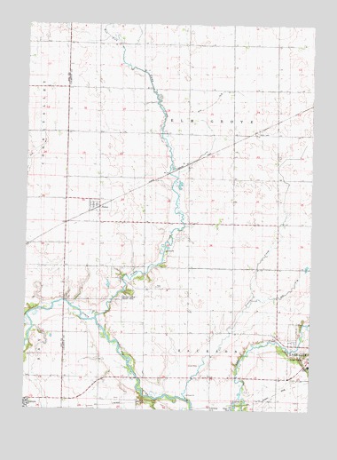
Yetter, IA USGS Topographic Map
Click on map above to begin viewing in our Map Viewer.

This topographic map contains these locations and features:
Feature Name Type Latitude Longitude GNIS ID View Map
Camp CreekStreamN42.2797°W94.8444°455112View Map
Camp Creek Wildlife AreaParkN42.2833°W94.8419°1995725View Map
City of YetterCivilN42.3161°W94.8432°2397391View Map
Drainage Ditch 46CanalN42.3497°W94.7944°455994View Map
Elm Grove Wildlife AreaParkN42.3272°W94.8072°1995726View Map
Elmgrove Post Office (historical)Post OfficeN42.3403°W94.8044°1995740View Map
Hickory Grove County ParkParkN42.2875°W94.8308°1823190View Map
Lake City CemeteryCemeteryN42.2720°W94.7578°458182View Map
Prairie CreekStreamN42.2536°W94.8042°460394View Map
Saint Mary's CemeteryCemeteryN42.2708°W94.7578°1995882View Map
Saint Marys Catholic ChurchChurchN42.2528°W94.8744°1983035View Map
Saint Marys SchoolSchoolN42.2522°W94.8739°1983036View Map
Shady Oaks CenterHospitalN42.2644°W94.7508°1995849View Map
Township of Elm GroveCivilN42.3402°W94.8018°467789View Map
Township of JacksonCivilN42.2524°W94.8030°468095View Map
West Fork Camp CreekStreamN42.3680°W94.8350°462845View Map
YetterLocaleN42.3161°W94.8461°1995742View Map
YetterPopulated PlaceN42.3161°W94.8461°463245View Map
Yetter Post Office (historical)Post OfficeN42.3161°W94.8461°1995741View Map

Note: Coordinates in the location and feature list above are referenced to NAD83 datum.


Copyright (C) 2008-2024 Ryan Niemi / Sunset Dynamics ... All Rights Reserved